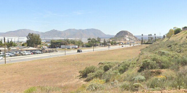
Property Record
12152 Cedar Ave, Bloomington, CA 92316


NEARBY LISTINGS FOR SALE OR LEASE
Property Detail
12152 Cedar Ave
Riverside-San Bernardino-Ontario, CA
Parcel Map No 12261
0259-082-11
PARCEL MAP 12261 PARCEL 11 BOOK 169 PAGE 29
Vacantlandnec
San Bernardino
X
California
06065C0045H
5.40 AC
2024
San Bernardino
2025
Inland Empire (California)
004001
DEMOGRAPHICS near 12152 Cedar Ave
1 Mile
3 Mile
5 Mile
2024 Total Population
6,463
57,774
293,660
2029 Population
6,525
59,605
301,988
Pop Growth 2024-2029
+ 0.96%
+ 3.17%
+ 2.84%
Average Age
34
35
35
2024 Total Households
1,397
14,127
80,331
HH Growth 2024-2029
+ 0.86%
+ 3.10%
+ 2.79%
Median Household Inc
$61,297
$73,080
$71,487
Avg Household Size
4.40
3.90
3.50
2024 Avg HH Vehicles
3.00
3.00
2.00
Median Home Value
$391,993
$415,878
$406,646
Median Year Built
1966
1979
1976
Nearby Places
Map Layers
Map Styles
 Street
 Aerial
- Restaurants
- Banks
- Shops
- Fitness
- Groceries
PUBLIC TRANSPORTATION
COMMUTER RAIL
Riverside-Downtown (91 Line - Southern California Regional Rail Authority (Metrolink), Inland Empire-Orange County Line - Southern California Regional Rail Authority (Metrolink), Riverside Line - Southern California Regional Rail Authority (Metrolink))
DRIVE
WALK
Distance
Riverside-Downtown (91 Line - Southern California Regional Rail Authority (Metrolink), Inland Empire-Orange County Line - Southern California Regional Rail Authority (Metrolink), Riverside Line - Southern California Regional Rail Authority (Metrolink))
10 min
5.1 mi
Riverside-Hunter Park/Ucr (Metrolink 91-Perris Valley Line - Metrolink Trains)
DRIVE
WALK
Distance
Riverside-Hunter Park/Ucr (Metrolink 91-Perris Valley Line - Metrolink Trains)
9 min
5.9 mi
AIRPORT
Ontario International
DRIVE
WALK
Distance
Ontario International
22 min
15.2 mi
Freight Ports
Port of Long Beach
DRIVE
WALK
Distance
Port of Long Beach
78 min
63.2 mi
SALE & LEASE HISTORY
LISTING DATE
SALE/LEASE

Sep 22, 2023
For Sale
Nearby Properties
Address
Land Use
TOTAL SIZE
Lot Size
Zoning
Address
Land Use
TOTAL SIZE
Lot Size
Zoning
1,101,400 SF
45.91 AC
Address
Land Use
TOTAL SIZE
Lot Size
Zoning
1,186,950 SF
54.77 AC
Address
Land Use
TOTAL SIZE
Lot Size
Zoning
1,025,132 SF
46.44 AC
Address
Land Use
TOTAL SIZE
Lot Size
Zoning
1,264,064 SF
64.44 AC
Address
Land Use
TOTAL SIZE
Lot Size
Zoning
1,000,177 SF
46 AC
Address
Land Use
TOTAL SIZE
Lot Size
Zoning
798,304 SF
42.64 AC
AMSP
Address
Land Use
TOTAL SIZE
Lot Size
Zoning
748,560 SF
29.72 AC
Address
Land Use
TOTAL SIZE
Lot Size
Zoning
505,152 SF
28.88 AC
Address
Land Use
TOTAL SIZE
Lot Size
Zoning
677,280 SF
34.53 AC
BLRS1AA
Address
Land Use
TOTAL SIZE
Lot Size
Zoning
615,310 SF
49.91 AC
Address
Land Use
TOTAL SIZE
Lot Size
Zoning
344,360 SF
17.32 AC
Address
Land Use
TOTAL SIZE
Lot Size
Zoning
599,735 SF
33.25 AC
AMSP
Address
Land Use
TOTAL SIZE
Lot Size
Zoning
436,424 SF
19.04 AC
Address
Land Use
TOTAL SIZE
Lot Size
Zoning
311,363 SF
34.60 AC
BLRS20M
Address
Land Use
TOTAL SIZE
Lot Size
Zoning
401,106 SF
16.91 AC
Address
Land Use
TOTAL SIZE
Lot Size
Zoning
174,780 SF
8.83 AC
Address
Land Use
TOTAL SIZE
Lot Size
Zoning
340,120 SF
36.36 AC
Address
Land Use
TOTAL SIZE
Lot Size
Zoning
272,120 SF
13.05 AC
Address
Land Use
TOTAL SIZE
Lot Size
Zoning
525,110 SF
24.25 AC
Address
Land Use
TOTAL SIZE
Lot Size
Zoning
492,631 SF
21 AC
Address
Land Use
TOTAL SIZE
Lot Size
Zoning
35,260 SF
9.55 AC
Address
Land Use
TOTAL SIZE
Lot Size
Zoning
447,190 SF
21.08 AC
Address
Land Use
TOTAL SIZE
Lot Size
Zoning
325,161 SF
14.49 AC
Address
Land Use
TOTAL SIZE
Lot Size
Zoning
651,120 SF
28.11 AC
Address
Land Use
TOTAL SIZE
Lot Size
Zoning
424,904 SF
23.03 AC
Address
Land Use
TOTAL SIZE
Lot Size
Zoning
261,632 SF
13.16 AC
Address
Land Use
TOTAL SIZE
Lot Size
Zoning
610,400 SF
27.41 AC
BLIR
Address
Land Use
TOTAL SIZE
Lot Size
Zoning
208,510 SF
47.30 AC
BLIC
Address
Land Use
TOTAL SIZE
Lot Size
Zoning
1,101,400 SF
45.92 AC
Address
Land Use
TOTAL SIZE
Lot Size
Zoning
1,056,072 SF
51.85 AC
AMSP
The World's #1 Commercial Real Estate Marketplace
Connect with us
© 2026 CoStar Group
The information above has been obtained from sources believed reliable. While we do not doubt its accuracy we have not verified it and make no guarantee, warranty or representation about it. It is your responsibility to independently confirm its accuracy and completeness. Any projections, opinions, assumptions, or estimates used are for example only and do not represent the current or future performance of the property. The value of this transaction to you depends on tax and other factors which should be evaluated by your tax, financial, and legal advisors. You and your advisors should conduct a careful, independent investigation of the property to determine to your satisfaction the suitability of the property for your needs.