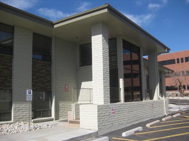
Property Record
12157 W Cedar Dr, Lakewood, CO 80228
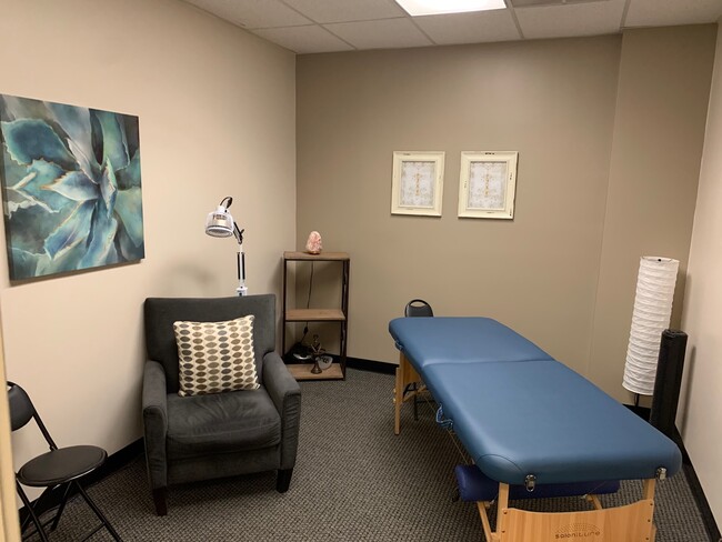
Current Lease Availabilities
NEARBY LISTINGS FOR SALE OR LEASE
Property Detail
12157 W Cedar Dr
Denver-Aurora-Centennial, CO
Cedar Park
49-084-03-003
SECTION 08 TOWNSHIP 04 RANGE 69 QTR SE SUBDIVISIONCD 117000 SUBDIVISIONNAME CEDAR PARK BLOCK 003 LOT 0002 SIZE: 35250 TRACT VALUE: .809
Commercialnec
Jefferson
X
Colorado
08059C0284F
2
0
0.81 AC
2024
West Denver
011733
Denver
13,216 SF
DEMOGRAPHICS near 12157 W Cedar Dr
1 Mile
3 Mile
5 Mile
2024 Total Population
16,146
86,291
221,524
2029 Population
16,124
85,441
219,786
Pop Growth 2024-2029
(0.14%)
(0.99%)
(0.78%)
Average Age
38
42
41
2024 Total Households
7,817
36,861
93,167
HH Growth 2024-2029
(0.12%)
(0.98%)
(0.85%)
Median Household Inc
$73,208
$87,193
$79,723
Avg Household Size
2.00
2.20
2.30
2024 Avg HH Vehicles
2.00
2.00
2.00
Median Home Value
$402,209
$535,505
$524,436
Median Year Built
1980
1974
1974
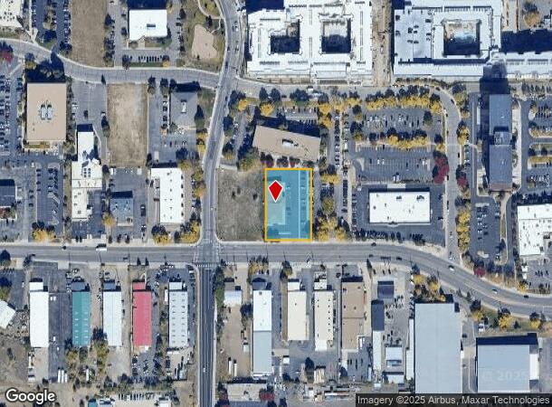
Nearby Places
Map Layers
Map Styles
 Street
 Aerial
- Restaurants
- Banks
- Shops
- Fitness
- Groceries
PUBLIC TRANSPORTATION
TRANSIT/SUBWAY
Federal Center (W Line - Denver Regional Transportation District Light Rail (TheRide))
DRIVE
WALK
Distance
Federal Center (W Line - Denver Regional Transportation District Light Rail (TheRide))
4 min
19 min
1.0 mi
COMMUTER RAIL
DRIVE
WALK
Distance
16 min
6.9 mi
DRIVE
WALK
Distance
16 min
7.9 mi
AIRPORT
Denver International
DRIVE
WALK
Distance
Denver International
47 min
34.1 mi
Nearby Properties
Address
Land Use
TOTAL SIZE
Lot Size
Zoning
Address
Land Use
TOTAL SIZE
Lot Size
Zoning
943,179 SF
23.96 AC
Address
Land Use
TOTAL SIZE
Lot Size
Zoning
3,195,026 SF
562.97 AC
Address
Land Use
TOTAL SIZE
Lot Size
Zoning
229,819 SF
29.97 AC
Address
Land Use
TOTAL SIZE
Lot Size
Zoning
1,193,158 SF
68.86 AC
Address
Land Use
TOTAL SIZE
Lot Size
Zoning
198,081 SF
Address
Land Use
TOTAL SIZE
Lot Size
Zoning
232,678 SF
27.50 AC
Address
Land Use
TOTAL SIZE
Lot Size
Zoning
233,688 SF
22.37 AC
Address
Land Use
TOTAL SIZE
Lot Size
Zoning
199,685 SF
27.73 AC
Address
Land Use
TOTAL SIZE
Lot Size
Zoning
282,190 SF
6.42 AC
PD
Address
Land Use
TOTAL SIZE
Lot Size
Zoning
322,105 SF
136.23 AC
Address
Land Use
TOTAL SIZE
Lot Size
Zoning
239,510 SF
6.63 AC
Address
Land Use
TOTAL SIZE
Lot Size
Zoning
238,452 SF
8.03 AC
Address
Land Use
TOTAL SIZE
Lot Size
Zoning
738 SF
3.69 AC
Address
Land Use
TOTAL SIZE
Lot Size
Zoning
118,522 SF
7.07 AC
PD
Address
Land Use
TOTAL SIZE
Lot Size
Zoning
173,389 SF
24.80 AC
Address
Land Use
TOTAL SIZE
Lot Size
Zoning
298,767 SF
4.43 AC
Address
Land Use
TOTAL SIZE
Lot Size
Zoning
397,700 SF
14.45 AC
Address
Land Use
TOTAL SIZE
Lot Size
Zoning
284,413 SF
3.82 AC
Address
Land Use
TOTAL SIZE
Lot Size
Zoning
167,420 SF
5.84 AC
Address
Land Use
TOTAL SIZE
Lot Size
Zoning
214,839 SF
8.17 AC
Address
Land Use
TOTAL SIZE
Lot Size
Zoning
299,678 SF
20.79 AC
PD
Address
Land Use
TOTAL SIZE
Lot Size
Zoning
82,756 SF
14.95 AC
Address
Land Use
TOTAL SIZE
Lot Size
Zoning
147,609 SF
9.22 AC
Address
Land Use
TOTAL SIZE
Lot Size
Zoning
391,227 SF
5.77 AC
Address
Land Use
TOTAL SIZE
Lot Size
Zoning
143,603 SF
4.71 AC
Address
Land Use
TOTAL SIZE
Lot Size
Zoning
327,549 SF
128.38 AC
Address
Land Use
TOTAL SIZE
Lot Size
Zoning
324,777 SF
12.63 AC
Address
Land Use
TOTAL SIZE
Lot Size
Zoning
146,133 SF
3.75 AC
Address
Land Use
TOTAL SIZE
Lot Size
Zoning
230,285 SF
3.21 AC
Address
Land Use
TOTAL SIZE
Lot Size
Zoning
330,357 SF
15.16 AC
The World's #1 Commercial Real Estate Marketplace
Connect with us
© 2026 CoStar Group
The information above has been obtained from sources believed reliable. While we do not doubt its accuracy we have not verified it and make no guarantee, warranty or representation about it. It is your responsibility to independently confirm its accuracy and completeness. Any projections, opinions, assumptions, or estimates used are for example only and do not represent the current or future performance of the property. The value of this transaction to you depends on tax and other factors which should be evaluated by your tax, financial, and legal advisors. You and your advisors should conduct a careful, independent investigation of the property to determine to your satisfaction the suitability of the property for your needs.