Property Record
12164 Lebanon Rd, Cincinnati, OH 45241
NEARBY LISTINGS FOR SALE OR LEASE
Property Detail
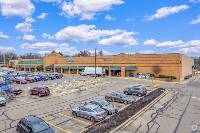
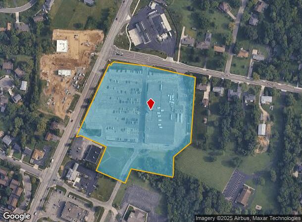
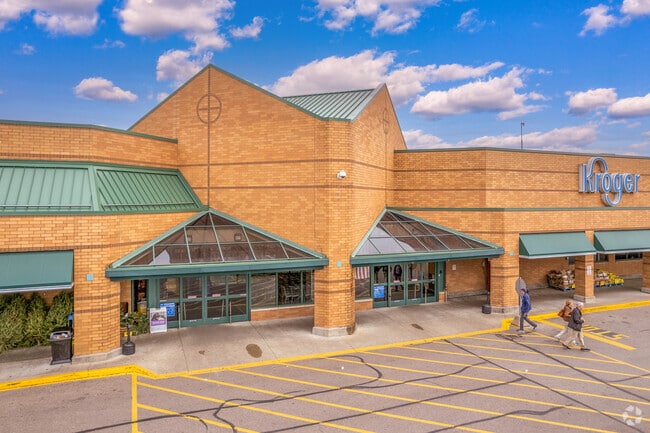
12164 Lebanon Rd
608-0029-0498
SE CORNER FIELDS ERTEL RD & US 428.6827 AC
Supermarket
Hamilton
X
Ohio
39017C0342E
8.68 AC
2024
Tri-County I-275
2024
Cincinnati/Dayton
023001
Cincinnati, OH-KY-IN
DEMOGRAPHICS near 12164 Lebanon Rd
1 Mile
3 Mile
5 Mile
2024 Total Population
7,286
39,764
137,242
2029 Population
7,290
40,217
139,493
Pop Growth 2024-2029
+ 0.05%
+ 1.14%
+ 1.64%
Average Age
43
42
41
2024 Total Households
2,946
15,576
53,499
HH Growth 2024-2029
(0.14%)
+ 0.81%
+ 1.46%
Median Household Inc
$92,041
$100,646
$98,019
Avg Household Size
2.30
2.50
2.50
2024 Avg HH Vehicles
2.00
2.00
2.00
Median Home Value
$283,234
$259,144
$288,124
Median Year Built
1984
1981
1984
Nearby Places
Map Layers
Map Styles
 Street
 Aerial
- Restaurants
- Banks
- Shops
- Fitness
- Groceries
PUBLIC TRANSPORTATION
AIRPORT
Cincinnati/Northern Kentucky International
DRIVE
WALK
Distance
Cincinnati/Northern Kentucky International
53 min
33.2 mi
Freight Ports
Port of Toledo
DRIVE
WALK
Distance
Port of Toledo
223 min
188.7 mi
Nearby Properties
Address
Land Use
TOTAL SIZE
Lot Size
Zoning
Address
Land Use
TOTAL SIZE
Lot Size
Zoning
10.76 AC
Address
Land Use
TOTAL SIZE
Lot Size
Zoning
11.19 AC
Address
Land Use
TOTAL SIZE
Lot Size
Zoning
58.52 AC
Address
Land Use
TOTAL SIZE
Lot Size
Zoning
29.79 AC
M1
Address
Land Use
TOTAL SIZE
Lot Size
Zoning
287,883 SF
10.90 AC
Address
Land Use
TOTAL SIZE
Lot Size
Zoning
4,620 SF
85.80 AC
Address
Land Use
TOTAL SIZE
Lot Size
Zoning
68.49 AC
Address
Land Use
TOTAL SIZE
Lot Size
Zoning
84,133 SF
4.28 AC
Address
Land Use
TOTAL SIZE
Lot Size
Zoning
Address
Land Use
TOTAL SIZE
Lot Size
Zoning
29.95 AC
Address
Land Use
TOTAL SIZE
Lot Size
Zoning
47,788 SF
25.84 AC
Address
Land Use
TOTAL SIZE
Lot Size
Zoning
342,284 SF
36.35 AC
Address
Land Use
TOTAL SIZE
Lot Size
Zoning
28.73 AC
DD
Address
Land Use
TOTAL SIZE
Lot Size
Zoning
105,280 SF
10.76 AC
Address
Land Use
TOTAL SIZE
Lot Size
Zoning
105,280 SF
11.19 AC
Address
Land Use
TOTAL SIZE
Lot Size
Zoning
Address
Land Use
TOTAL SIZE
Lot Size
Zoning
536,648 SF
22.28 AC
Address
Land Use
TOTAL SIZE
Lot Size
Zoning
Address
Land Use
TOTAL SIZE
Lot Size
Zoning
54.92 AC
Address
Land Use
TOTAL SIZE
Lot Size
Zoning
133,851 SF
17.47 AC
Address
Land Use
TOTAL SIZE
Lot Size
Zoning
3,202 SF
3.34 AC
Address
Land Use
TOTAL SIZE
Lot Size
Zoning
17.10 AC
Address
Land Use
TOTAL SIZE
Lot Size
Zoning
22.14 AC
Address
Land Use
TOTAL SIZE
Lot Size
Zoning
16.46 AC
M1
Address
Land Use
TOTAL SIZE
Lot Size
Zoning
25,032 SF
18.33 AC
Address
Land Use
TOTAL SIZE
Lot Size
Zoning
24.93 AC
FF
Address
Land Use
TOTAL SIZE
Lot Size
Zoning
317,346 SF
9.96 AC
Address
Land Use
TOTAL SIZE
Lot Size
Zoning
327,526 SF
22.42 AC
Address
Land Use
TOTAL SIZE
Lot Size
Zoning
260,160 SF
22.68 AC
Address
Land Use
TOTAL SIZE
Lot Size
Zoning
621,383 SF
35.05 AC
The World's #1 Commercial Real Estate Marketplace
Connect with us
© 2026 CoStar Group
The information above has been obtained from sources believed reliable. While we do not doubt its accuracy we have not verified it and make no guarantee, warranty or representation about it. It is your responsibility to independently confirm its accuracy and completeness. Any projections, opinions, assumptions, or estimates used are for example only and do not represent the current or future performance of the property. The value of this transaction to you depends on tax and other factors which should be evaluated by your tax, financial, and legal advisors. You and your advisors should conduct a careful, independent investigation of the property to determine to your satisfaction the suitability of the property for your needs.