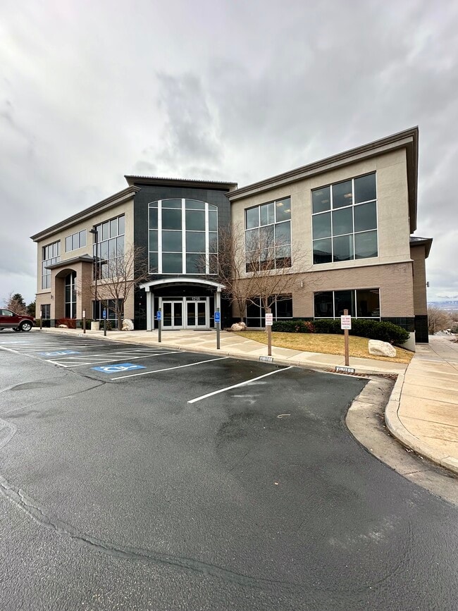
Property Record
1218 E 7800 S, Sandy, UT 84094


Current Lease Availabilities
Property Detail
1218 E 7800 S
22-32-228-014-0000
UNIT 3A, HIGHPOINT PROFESSIONAL PLAZA PH 1 CONDO. 9576-6187 9601-8026 9729-7294 09729-7294 11076-5330 11109-1609 11322-2358 11414-1649
Commercialcondominium
Salt Lake
SD CN
Utah
B and X Area of moderate flood hazard, usually the area between the limits of the 100-year and 500-year floods.
0.01 AC
2024
Southeast Valley
2025
Salt Lake City
112611
Salt Lake City-Murray, UT
144 SF
NEARBY LISTINGS FOR SALE OR LEASE
DEMOGRAPHICS near 1218 E 7800 S
1 mile
3 mile
5 mile
2025 Total Population
17,189
136,945
299,971
2030 Population
17,516
139,460
306,430
Pop Growth 2025-2030
+ 1.90%
+ 1.84%
+ 2.15%
Average Age
39
39
39
2025 Total Households
6,448
51,412
111,429
HH Growth 2025-2030
+ 2.09%
+ 2.07%
+ 2.35%
Median Household Inc
$98,271
$97,727
$99,645
Avg Household Size
2.60
2.60
2.60
2025 Avg HH Vehicles
2.00
2.00
2.00
Median Home Value
$640,625
$630,795
$643,338
Median Year Built
1981
1978
1982
Nearby Places
Map Layers
Map Styles
 Street
 Aerial
Transit
 Traffic
 Biking
Places
Listings with unknown addresses are not visible on the map
- Restaurants
- Banks
- Shops
- Fitness
- Groceries
PUBLIC TRANSPORTATION
COMMUTER RAIL
South Jordan Station (FrontRunner - Utah Transit Authority (UTA))
Drive
Walk
Distance
South Jordan Station (FrontRunner - Utah Transit Authority (UTA))
12 min
6.4 mi
Draper Station (FrontRunner - Utah Transit Authority (UTA))
Drive
Walk
Distance
Draper Station (FrontRunner - Utah Transit Authority (UTA))
18 min
9.8 mi
AIRPORT
Salt Lake City International
Drive
Walk
Distance
Salt Lake City International
25 min
18.2 mi
Provo Municipal
Drive
Walk
Distance
Provo Municipal
51 min
37.1 mi
Freight Ports
Port of Stockton
Drive
Walk
Distance
Port of Stockton
724 min
705.2 mi
Nearby Properties
Address
Land Use
TOTAL SIZE
Lot Size
Zoning
Address
Land Use
TOTAL SIZE
Lot Size
Zoning
659,583 SF
18.32 AC
CDC
Address
Land Use
TOTAL SIZE
Lot Size
Zoning
257,906 SF
36.42 AC
1110
Address
Land Use
TOTAL SIZE
Lot Size
Zoning
235,963 SF
35.56 AC
SF1-DO
Address
Land Use
TOTAL SIZE
Lot Size
Zoning
512,301 SF
25.39 AC
SD(H)
Address
Land Use
TOTAL SIZE
Lot Size
Zoning
258,000 SF
13.25 AC
1D
Address
Land Use
TOTAL SIZE
Lot Size
Zoning
552,994 SF
13.64 AC
SD-X
Address
Land Use
TOTAL SIZE
Lot Size
Zoning
186,717 SF
21.58 AC
RM
Address
Land Use
TOTAL SIZE
Lot Size
Zoning
251,867 SF
25.66 AC
H
Address
Land Use
TOTAL SIZE
Lot Size
Zoning
133,669 SF
19.81 AC
R-M
Address
Land Use
TOTAL SIZE
Lot Size
Zoning
191,718 SF
6.74 AC
RM-25
Address
Land Use
TOTAL SIZE
Lot Size
Zoning
191,718 SF
0.83 AC
RM-25
Address
Land Use
TOTAL SIZE
Lot Size
Zoning
500,249 SF
3.16 AC
MU
Address
Land Use
TOTAL SIZE
Lot Size
Zoning
500,249 SF
3.16 AC
MU
Address
Land Use
TOTAL SIZE
Lot Size
Zoning
124,434 SF
13.64 AC
PUD-15
Address
Land Use
TOTAL SIZE
Lot Size
Zoning
225,849 SF
16.36 AC
RM-ZC
Address
Land Use
TOTAL SIZE
Lot Size
Zoning
280,668 SF
12 AC
CBD
Address
Land Use
TOTAL SIZE
Lot Size
Zoning
143,600 SF
7.56 AC
2000
Address
Land Use
TOTAL SIZE
Lot Size
Zoning
327,940 SF
3.95 AC
SD
Address
Land Use
TOTAL SIZE
Lot Size
Zoning
103,114 SF
14.82 AC
RM 25
Address
Land Use
TOTAL SIZE
Lot Size
Zoning
371,607 SF
10.77 AC
A-1
Address
Land Use
TOTAL SIZE
Lot Size
Zoning
327,940 SF
3.37 AC
SD
Address
Land Use
TOTAL SIZE
Lot Size
Zoning
551,648 SF
31.71 AC
C B D
Address
Land Use
TOTAL SIZE
Lot Size
Zoning
241,418 SF
8.84 AC
ORD
Address
Land Use
TOTAL SIZE
Lot Size
Zoning
176,826 SF
6.13 AC
SD(H)
Address
Land Use
TOTAL SIZE
Lot Size
Zoning
97,360 SF
10.43 AC
RM-25
Address
Land Use
TOTAL SIZE
Lot Size
Zoning
198,479 SF
2.52 AC
MU
Address
Land Use
TOTAL SIZE
Lot Size
Zoning
199,446 SF
12.65 AC
RM25
Address
Land Use
TOTAL SIZE
Lot Size
Zoning
168,488 SF
21.11 AC
1107
Address
Land Use
TOTAL SIZE
Lot Size
Zoning
422,482 SF
3.42 AC
RC
Address
Land Use
TOTAL SIZE
Lot Size
Zoning
185,116 SF
14.49 AC
PUD-10
The World's #1 Commercial Real Estate Marketplace
Connect with us
© 2026 CoStar Group
The information above has been obtained from sources believed reliable. While we do not doubt its accuracy we have not verified it and make no guarantee, warranty or representation about it. It is your responsibility to independently confirm its accuracy and completeness. Any projections, opinions, assumptions, or estimates used are for example only and do not represent the current or future performance of the property. The value of this transaction to you depends on tax and other factors which should be evaluated by your tax, financial, and legal advisors. You and your advisors should conduct a careful, independent investigation of the property to determine to your satisfaction the suitability of the property for your needs.