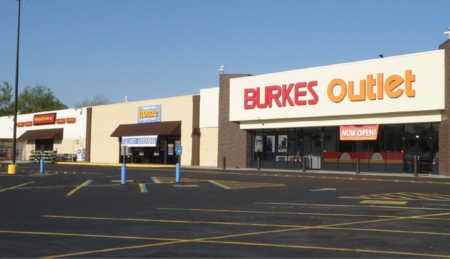
Property Record
1218 S Eufaula Ave, Eufaula, AL 36027
Property Detail
1218 S Eufaula Ave
24-03-05-3-002-001-000-0
COM SW COR OF SE 1/4; N 1465' TO POB; N 150'; E 540'; SW ALG NW ROW HWY 431 80'; NW 34.08'; W 294.35'; S 134.63'; NW 130' TO
Stripcommercialcenter
Barbour
B and X Area of moderate flood hazard, usually the area between the limits of the 100-year and 500-year floods.
Alabama
2025
8.14 AC
2025
Alabama South Area
950700
Other Market Areas
1,025 SF
Eufaula, AL-GA
NEARBY LISTINGS FOR SALE OR LEASE
DEMOGRAPHICS near 1218 S Eufaula Ave
1 mile
3 mile
5 mile
2025 Total Population
3,595
9,204
12,119
2030 Population
3,434
8,841
11,756
Pop Growth 2025-2030
(4.48%)
(3.94%)
(3.00%)
Average Age
38
40
41
2025 Total Households
1,560
3,832
5,079
HH Growth 2025-2030
(4.81%)
(4.20%)
(3.17%)
Median Household Inc
$29,125
$41,785
$44,068
Avg Household Size
2.30
2.30
2.30
2025 Avg HH Vehicles
1.00
2.00
2.00
Median Home Value
$101,342
$155,294
$149,738
Median Year Built
1971
1974
1978
Nearby Places
Map Layers
Map Styles
 Street
 Aerial
Layers
 Traffic
 Biking
Places
Listings with unknown addresses are not visible on the map
- Restaurants
- Banks
- Shops
- Fitness
- Groceries
SALE & LEASE HISTORY
LISTING DATE
SALE/LEASE

Sep 25, 2016
For Lease
Nearby Properties
Address
Land Use
TOTAL SIZE
Lot Size
Zoning
Address
Land Use
TOTAL SIZE
Lot Size
Zoning
1,505 SF
3.87 AC
Address
Land Use
TOTAL SIZE
Lot Size
Zoning
2,224 SF
1.55 AC
Address
Land Use
TOTAL SIZE
Lot Size
Zoning
4,173 SF
0.45 AC
Address
Land Use
TOTAL SIZE
Lot Size
Zoning
3,294 SF
1.46 AC
Address
Land Use
TOTAL SIZE
Lot Size
Zoning
1,471 SF
24 AC
Address
Land Use
TOTAL SIZE
Lot Size
Zoning
3,129 SF
0.69 AC
Address
Land Use
TOTAL SIZE
Lot Size
Zoning
3,433 SF
5.96 AC
Address
Land Use
TOTAL SIZE
Lot Size
Zoning
1,304 SF
1.47 AC
C-1
The World's #1 Commercial Real Estate Marketplace
Connect with us
© 2026 CoStar Group
The information above has been obtained from sources believed reliable. While we do not doubt its accuracy we have not verified it and make no guarantee, warranty or representation about it. It is your responsibility to independently confirm its accuracy and completeness. Any projections, opinions, assumptions, or estimates used are for example only and do not represent the current or future performance of the property. The value of this transaction to you depends on tax and other factors which should be evaluated by your tax, financial, and legal advisors. You and your advisors should conduct a careful, independent investigation of the property to determine to your satisfaction the suitability of the property for your needs.