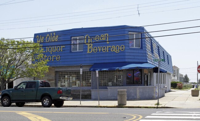
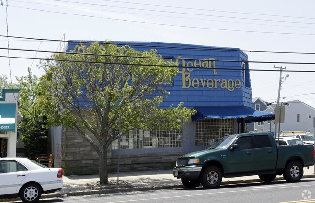
Property Record
1218 W Brigantine Ave, Brigantine, NJ 08203

NEARBY LISTINGS FOR SALE OR LEASE
Property Detail
1218 W Brigantine Ave
03-01105-0000-00010
Atlantic
Storebuilding
New Jersey
AE
10
34001C0363F
0.14 AC
2024
Atlantic City/Hammonton
2025
Philadelphia
010102
Atlantic City-Hammonton, NJ
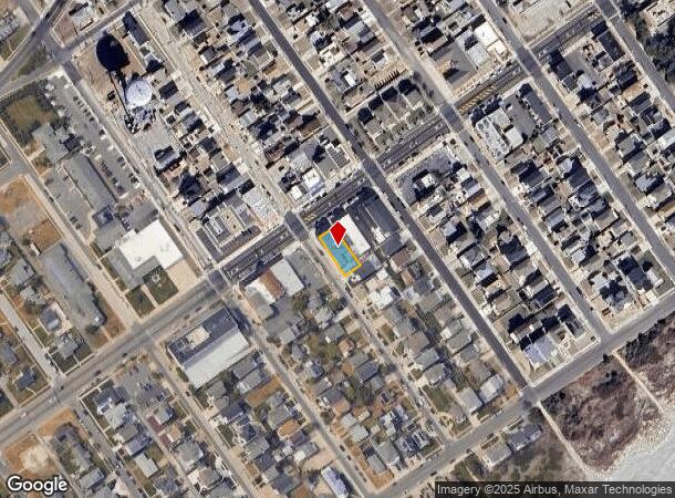
DEMOGRAPHICS near 1218 W Brigantine Ave
1 Mile
3 Mile
5 Mile
2024 Total Population
6,043
15,443
39,028
2029 Population
6,643
16,911
40,516
Pop Growth 2024-2029
+ 9.93%
+ 9.51%
+ 3.81%
Average Age
52
51
44
2024 Total Households
2,990
7,642
17,815
HH Growth 2024-2029
+ 10.07%
+ 9.57%
+ 3.99%
Median Household Inc
$99,783
$77,984
$41,672
Avg Household Size
1.90
2.00
2.10
2024 Avg HH Vehicles
2.00
2.00
1.00
Median Home Value
$432,563
$378,484
$341,297
Median Year Built
1976
1981
1972
Nearby Places
Map Layers
Map Styles
 Street
 Aerial
- Restaurants
- Banks
- Shops
- Fitness
- Groceries
PUBLIC TRANSPORTATION
COMMUTER RAIL
Atlantic City (Atlantic City Line - NJ Transit Commuter Rail (NJ Transit))
DRIVE
WALK
Distance
Atlantic City (Atlantic City Line - NJ Transit Commuter Rail (NJ Transit))
12 min
5.6 mi
Absecon (Atlantic City Line - NJ Transit Commuter Rail (NJ Transit))
DRIVE
WALK
Distance
Absecon (Atlantic City Line - NJ Transit Commuter Rail (NJ Transit))
18 min
10.0 mi
AIRPORT
Atlantic City International
DRIVE
WALK
Distance
Atlantic City International
48 min
18.3 mi
Freight Ports
Broadway Terminal - Pier 5
DRIVE
WALK
Distance
Broadway Terminal - Pier 5
80 min
60.0 mi
Nearby Properties
Address
Land Use
TOTAL SIZE
Lot Size
Zoning
Address
Land Use
TOTAL SIZE
Lot Size
Zoning
132 AC
C1
Address
Land Use
TOTAL SIZE
Lot Size
Zoning
10.25 AC
R2
Address
Land Use
TOTAL SIZE
Lot Size
Zoning
60 AC
C1
Address
Land Use
TOTAL SIZE
Lot Size
Zoning
47 AC
Address
Land Use
TOTAL SIZE
Lot Size
Zoning
13.47 AC
B3
Address
Land Use
TOTAL SIZE
Lot Size
Zoning
9.97 AC
B
Address
Land Use
TOTAL SIZE
Lot Size
Zoning
Address
Land Use
TOTAL SIZE
Lot Size
Zoning
12,900 SF
0.80 AC
B1
Address
Land Use
TOTAL SIZE
Lot Size
Zoning
2.46 AC
R3
Address
Land Use
TOTAL SIZE
Lot Size
Zoning
37.19 AC
C1
Address
Land Use
TOTAL SIZE
Lot Size
Zoning
2.30 AC
R-2A
Address
Land Use
TOTAL SIZE
Lot Size
Zoning
0.58 AC
C1
Address
Land Use
TOTAL SIZE
Lot Size
Zoning
26.23 AC
NEIR
Address
Land Use
TOTAL SIZE
Lot Size
Zoning
0.99 AC
R2
Address
Land Use
TOTAL SIZE
Lot Size
Zoning
0.92 AC
B1-A
Address
Land Use
TOTAL SIZE
Lot Size
Zoning
862 SF
1.82 AC
R4
Address
Land Use
TOTAL SIZE
Lot Size
Zoning
1.54 AC
R2
Address
Land Use
TOTAL SIZE
Lot Size
Zoning
5.58 AC
R-2A
Address
Land Use
TOTAL SIZE
Lot Size
Zoning
4.82 AC
B
Address
Land Use
TOTAL SIZE
Lot Size
Zoning
5,511 SF
0.01 AC
R4
Address
Land Use
TOTAL SIZE
Lot Size
Zoning
7,470 SF
0.38 AC
R8
Address
Land Use
TOTAL SIZE
Lot Size
Zoning
0.79 AC
C1
Address
Land Use
TOTAL SIZE
Lot Size
Zoning
0.75 AC
R-2A
Address
Land Use
TOTAL SIZE
Lot Size
Zoning
1.12 AC
B1
Address
Land Use
TOTAL SIZE
Lot Size
Zoning
0.62 AC
B3
Address
Land Use
TOTAL SIZE
Lot Size
Zoning
0.18 AC
R-2A
Address
Land Use
TOTAL SIZE
Lot Size
Zoning
4,378 SF
9.97 AC
R3
Address
Land Use
TOTAL SIZE
Lot Size
Zoning
0.37 AC
B1
Address
Land Use
TOTAL SIZE
Lot Size
Zoning
0.60 AC
R8
Address
Land Use
TOTAL SIZE
Lot Size
Zoning
185 AC
R2/C
The World's #1 Commercial Real Estate Marketplace
Connect with us
© 2025 CoStar Group
The information above has been obtained from sources believed reliable. While we do not doubt its accuracy we have not verified it and make no guarantee, warranty or representation about it. It is your responsibility to independently confirm its accuracy and completeness. Any projections, opinions, assumptions, or estimates used are for example only and do not represent the current or future performance of the property. The value of this transaction to you depends on tax and other factors which should be evaluated by your tax, financial, and legal advisors. You and your advisors should conduct a careful, independent investigation of the property to determine to your satisfaction the suitability of the property for your needs.