Property Record
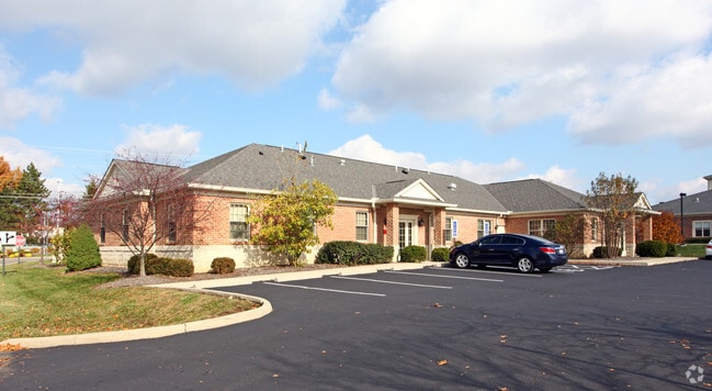
1219 County Line Rd, Westerville, OH 43081


NEARBY LISTINGS FOR SALE OR LEASE
Property Detail
1219 County Line Rd
080-011142
Spring Grove Extension Section Two
Medicalbuilding
COUNTY LINE ROAD R17 T2 1/4T1 1.095 ACRES
X
Franklin
39041C0269K
Ohio
2024
1.10 AC
2024
Westerville
007193
Columbus
5,628 SF
Columbus, OH
DEMOGRAPHICS near 1219 County Line Rd
1 Mile
3 Mile
5 Mile
2024 Total Population
5,973
55,214
159,598
2029 Population
6,231
58,129
165,281
Pop Growth 2024-2029
+ 4.32%
+ 5.28%
+ 3.56%
Average Age
43
42
39
2024 Total Households
2,221
21,313
64,949
HH Growth 2024-2029
+ 4.64%
+ 5.27%
+ 3.34%
Median Household Inc
$122,889
$106,041
$89,853
Avg Household Size
2.60
2.50
2.40
2024 Avg HH Vehicles
2.00
2.00
2.00
Median Home Value
$336,640
$319,527
$297,146
Median Year Built
1987
1989
1991
Nearby Places
Map Layers
Map Styles
 Street
 Aerial
- Restaurants
- Banks
- Shops
- Fitness
- Groceries
PUBLIC TRANSPORTATION
AIRPORT
John Glenn Columbus International
DRIVE
WALK
Distance
John Glenn Columbus International
21 min
11.6 mi
Rickenbacker International
DRIVE
WALK
Distance
Rickenbacker International
41 min
27.3 mi
SALE & LEASE HISTORY
LISTING DATE
SALE/LEASE

Sep 25, 2016
For Lease
Jun 13, 2017
For Lease
Nearby Properties
Address
Land Use
TOTAL SIZE
Lot Size
Zoning
Address
Land Use
TOTAL SIZE
Lot Size
Zoning
426,490 SF
19.43 AC
Address
Land Use
TOTAL SIZE
Lot Size
Zoning
446,516 SF
95.88 AC
Address
Land Use
TOTAL SIZE
Lot Size
Zoning
320,022 SF
37.14 AC
Address
Land Use
TOTAL SIZE
Lot Size
Zoning
218,891 SF
19.56 AC
Address
Land Use
TOTAL SIZE
Lot Size
Zoning
3,263 SF
989.66 AC
Address
Land Use
TOTAL SIZE
Lot Size
Zoning
292,377 SF
36.29 AC
Address
Land Use
TOTAL SIZE
Lot Size
Zoning
170,259 SF
16.30 AC
Address
Land Use
TOTAL SIZE
Lot Size
Zoning
137,489 SF
14.73 AC
Address
Land Use
TOTAL SIZE
Lot Size
Zoning
236,681 SF
7.83 AC
Address
Land Use
TOTAL SIZE
Lot Size
Zoning
100,848 SF
9.72 AC
Address
Land Use
TOTAL SIZE
Lot Size
Zoning
80,608 SF
7.34 AC
Address
Land Use
TOTAL SIZE
Lot Size
Zoning
140,162 SF
34.63 AC
Address
Land Use
TOTAL SIZE
Lot Size
Zoning
28,068 SF
22.61 AC
Address
Land Use
TOTAL SIZE
Lot Size
Zoning
27,978 SF
11.35 AC
Address
Land Use
TOTAL SIZE
Lot Size
Zoning
77,258 SF
2.57 AC
Address
Land Use
TOTAL SIZE
Lot Size
Zoning
175,042 SF
8.10 AC
Address
Land Use
TOTAL SIZE
Lot Size
Zoning
189,276 SF
16.25 AC
Address
Land Use
TOTAL SIZE
Lot Size
Zoning
166,382 SF
6.74 AC
Address
Land Use
TOTAL SIZE
Lot Size
Zoning
215,003 SF
22.42 AC
Address
Land Use
TOTAL SIZE
Lot Size
Zoning
110,583 SF
12.46 AC
Address
Land Use
TOTAL SIZE
Lot Size
Zoning
79,247 SF
13.20 AC
Address
Land Use
TOTAL SIZE
Lot Size
Zoning
136,567 SF
12.48 AC
Address
Land Use
TOTAL SIZE
Lot Size
Zoning
111,505 SF
8.86 AC
Address
Land Use
TOTAL SIZE
Lot Size
Zoning
60,588 SF
4.94 AC
Address
Land Use
TOTAL SIZE
Lot Size
Zoning
65,163 SF
7.04 AC
Address
Land Use
TOTAL SIZE
Lot Size
Zoning
18,041 SF
27.78 AC
Address
Land Use
TOTAL SIZE
Lot Size
Zoning
83,448 SF
4.89 AC
Address
Land Use
TOTAL SIZE
Lot Size
Zoning
54,499 SF
58.50 AC
Address
Land Use
TOTAL SIZE
Lot Size
Zoning
71,451 SF
22.62 AC
Address
Land Use
TOTAL SIZE
Lot Size
Zoning
58,356 SF
2.84 AC
The World's #1 Commercial Real Estate Marketplace
Connect with us
© 2025 CoStar Group
The information above has been obtained from sources believed reliable. While we do not doubt its accuracy we have not verified it and make no guarantee, warranty or representation about it. It is your responsibility to independently confirm its accuracy and completeness. Any projections, opinions, assumptions, or estimates used are for example only and do not represent the current or future performance of the property. The value of this transaction to you depends on tax and other factors which should be evaluated by your tax, financial, and legal advisors. You and your advisors should conduct a careful, independent investigation of the property to determine to your satisfaction the suitability of the property for your needs.