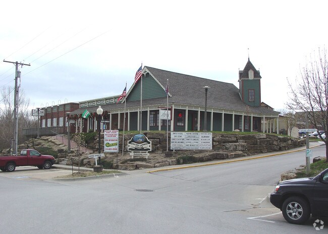
Property Record
160 S Main St, Kansas City, MO 64152


NEARBY LISTINGS FOR SALE OR LEASE
Property Detail
160 S Main St
Kansas City, MO-KS
English Landing 1St
20-70-35-400-006-004-002
REPLAT OF ENGLISH LANDING 1ST AMEND LOT 1
Storebuilding
Platte
AE
Missouri
29095C0108G
1
2024
4.48 AC
2025
I-29 Corridor
030309
Kansas City
30,446 SF
DEMOGRAPHICS near 160 S Main St
1 Mile
3 Mile
5 Mile
2024 Total Population
1,380
26,631
116,912
2029 Population
1,532
29,012
123,095
Pop Growth 2024-2029
+ 11.01%
+ 8.94%
+ 5.29%
Average Age
41
40
38
2024 Total Households
587
10,496
44,857
HH Growth 2024-2029
+ 11.41%
+ 9.10%
+ 5.70%
Median Household Inc
$43,055
$84,586
$69,751
Avg Household Size
2.20
2.40
2.50
2024 Avg HH Vehicles
2.00
2.00
2.00
Median Home Value
$386,110
$301,565
$234,837
Median Year Built
1987
1983
1977
Nearby Places
Map Layers
Map Styles
 Street
 Aerial
- Restaurants
- Banks
- Shops
- Fitness
- Groceries
PUBLIC TRANSPORTATION
AIRPORT
Kansas City International
DRIVE
WALK
Distance
Kansas City International
21 min
12.5 mi
SALE & LEASE HISTORY
LISTING DATE
SALE/LEASE

Sep 23, 2016
For Sale
Feb 21, 2017
For Sale
Nearby Properties
Address
Land Use
TOTAL SIZE
Lot Size
Zoning
Address
Land Use
TOTAL SIZE
Lot Size
Zoning
39,641 SF
70.67 AC
Address
Land Use
TOTAL SIZE
Lot Size
Zoning
315,970 SF
30.23 AC
Address
Land Use
TOTAL SIZE
Lot Size
Zoning
195,876 SF
14.62 AC
Address
Land Use
TOTAL SIZE
Lot Size
Zoning
448,340 SF
6.42 AC
Address
Land Use
TOTAL SIZE
Lot Size
Zoning
207,491 SF
616.94 AC
KR1
Address
Land Use
TOTAL SIZE
Lot Size
Zoning
552,085 SF
21.81 AC
Address
Land Use
TOTAL SIZE
Lot Size
Zoning
656,640 SF
20.07 AC
Address
Land Use
TOTAL SIZE
Lot Size
Zoning
251,983 SF
15.77 AC
Address
Land Use
TOTAL SIZE
Lot Size
Zoning
271,430 SF
15.70 AC
Address
Land Use
TOTAL SIZE
Lot Size
Zoning
245,507 SF
14.22 AC
Address
Land Use
TOTAL SIZE
Lot Size
Zoning
480,000 SF
20.10 AC
Address
Land Use
TOTAL SIZE
Lot Size
Zoning
479,408 SF
14.94 AC
Address
Land Use
TOTAL SIZE
Lot Size
Zoning
221,952 SF
28.85 AC
Address
Land Use
TOTAL SIZE
Lot Size
Zoning
409,280 SF
10.82 AC
Address
Land Use
TOTAL SIZE
Lot Size
Zoning
420,508 SF
13.95 AC
Address
Land Use
TOTAL SIZE
Lot Size
Zoning
194,298 SF
9.73 AC
Address
Land Use
TOTAL SIZE
Lot Size
Zoning
396,848 SF
10 AC
Address
Land Use
TOTAL SIZE
Lot Size
Zoning
165,610 SF
18.07 AC
Address
Land Use
TOTAL SIZE
Lot Size
Zoning
329,938 SF
12.02 AC
Address
Land Use
TOTAL SIZE
Lot Size
Zoning
358,806 SF
24.99 AC
Address
Land Use
TOTAL SIZE
Lot Size
Zoning
Address
Land Use
TOTAL SIZE
Lot Size
Zoning
171,375 SF
9.69 AC
Address
Land Use
TOTAL SIZE
Lot Size
Zoning
156,863 SF
9 AC
Address
Land Use
TOTAL SIZE
Lot Size
Zoning
268,032 SF
7.91 AC
Address
Land Use
TOTAL SIZE
Lot Size
Zoning
153,055 SF
10.76 AC
Address
Land Use
TOTAL SIZE
Lot Size
Zoning
4,993 SF
11.02 AC
R2
Address
Land Use
TOTAL SIZE
Lot Size
Zoning
132,804 SF
8.17 AC
R4
Address
Land Use
TOTAL SIZE
Lot Size
Zoning
185,927 SF
5.91 AC
Address
Land Use
TOTAL SIZE
Lot Size
Zoning
48,952 SF
2.44 AC
Address
Land Use
TOTAL SIZE
Lot Size
Zoning
The World's #1 Commercial Real Estate Marketplace
Connect with us
© 2026 CoStar Group
The information above has been obtained from sources believed reliable. While we do not doubt its accuracy we have not verified it and make no guarantee, warranty or representation about it. It is your responsibility to independently confirm its accuracy and completeness. Any projections, opinions, assumptions, or estimates used are for example only and do not represent the current or future performance of the property. The value of this transaction to you depends on tax and other factors which should be evaluated by your tax, financial, and legal advisors. You and your advisors should conduct a careful, independent investigation of the property to determine to your satisfaction the suitability of the property for your needs.