Property Record
122 Cannon River Ave N, Red Wing, MN 55066


NEARBY LISTINGS FOR SALE OR LEASE
-
-
View all Red Wing listings for sale on LoopNet.com
Property Detail
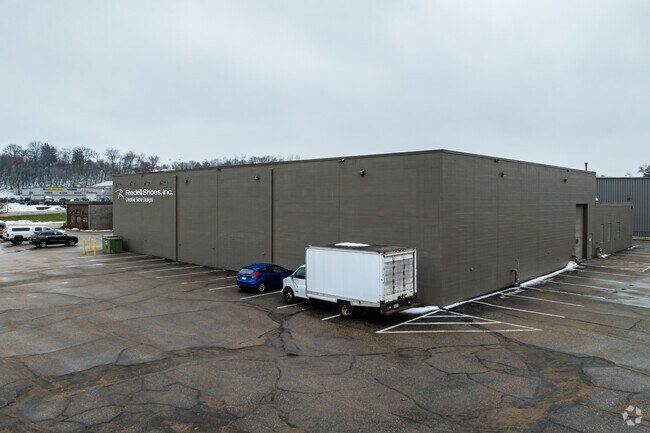
122 Cannon River Ave N
Red Wing, MN
Section 22
55.722.0220
SECTION 22 4.28 AC ID# 27-0000-25000 PART OF S E 1/4 SEC 22 113 15 FROM CEN CONC BR HWY 61 IN N E 1/4 SEC 27 RUN N W ALONG C
Heavymanufacturing
Goodhue
2025
Minnesota
2025
4.28 AC
080202
Minnesota South Area
65,869 SF
Other Market Areas
DEMOGRAPHICS near 122 Cannon River Ave N
1 Mile
3 Mile
5 Mile
2024 Total Population
1,446
7,135
19,019
2029 Population
1,466
7,187
19,050
Pop Growth 2024-2029
+ 1.38%
+ 0.73%
+ 0.16%
Average Age
43
44
43
2024 Total Households
612
3,142
8,115
HH Growth 2024-2029
+ 1.31%
+ 0.60%
+ 0.06%
Median Household Inc
$70,312
$70,997
$68,115
Avg Household Size
2.30
2.20
2.30
2024 Avg HH Vehicles
2.00
2.00
2.00
Median Home Value
$274,999
$263,464
$257,923
Median Year Built
1985
1979
1972
Nearby Places
Map Layers
Map Styles
 Street
 Aerial
- Restaurants
- Banks
- Shops
- Fitness
- Groceries
PUBLIC TRANSPORTATION
COMMUTER RAIL
Red Wing Amtrak Station (Empire Builder - Amtrak)
DRIVE
WALK
Distance
Red Wing Amtrak Station (Empire Builder - Amtrak)
6 min
3.5 mi
Freight Ports
Port Milwaukee
DRIVE
WALK
Distance
Port Milwaukee
343 min
300.6 mi
Nearby Properties
Address
Land Use
TOTAL SIZE
Lot Size
Zoning
Address
Land Use
TOTAL SIZE
Lot Size
Zoning
194,165 SF
24.87 AC
Address
Land Use
TOTAL SIZE
Lot Size
Zoning
88,787 SF
19.15 AC
Address
Land Use
TOTAL SIZE
Lot Size
Zoning
136,318 SF
4.30 AC
Address
Land Use
TOTAL SIZE
Lot Size
Zoning
192,379 SF
22.63 AC
Address
Land Use
TOTAL SIZE
Lot Size
Zoning
173,191 SF
17.94 AC
Address
Land Use
TOTAL SIZE
Lot Size
Zoning
119,200 SF
3.45 AC
Address
Land Use
TOTAL SIZE
Lot Size
Zoning
193,336 SF
15.04 AC
Address
Land Use
TOTAL SIZE
Lot Size
Zoning
120,692 SF
21.92 AC
Address
Land Use
TOTAL SIZE
Lot Size
Zoning
87,184 SF
4.96 AC
Address
Land Use
TOTAL SIZE
Lot Size
Zoning
205,520 SF
16.43 AC
Address
Land Use
TOTAL SIZE
Lot Size
Zoning
18,818 SF
7.91 AC
Address
Land Use
TOTAL SIZE
Lot Size
Zoning
68,142 SF
9.04 AC
Address
Land Use
TOTAL SIZE
Lot Size
Zoning
77,616 SF
100 AC
Address
Land Use
TOTAL SIZE
Lot Size
Zoning
1,800 SF
4.50 AC
Address
Land Use
TOTAL SIZE
Lot Size
Zoning
58,552 SF
2.21 AC
Address
Land Use
TOTAL SIZE
Lot Size
Zoning
1,824 SF
3.87 AC
Address
Land Use
TOTAL SIZE
Lot Size
Zoning
62,100 SF
4.03 AC
Address
Land Use
TOTAL SIZE
Lot Size
Zoning
52,602 SF
9.91 AC
Address
Land Use
TOTAL SIZE
Lot Size
Zoning
81,892 SF
1.05 AC
Address
Land Use
TOTAL SIZE
Lot Size
Zoning
35,721 SF
2.23 AC
Address
Land Use
TOTAL SIZE
Lot Size
Zoning
55,552 SF
3.74 AC
Address
Land Use
TOTAL SIZE
Lot Size
Zoning
13,653 SF
4.89 AC
Address
Land Use
TOTAL SIZE
Lot Size
Zoning
59,680 SF
2 AC
Address
Land Use
TOTAL SIZE
Lot Size
Zoning
52,411 SF
3.57 AC
Address
Land Use
TOTAL SIZE
Lot Size
Zoning
32,992 SF
20.83 AC
Address
Land Use
TOTAL SIZE
Lot Size
Zoning
61,206 SF
4.55 AC
Address
Land Use
TOTAL SIZE
Lot Size
Zoning
56,169 SF
2.21 AC
Address
Land Use
TOTAL SIZE
Lot Size
Zoning
31,428 SF
3.39 AC
The World's #1 Commercial Real Estate Marketplace
Connect with us
© 2026 CoStar Group
The information above has been obtained from sources believed reliable. While we do not doubt its accuracy we have not verified it and make no guarantee, warranty or representation about it. It is your responsibility to independently confirm its accuracy and completeness. Any projections, opinions, assumptions, or estimates used are for example only and do not represent the current or future performance of the property. The value of this transaction to you depends on tax and other factors which should be evaluated by your tax, financial, and legal advisors. You and your advisors should conduct a careful, independent investigation of the property to determine to your satisfaction the suitability of the property for your needs.