Property Record
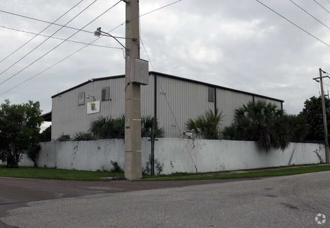
122 E Charlotte Ave, Punta Gorda, FL 33950


Property Detail
122 E Charlotte Ave
412306452001
PUNTA GORDA BLK 65 LESS 163.32 FTX 99.2 FT X 158.55 FT OUT OF NW COR INCLUDES VAC ALLEYS 70/314 247/232 368/922 381/165 843/1314 937/1273 1016/11-15
Utilities
Charlotte
SP
Florida
AE The base floodplain where base flood elevations are provided. AE Zones are now used on new format FIRMs instead of A1-A30 Zones.
17
2024
4.63 AC
2025
Charlotte County
010302
Southwest Florida
6,894 SF
Punta Gorda, FL
NEARBY LISTINGS FOR SALE OR LEASE
DEMOGRAPHICS near 122 E Charlotte Ave
1 mile
3 mile
5 mile
2025 Total Population
3,287
28,739
66,626
2030 Population
3,624
31,668
73,153
Pop Growth 2025-2030
+ 10.25%
+ 10.19%
+ 9.80%
Average Age
51
58
55
2025 Total Households
1,610
14,369
31,582
HH Growth 2025-2030
+ 10.12%
+ 10.00%
+ 9.74%
Median Household Inc
$57,202
$77,610
$71,009
Avg Household Size
2.00
1.90
2.00
2025 Avg HH Vehicles
1.00
2.00
2.00
Median Home Value
$368,571
$475,679
$367,995
Median Year Built
1988
1993
1990
Nearby Places
Map Layers
Map Styles
 Street
 Aerial
Layers
 Traffic
 Biking
Places
Listings with unknown addresses are not visible on the map
- Restaurants
- Banks
- Shops
- Fitness
- Groceries
PUBLIC TRANSPORTATION
AIRPORT
Punta Gorda
Drive
Walk
Distance
Punta Gorda
10 min
3.9 mi
Freight Ports
Port Manatee
Drive
Walk
Distance
Port Manatee
86 min
72.2 mi
Nearby Properties
Address
Land Use
TOTAL SIZE
Lot Size
Zoning
Address
Land Use
TOTAL SIZE
Lot Size
Zoning
333,027 SF
9.79 AC
CHRW
Address
Land Use
TOTAL SIZE
Lot Size
Zoning
349,844 SF
78.47 AC
P
Address
Land Use
TOTAL SIZE
Lot Size
Zoning
164,121 SF
44.20 AC
ECAP
Address
Land Use
TOTAL SIZE
Lot Size
Zoning
77,154 SF
10.30 AC
CC
Address
Land Use
TOTAL SIZE
Lot Size
Zoning
161,439 SF
171 AC
RE1
Address
Land Use
TOTAL SIZE
Lot Size
Zoning
121,585 SF
696.03 AC
RE1
Address
Land Use
TOTAL SIZE
Lot Size
Zoning
345,043 SF
33.12 AC
ECAP
Address
Land Use
TOTAL SIZE
Lot Size
Zoning
249,777 SF
48 AC
RMF10
Address
Land Use
TOTAL SIZE
Lot Size
Zoning
789,392 SF
31.39 AC
RMF15
Address
Land Use
TOTAL SIZE
Lot Size
Zoning
254.31 AC
PD
Address
Land Use
TOTAL SIZE
Lot Size
Zoning
47,443 SF
7.94 AC
CC
Address
Land Use
TOTAL SIZE
Lot Size
Zoning
62,415 SF
281.65 AC
ECAP
Address
Land Use
TOTAL SIZE
Lot Size
Zoning
15,253 SF
13.27 AC
P
Address
Land Use
TOTAL SIZE
Lot Size
Zoning
208,560 SF
36.69 AC
PD-GM
Address
Land Use
TOTAL SIZE
Lot Size
Zoning
385,350 SF
374.81 AC
ECAP
Address
Land Use
TOTAL SIZE
Lot Size
Zoning
134,308 SF
16 AC
RSF3.5
Address
Land Use
TOTAL SIZE
Lot Size
Zoning
6,313 SF
15.49 AC
P
Address
Land Use
TOTAL SIZE
Lot Size
Zoning
73,095 SF
5 AC
NC
Address
Land Use
TOTAL SIZE
Lot Size
Zoning
44,185 SF
1.22 AC
CC
Address
Land Use
TOTAL SIZE
Lot Size
Zoning
128,594 SF
25.54 AC
PD
Address
Land Use
TOTAL SIZE
Lot Size
Zoning
25,356 SF
1.40 AC
CC
Address
Land Use
TOTAL SIZE
Lot Size
Zoning
70,518 SF
2.08 AC
PD
Address
Land Use
TOTAL SIZE
Lot Size
Zoning
125.54 AC
PD
Address
Land Use
TOTAL SIZE
Lot Size
Zoning
82,379 SF
0.88 AC
CC
Address
Land Use
TOTAL SIZE
Lot Size
Zoning
12,159 SF
0.56 AC
CC
Address
Land Use
TOTAL SIZE
Lot Size
Zoning
24,880 SF
84.50 AC
PKR
Address
Land Use
TOTAL SIZE
Lot Size
Zoning
1,296 SF
14.46 AC
CG
Address
Land Use
TOTAL SIZE
Lot Size
Zoning
43,755 SF
8.19 AC
CC
Address
Land Use
TOTAL SIZE
Lot Size
Zoning
84,500 SF
5.59 AC
CG
Address
Land Use
TOTAL SIZE
Lot Size
Zoning
30,472 SF
3.19 AC
NR-10
The World's #1 Commercial Real Estate Marketplace
Connect with us
© 2026 CoStar Group
The information above has been obtained from sources believed reliable. While we do not doubt its accuracy we have not verified it and make no guarantee, warranty or representation about it. It is your responsibility to independently confirm its accuracy and completeness. Any projections, opinions, assumptions, or estimates used are for example only and do not represent the current or future performance of the property. The value of this transaction to you depends on tax and other factors which should be evaluated by your tax, financial, and legal advisors. You and your advisors should conduct a careful, independent investigation of the property to determine to your satisfaction the suitability of the property for your needs.