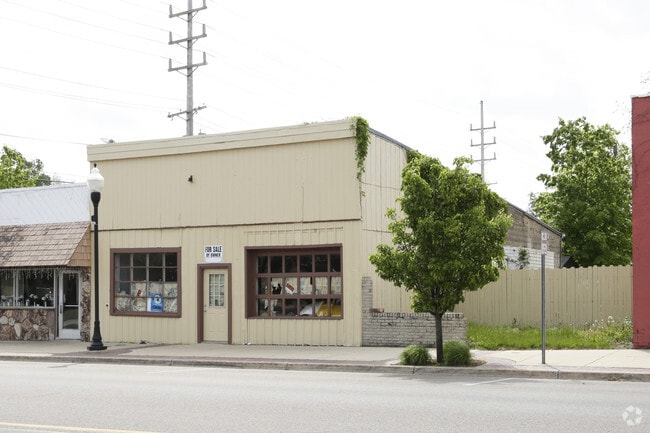
Property Record
122 E E Ferry St, Berrien Springs, MI 49103


NEARBY LISTINGS FOR SALE OR LEASE
Property Detail
122 E E Ferry St
Niles, MI
Berrien
11-32-0340-0122-02-9
W2N2 LOT 122
Storebuilding
Berrien
X
Michigan
26021C0254C
122
2024
0.04 AC
2025
Michigan Southwest Area
021400
Other Market Areas
1,920 SF
DEMOGRAPHICS near 122 E E Ferry St
1 mile
3 mile
5 mile
2024 Total Population
4,070
9,897
14,164
2029 Population
3,981
9,675
13,807
Pop Growth 2024-2029
(2.19%)
(2.24%)
(2.52%)
Average Age
39
39
40
2024 Total Households
1,572
3,466
5,076
HH Growth 2024-2029
(2.29%)
(2.57%)
(2.82%)
Median Household Inc
$59,492
$58,093
$61,156
Avg Household Size
2.40
2.40
2.50
2024 Avg HH Vehicles
2.00
2.00
2.00
Median Home Value
$169,034
$186,224
$201,489
Median Year Built
1971
1972
1973
Nearby Places
Map Layers
Map Styles
 Street
 Aerial
Transit
 Traffic
 Biking
Places
Listings with unknown addresses are not visible on the map
- Restaurants
- Banks
- Shops
- Fitness
- Groceries
PUBLIC TRANSPORTATION
COMMUTER RAIL
Drive
Walk
Distance
15 min
9.7 mi
AIRPORT
South Bend International
Drive
Walk
Distance
South Bend International
37 min
22.0 mi
Nearby Properties
Address
Land Use
TOTAL SIZE
Lot Size
Zoning
Address
Land Use
TOTAL SIZE
Lot Size
Zoning
Address
Land Use
TOTAL SIZE
Lot Size
Zoning
28,992 SF
5.94 AC
B
Address
Land Use
TOTAL SIZE
Lot Size
Zoning
36,571 SF
3.80 AC
R3
Address
Land Use
TOTAL SIZE
Lot Size
Zoning
53,348 SF
4.19 AC
B
Address
Land Use
TOTAL SIZE
Lot Size
Zoning
9,836 SF
36.65 AC
AR
Address
Land Use
TOTAL SIZE
Lot Size
Zoning
4,906 SF
39.27 AC
E1
Address
Land Use
TOTAL SIZE
Lot Size
Zoning
18,310 SF
4.84 AC
B
Address
Land Use
TOTAL SIZE
Lot Size
Zoning
6,633 SF
34.83 AC
E1
Address
Land Use
TOTAL SIZE
Lot Size
Zoning
47,242 SF
124.57 AC
UC
Address
Land Use
TOTAL SIZE
Lot Size
Zoning
49,056 SF
2.21 AC
R-3
Address
Land Use
TOTAL SIZE
Lot Size
Zoning
4,460 SF
105.20 AC
AGRI / RES
Address
Land Use
TOTAL SIZE
Lot Size
Zoning
4,501 SF
4.22 AC
B
Address
Land Use
TOTAL SIZE
Lot Size
Zoning
20,090 SF
2.13 AC
R3
Address
Land Use
TOTAL SIZE
Lot Size
Zoning
4,668 SF
3.84 AC
AGRI / RES
Address
Land Use
TOTAL SIZE
Lot Size
Zoning
5,235 SF
12.72 AC
E1
Address
Land Use
TOTAL SIZE
Lot Size
Zoning
3,243 SF
1.78 AC
R1
Address
Land Use
TOTAL SIZE
Lot Size
Zoning
9,098 SF
40 AC
AGRI / RES
Address
Land Use
TOTAL SIZE
Lot Size
Zoning
5,044 SF
79.50 AC
AGRI / RES
Address
Land Use
TOTAL SIZE
Lot Size
Zoning
6,328 SF
109.19 AC
AGRI / RES
Address
Land Use
TOTAL SIZE
Lot Size
Zoning
3,222 SF
1.06 AC
B
Address
Land Use
TOTAL SIZE
Lot Size
Zoning
5,439 SF
1.02 AC
AGRI / RES
Address
Land Use
TOTAL SIZE
Lot Size
Zoning
4,686 SF
1.86 AC
AGRI / RES
Address
Land Use
TOTAL SIZE
Lot Size
Zoning
5,410 SF
3.34 AC
AGRI / RES
Address
Land Use
TOTAL SIZE
Lot Size
Zoning
2,566 SF
63.40 AC
AGRI / RES
Address
Land Use
TOTAL SIZE
Lot Size
Zoning
5,250 SF
3.48 AC
AGRI / RES
Address
Land Use
TOTAL SIZE
Lot Size
Zoning
3,174 SF
1.42 AC
R1
Address
Land Use
TOTAL SIZE
Lot Size
Zoning
950 SF
9.10 AC
I-1
Address
Land Use
TOTAL SIZE
Lot Size
Zoning
106,762 SF
22.26 AC
AGRI / RES
Address
Land Use
TOTAL SIZE
Lot Size
Zoning
4,236 SF
11.25 AC
E1
Address
Land Use
TOTAL SIZE
Lot Size
Zoning
4,524 SF
1.64 AC
AGRI / RES
The World's #1 Commercial Real Estate Marketplace
Connect with us
© 2026 CoStar Group
The information above has been obtained from sources believed reliable. While we do not doubt its accuracy we have not verified it and make no guarantee, warranty or representation about it. It is your responsibility to independently confirm its accuracy and completeness. Any projections, opinions, assumptions, or estimates used are for example only and do not represent the current or future performance of the property. The value of this transaction to you depends on tax and other factors which should be evaluated by your tax, financial, and legal advisors. You and your advisors should conduct a careful, independent investigation of the property to determine to your satisfaction the suitability of the property for your needs.