Property Record
122 E Seneca St, Manlius, NY 13104


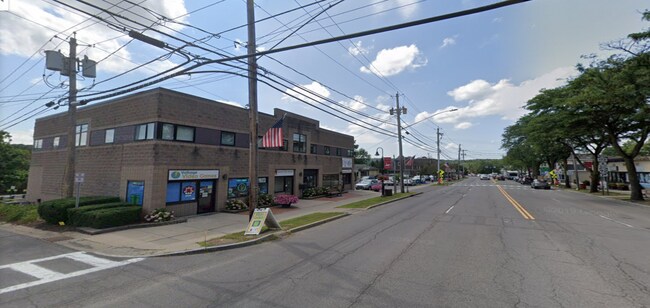
Property Detail
122 E Seneca St
313803-029-000-0002-018-001-0000
FL 97 VILL BK 11
Officebuilding
Onondaga
IND
New York
B and X Area of moderate flood hazard, usually the area between the limits of the 100-year and 500-year floods.
18.001
2025
0.25 AC
2025
SE Outer Onondaga County
015203
Syracuse
7,452 SF
Syracuse, NY
NEARBY LISTINGS FOR SALE OR LEASE
DEMOGRAPHICS near 122 E Seneca St
1 mile
3 mile
5 mile
2025 Total Population
6,746
22,795
36,913
2030 Population
6,714
22,612
36,579
Pop Growth 2025-2030
(0.47%)
(0.80%)
(0.90%)
Average Age
43
43
44
2025 Total Households
2,781
9,043
14,786
HH Growth 2025-2030
(0.65%)
(0.95%)
(1.06%)
Median Household Inc
$108,739
$132,127
$126,443
Avg Household Size
2.40
2.50
2.40
2025 Avg HH Vehicles
2.00
2.00
2.00
Median Home Value
$300,623
$318,950
$296,013
Median Year Built
1972
1974
1973
Nearby Places
Map Layers
Map Styles
 Street
 Aerial
Layers
 Traffic
 Biking
Places
Listings with unknown addresses are not visible on the map
- Restaurants
- Banks
- Shops
- Fitness
- Groceries
PUBLIC TRANSPORTATION
AIRPORT
Syracuse Hancock International
Drive
Walk
Distance
Syracuse Hancock International
29 min
18.1 mi
SALE & LEASE HISTORY
LISTING DATE
SALE/LEASE

Feb 20, 2024
For Lease
Apr 04, 2022
For Lease
Nearby Properties
Address
Land Use
TOTAL SIZE
Lot Size
Zoning
Address
Land Use
TOTAL SIZE
Lot Size
Zoning
293,638 SF
58.90 AC
R1
Address
Land Use
TOTAL SIZE
Lot Size
Zoning
151,628 SF
38.98 AC
RA
Address
Land Use
TOTAL SIZE
Lot Size
Zoning
4,722 SF
35.39 AC
R5
Address
Land Use
TOTAL SIZE
Lot Size
Zoning
6.24 AC
RA
Address
Land Use
TOTAL SIZE
Lot Size
Zoning
6,936 SF
13.18 AC
R2
Address
Land Use
TOTAL SIZE
Lot Size
Zoning
15,240 SF
12.46 AC
R1
Address
Land Use
TOTAL SIZE
Lot Size
Zoning
26,508 SF
4.38 AC
C
Address
Land Use
TOTAL SIZE
Lot Size
Zoning
116,748 SF
7.67 AC
R1
Address
Land Use
TOTAL SIZE
Lot Size
Zoning
126,701 SF
6.03 AC
R2
Address
Land Use
TOTAL SIZE
Lot Size
Zoning
128,733 SF
9.76 AC
RS
Address
Land Use
TOTAL SIZE
Lot Size
Zoning
32,094 SF
1.70 AC
B2
Address
Land Use
TOTAL SIZE
Lot Size
Zoning
5,376 SF
8.91 AC
R2
Address
Land Use
TOTAL SIZE
Lot Size
Zoning
4,320 SF
5.67 AC
R4
Address
Land Use
TOTAL SIZE
Lot Size
Zoning
401,546 SF
24 AC
C
Address
Land Use
TOTAL SIZE
Lot Size
Zoning
60,621 SF
5.63 AC
C1
Address
Land Use
TOTAL SIZE
Lot Size
Zoning
60,300 SF
3.70 AC
IND
Address
Land Use
TOTAL SIZE
Lot Size
Zoning
52,145 SF
4.36 AC
RS
Address
Land Use
TOTAL SIZE
Lot Size
Zoning
43,620 SF
33.82 AC
R1
Address
Land Use
TOTAL SIZE
Lot Size
Zoning
59,066 SF
3.46 AC
R2
Address
Land Use
TOTAL SIZE
Lot Size
Zoning
74,424 SF
35.70 AC
R1
Address
Land Use
TOTAL SIZE
Lot Size
Zoning
9,616 SF
6.40 AC
R5
Address
Land Use
TOTAL SIZE
Lot Size
Zoning
45,285 SF
5.33 AC
C1
Address
Land Use
TOTAL SIZE
Lot Size
Zoning
1,776 SF
14.74 AC
C
Address
Land Use
TOTAL SIZE
Lot Size
Zoning
28,037 SF
40.68 AC
C
Address
Land Use
TOTAL SIZE
Lot Size
Zoning
27,864 SF
4.20 AC
CA
Address
Land Use
TOTAL SIZE
Lot Size
Zoning
36,072 SF
2.27 AC
C
Address
Land Use
TOTAL SIZE
Lot Size
Zoning
28,334 SF
3.97 AC
IND
Address
Land Use
TOTAL SIZE
Lot Size
Zoning
62,188 SF
20.24 AC
R1
Address
Land Use
TOTAL SIZE
Lot Size
Zoning
9,102 SF
2.08 AC
C
Address
Land Use
TOTAL SIZE
Lot Size
Zoning
3,408 SF
5.12 AC
R5
The World's #1 Commercial Real Estate Marketplace
Connect with us
© 2026 CoStar Group
The information above has been obtained from sources believed reliable. While we do not doubt its accuracy we have not verified it and make no guarantee, warranty or representation about it. It is your responsibility to independently confirm its accuracy and completeness. Any projections, opinions, assumptions, or estimates used are for example only and do not represent the current or future performance of the property. The value of this transaction to you depends on tax and other factors which should be evaluated by your tax, financial, and legal advisors. You and your advisors should conduct a careful, independent investigation of the property to determine to your satisfaction the suitability of the property for your needs.