Property Record
122 Mastic Rd, Mastic Beach, NY 11951


Property Detail
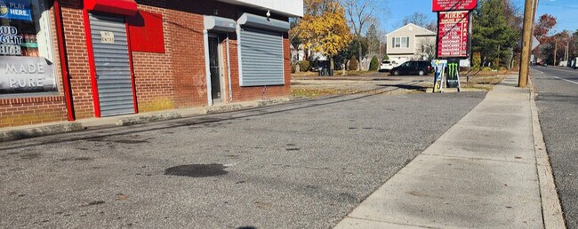
122 Mastic Rd
Nassau County-Suffolk County, NY
Suffolk
0200-976-80-12-00-007-000
New York
Commercialnec
200
B and X Area of moderate flood hazard, usually the area between the limits of the 100-year and 500-year floods.
0.14 AC
2024
Eastern Suffolk
2025
Long Island (New York)
159518
NEARBY LISTINGS FOR SALE OR LEASE
DEMOGRAPHICS near 122 Mastic Rd
1 mile
3 mile
5 mile
2025 Total Population
13,166
47,500
78,915
2030 Population
13,330
47,644
79,321
Pop Growth 2025-2030
+ 1.25%
+ 0.30%
+ 0.51%
Average Age
39
39
40
2025 Total Households
4,219
15,120
25,620
HH Growth 2025-2030
+ 1.09%
+ 0.20%
+ 0.39%
Median Household Inc
$103,848
$103,112
$106,813
Avg Household Size
3.00
3.00
2.90
2025 Avg HH Vehicles
2.00
2.00
2.00
Median Home Value
$371,664
$403,626
$446,097
Median Year Built
1975
1974
1975
Nearby Places
Map Layers
Map Styles
 Street
 Aerial
Layers
 Traffic
 Biking
Places
Listings with unknown addresses are not visible on the map
- Restaurants
- Banks
- Shops
- Fitness
- Groceries
PUBLIC TRANSPORTATION
COMMUTER RAIL
Drive
Walk
Distance
7 min
2.7 mi
Bellport Station (Montauk Branch - Long Island Rail Road)
Drive
Walk
Distance
Bellport Station (Montauk Branch - Long Island Rail Road)
15 min
8.0 mi
AIRPORT
Long Island MacArthur
Drive
Walk
Distance
Long Island MacArthur
30 min
16.9 mi
SALE & LEASE HISTORY
LISTING DATE
SALE/LEASE

Dec 09, 2022
For Lease
Nearby Properties
Address
Land Use
TOTAL SIZE
Lot Size
Zoning
Address
Land Use
TOTAL SIZE
Lot Size
Zoning
1.70 AC
RRD
Address
Land Use
TOTAL SIZE
Lot Size
Zoning
576 SF
2.70 AC
HB
Address
Land Use
TOTAL SIZE
Lot Size
Zoning
2,028 SF
0.19 AC
VILLA
Address
Land Use
TOTAL SIZE
Lot Size
Zoning
4,016 SF
0.50 AC
R4
Address
Land Use
TOTAL SIZE
Lot Size
Zoning
2,040 SF
0.59 AC
R20
Address
Land Use
TOTAL SIZE
Lot Size
Zoning
1,388.50 AC
Address
Land Use
TOTAL SIZE
Lot Size
Zoning
0.48 AC
R40
Address
Land Use
TOTAL SIZE
Lot Size
Zoning
28.82 AC
Address
Land Use
TOTAL SIZE
Lot Size
Zoning
Address
Land Use
TOTAL SIZE
Lot Size
Zoning
19.69 AC
Address
Land Use
TOTAL SIZE
Lot Size
Zoning
0.18 AC
R20
Address
Land Use
TOTAL SIZE
Lot Size
Zoning
0.46 AC
R20
Address
Land Use
TOTAL SIZE
Lot Size
Zoning
0.83 AC
BUS1
Address
Land Use
TOTAL SIZE
Lot Size
Zoning
12.31 AC
Address
Land Use
TOTAL SIZE
Lot Size
Zoning
92.78 AC
Address
Land Use
TOTAL SIZE
Lot Size
Zoning
0.62 AC
BUS1
Address
Land Use
TOTAL SIZE
Lot Size
Zoning
186.73 AC
Address
Land Use
TOTAL SIZE
Lot Size
Zoning
Address
Land Use
TOTAL SIZE
Lot Size
Zoning
Address
Land Use
TOTAL SIZE
Lot Size
Zoning
14.83 AC
Address
Land Use
TOTAL SIZE
Lot Size
Zoning
23.33 AC
Address
Land Use
TOTAL SIZE
Lot Size
Zoning
0.79 AC
Address
Land Use
TOTAL SIZE
Lot Size
Zoning
0.27 AC
BUS1
Address
Land Use
TOTAL SIZE
Lot Size
Zoning
611.50 AC
Address
Land Use
TOTAL SIZE
Lot Size
Zoning
Address
Land Use
TOTAL SIZE
Lot Size
Zoning
Address
Land Use
TOTAL SIZE
Lot Size
Zoning
6.28 AC
Address
Land Use
TOTAL SIZE
Lot Size
Zoning
127.50 AC
Address
Land Use
TOTAL SIZE
Lot Size
Zoning
0.41 AC
Address
Land Use
TOTAL SIZE
Lot Size
Zoning
103.66 AC
The World's #1 Commercial Real Estate Marketplace
Connect with us
© 2026 CoStar Group
The information above has been obtained from sources believed reliable. While we do not doubt its accuracy we have not verified it and make no guarantee, warranty or representation about it. It is your responsibility to independently confirm its accuracy and completeness. Any projections, opinions, assumptions, or estimates used are for example only and do not represent the current or future performance of the property. The value of this transaction to you depends on tax and other factors which should be evaluated by your tax, financial, and legal advisors. You and your advisors should conduct a careful, independent investigation of the property to determine to your satisfaction the suitability of the property for your needs.