Property Record
122 Pendleton Ave, Valdosta, GA 31601
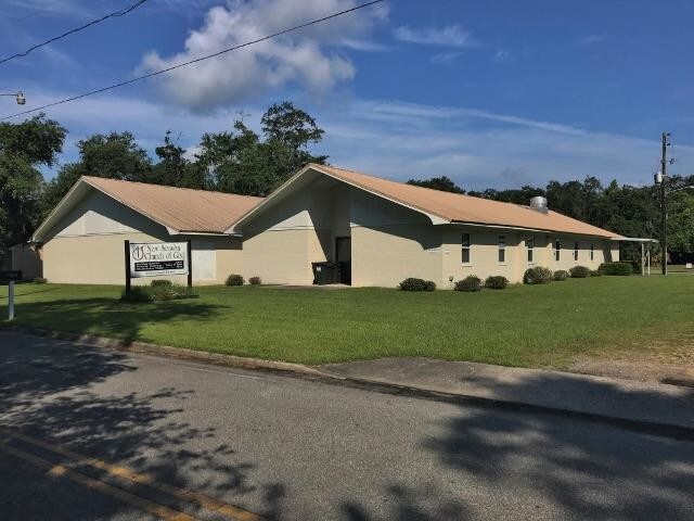


Property Detail
122 Pendleton Ave
0161C-097
LT 10-12 BLK E DIAMOND OIL SUB
Religious
Lowndes
R-6
Georgia
B and X Area of moderate flood hazard, usually the area between the limits of the 100-year and 500-year floods.
10-12
2025
0.69 AC
2025
Valdosta/Lake Park
010801
Other Market Areas
8,546 SF
Valdosta, GA
NEARBY LISTINGS FOR SALE OR LEASE
-
-
View all Valdosta listings for sale on LoopNet.com
DEMOGRAPHICS near 122 Pendleton Ave
1 mile
3 mile
5 mile
2025 Total Population
4,382
24,282
55,763
2030 Population
4,529
24,952
56,925
Pop Growth 2025-2030
+ 3.35%
+ 2.76%
+ 2.08%
Average Age
36
35
36
2025 Total Households
1,676
9,112
21,870
HH Growth 2025-2030
+ 3.70%
+ 3.30%
+ 2.48%
Median Household Inc
$29,426
$30,905
$40,993
Avg Household Size
2.50
2.40
2.30
2025 Avg HH Vehicles
1.00
1.00
2.00
Median Home Value
$116,749
$97,999
$161,315
Median Year Built
1991
1978
1984
Nearby Places
Map Layers
Map Styles
 Street
 Aerial
Layers
 Traffic
 Biking
Places
Listings with unknown addresses are not visible on the map
- Restaurants
- Banks
- Shops
- Fitness
- Groceries
PUBLIC TRANSPORTATION
AIRPORT
Valdosta Regional
Drive
Walk
Distance
Valdosta Regional
6 min
3.0 mi
SALE & LEASE HISTORY
LISTING DATE
SALE/LEASE

Nov 19, 2018
For Sale
Nearby Properties
Address
Land Use
TOTAL SIZE
Lot Size
Zoning
Address
Land Use
TOTAL SIZE
Lot Size
Zoning
1,200 SF
73.36 AC
M-2
Address
Land Use
TOTAL SIZE
Lot Size
Zoning
60,000 SF
56.32 AC
M-1
Address
Land Use
TOTAL SIZE
Lot Size
Zoning
210,020 SF
4.22 AC
C-C
Address
Land Use
TOTAL SIZE
Lot Size
Zoning
339 SF
23.53 AC
E-R
Address
Land Use
TOTAL SIZE
Lot Size
Zoning
414,158 SF
40 AC
M-1
Address
Land Use
TOTAL SIZE
Lot Size
Zoning
210,000 SF
81.43 AC
M-2
Address
Land Use
TOTAL SIZE
Lot Size
Zoning
150,802 SF
11.97 AC
M-1
Address
Land Use
TOTAL SIZE
Lot Size
Zoning
2,496 SF
63.73 AC
M-2
Address
Land Use
TOTAL SIZE
Lot Size
Zoning
142,140 SF
24.29 AC
DR-10
Address
Land Use
TOTAL SIZE
Lot Size
Zoning
101,774 SF
3.55 AC
C-H
Address
Land Use
TOTAL SIZE
Lot Size
Zoning
1,732 SF
9.28 AC
R-M
Address
Land Use
TOTAL SIZE
Lot Size
Zoning
143,560 SF
M-1
Address
Land Use
TOTAL SIZE
Lot Size
Zoning
7,200 SF
9.92 AC
M-1
Address
Land Use
TOTAL SIZE
Lot Size
Zoning
114,460 SF
M-1
Address
Land Use
TOTAL SIZE
Lot Size
Zoning
48,000 SF
9.06 AC
C-C
Address
Land Use
TOTAL SIZE
Lot Size
Zoning
55,180 SF
2.46 AC
M-2
Address
Land Use
TOTAL SIZE
Lot Size
Zoning
12,000 SF
0.27 AC
M-2
Address
Land Use
TOTAL SIZE
Lot Size
Zoning
15,140 SF
5.73 AC
C-H
Address
Land Use
TOTAL SIZE
Lot Size
Zoning
100,000 SF
25.27 AC
M-1
Address
Land Use
TOTAL SIZE
Lot Size
Zoning
56,879 SF
63 AC
CON
Address
Land Use
TOTAL SIZE
Lot Size
Zoning
2,610 SF
10 AC
R-M
Address
Land Use
TOTAL SIZE
Lot Size
Zoning
66,395 SF
1.49 AC
M-1
Address
Land Use
TOTAL SIZE
Lot Size
Zoning
480 SF
10 AC
R-M
Address
Land Use
TOTAL SIZE
Lot Size
Zoning
9,000 SF
72.18 AC
E-A
Address
Land Use
TOTAL SIZE
Lot Size
Zoning
2,280 SF
4,680.74 AC
E-A, M-2
Address
Land Use
TOTAL SIZE
Lot Size
Zoning
74,638 SF
4.72 AC
M-1
Address
Land Use
TOTAL SIZE
Lot Size
Zoning
3,284 SF
17.45 AC
R-M
Address
Land Use
TOTAL SIZE
Lot Size
Zoning
4,776 SF
6.95 AC
R-M
Address
Land Use
TOTAL SIZE
Lot Size
Zoning
8,320 SF
61 AC
E-A
The World's #1 Commercial Real Estate Marketplace
Connect with us
© 2026 CoStar Group
The information above has been obtained from sources believed reliable. While we do not doubt its accuracy we have not verified it and make no guarantee, warranty or representation about it. It is your responsibility to independently confirm its accuracy and completeness. Any projections, opinions, assumptions, or estimates used are for example only and do not represent the current or future performance of the property. The value of this transaction to you depends on tax and other factors which should be evaluated by your tax, financial, and legal advisors. You and your advisors should conduct a careful, independent investigation of the property to determine to your satisfaction the suitability of the property for your needs.