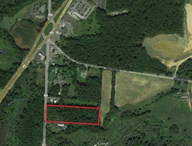
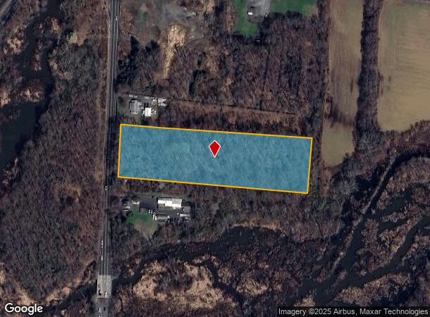
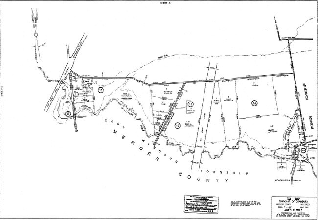
Property Record
122 S Main St, Cranbury, NJ 08512
NEARBY LISTINGS FOR SALE OR LEASE
Property Detail
122 S Main St
New York-Jersey City-White Plains, NY-NJ
5 ACRES
02-00016-0000-00008
Middlesex
Vacantlandnec
New Jersey
AE
8
34021C0167F
5 AC
2024
Brunswick West
2025
Northern New Jersey
008700
DEMOGRAPHICS near 122 S Main St
1 Mile
3 Mile
5 Mile
2024 Total Population
6,689
45,900
93,585
2029 Population
6,643
45,572
92,647
Pop Growth 2024-2029
(0.69%)
(0.71%)
(1.00%)
Average Age
40
41
45
2024 Total Households
2,540
16,541
37,685
HH Growth 2024-2029
(0.94%)
(1.05%)
(1.35%)
Median Household Inc
$94,013
$113,981
$106,489
Avg Household Size
2.60
2.70
2.40
2024 Avg HH Vehicles
2.00
2.00
2.00
Median Home Value
$358,080
$401,526
$406,889
Median Year Built
1972
1979
1984
Nearby Places
Map Layers
Map Styles
 Street
 Aerial
- Restaurants
- Banks
- Shops
- Fitness
- Groceries
PUBLIC TRANSPORTATION
COMMUTER RAIL
Princeton Junction (Northeast Corridor Line - NJ Transit Commuter Rail (NJ Transit), Princeton Branch - NJ Transit Commuter Rail (NJ Transit))
DRIVE
WALK
Distance
Princeton Junction (Northeast Corridor Line - NJ Transit Commuter Rail (NJ Transit), Princeton Branch - NJ Transit Commuter Rail (NJ Transit))
14 min
7.7 mi
AIRPORT
Trenton Mercer
DRIVE
WALK
Distance
Trenton Mercer
34 min
21.9 mi
Freight Ports
New York Container Terminal
DRIVE
WALK
Distance
New York Container Terminal
47 min
35.1 mi
SALE & LEASE HISTORY
LISTING DATE
SALE/LEASE

Sep 24, 2016
For Sale
Nearby Properties
Address
Land Use
TOTAL SIZE
Lot Size
Zoning
Address
Land Use
TOTAL SIZE
Lot Size
Zoning
203.85 AC
I/LI
Address
Land Use
TOTAL SIZE
Lot Size
Zoning
57.09 AC
R-1
Address
Land Use
TOTAL SIZE
Lot Size
Zoning
2,448 SF
59.55 AC
RO
Address
Land Use
TOTAL SIZE
Lot Size
Zoning
115.37 AC
I/LI
Address
Land Use
TOTAL SIZE
Lot Size
Zoning
63.54 AC
LI
Address
Land Use
TOTAL SIZE
Lot Size
Zoning
51.01 AC
RO
Address
Land Use
TOTAL SIZE
Lot Size
Zoning
69.34 AC
LI
Address
Land Use
TOTAL SIZE
Lot Size
Zoning
47.51 AC
I/LI
Address
Land Use
TOTAL SIZE
Lot Size
Zoning
53.31 AC
LI
Address
Land Use
TOTAL SIZE
Lot Size
Zoning
318,155 SF
36.28 AC
RO
Address
Land Use
TOTAL SIZE
Lot Size
Zoning
83.35 AC
I/LA
Address
Land Use
TOTAL SIZE
Lot Size
Zoning
2,338 SF
58.26 AC
I/LI
Address
Land Use
TOTAL SIZE
Lot Size
Zoning
376,379 SF
81.40 AC
PRC
Address
Land Use
TOTAL SIZE
Lot Size
Zoning
606,000 SF
51.49 AC
PUD
Address
Land Use
TOTAL SIZE
Lot Size
Zoning
53.31 AC
LI
Address
Land Use
TOTAL SIZE
Lot Size
Zoning
567,798 SF
134.06 AC
RO
Address
Land Use
TOTAL SIZE
Lot Size
Zoning
12.30 AC
R-1
Address
Land Use
TOTAL SIZE
Lot Size
Zoning
69.94 AC
ILIS
Address
Land Use
TOTAL SIZE
Lot Size
Zoning
27.57 AC
PUD
Address
Land Use
TOTAL SIZE
Lot Size
Zoning
53.98 AC
LI
Address
Land Use
TOTAL SIZE
Lot Size
Zoning
46.04 AC
I/LI
Address
Land Use
TOTAL SIZE
Lot Size
Zoning
186,785 SF
29.83 AC
HC
Address
Land Use
TOTAL SIZE
Lot Size
Zoning
243,700 SF
34.78 AC
HC
Address
Land Use
TOTAL SIZE
Lot Size
Zoning
38.20 AC
LI
Address
Land Use
TOTAL SIZE
Lot Size
Zoning
23.60 AC
R1
Address
Land Use
TOTAL SIZE
Lot Size
Zoning
161,588 SF
28 AC
RO
Address
Land Use
TOTAL SIZE
Lot Size
Zoning
53.56 AC
I/LI
Address
Land Use
TOTAL SIZE
Lot Size
Zoning
15 AC
PUD
Address
Land Use
TOTAL SIZE
Lot Size
Zoning
281,154 SF
39.34 AC
RO
Address
Land Use
TOTAL SIZE
Lot Size
Zoning
29.89 AC
LI
The World's #1 Commercial Real Estate Marketplace
Connect with us
© 2025 CoStar Group
The information above has been obtained from sources believed reliable. While we do not doubt its accuracy we have not verified it and make no guarantee, warranty or representation about it. It is your responsibility to independently confirm its accuracy and completeness. Any projections, opinions, assumptions, or estimates used are for example only and do not represent the current or future performance of the property. The value of this transaction to you depends on tax and other factors which should be evaluated by your tax, financial, and legal advisors. You and your advisors should conduct a careful, independent investigation of the property to determine to your satisfaction the suitability of the property for your needs.