Property Record
1220 E Washington St, Colton, CA 92324


Save to a Folder
{{folder.Name}}
{{folder.ListingIds.length}} Properties
{{folder.ListingIds.length}} Property
Create a New Folder
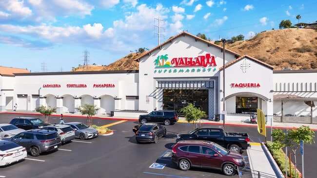
Property Detail
1220 E Washington St
0276-361-88
PARCEL 1 AND PARCEL 2 OF PARCEL MAP NO. 10379, IN THE CITY OF COLTON, COUNTY OF SAN BERNARDINO, STATE OF CALIFORNIA, AS PER MAP RECORDED IN BOOK 115 PAGE 47 AND 48 OF PARCELS MAPS, IN THE OFFICE OF THE COUNTY RECORDED OF SAID COUNTY. TOGETHER WITH TH
Storebuilding
San Bernardino
B and X Area of moderate flood hazard, usually the area between the limits of the 100-year and 500-year floods.
California
2025
5.89 AC
2026
San Bernardino
007112
Inland Empire (California)
45,180 SF
Riverside-San Bernardino-Ontario, CA
NEARBY LISTINGS FOR SALE OR LEASE
DEMOGRAPHICS near 1220 E Washington St
1 mile
3 mile
5 mile
2025 Total Population
16,164
77,628
223,597
2030 Population
16,533
78,965
227,134
Pop Growth 2025-2030
+ 2.28%
+ 1.72%
+ 1.58%
Average Age
36
37
35
2025 Total Households
6,051
25,161
66,464
HH Growth 2025-2030
+ 2.25%
+ 1.67%
+ 1.60%
Median Household Inc
$69,746
$76,704
$73,670
Avg Household Size
2.60
3.00
3.20
2025 Avg HH Vehicles
2.00
2.00
2.00
Median Home Value
$459,222
$482,687
$460,636
Median Year Built
1982
1978
1978
Nearby Places
Map Layers
Map Styles
 Street
 Aerial
Layers
 Traffic
 Biking
Places
Listings with unknown addresses are not visible on the map
- Restaurants
- Banks
- Shops
- Fitness
- Groceries
PUBLIC TRANSPORTATION
COMMUTER RAIL
San Bernardino - Tippecanoe Metrolink Station (Metrolink San Bernardino Line - Metrolink Trains)
Drive
Walk
Distance
San Bernardino - Tippecanoe Metrolink Station (Metrolink San Bernardino Line - Metrolink Trains)
8 min
4.2 mi
San Bernardino - Downtown Metrolink Station (Metrolink Inland Empire-Orange County Line - Metrolink Trains, Metrolink San Bernardino Line - Metrolink Trains)
Drive
Walk
Distance
San Bernardino - Downtown Metrolink Station (Metrolink Inland Empire-Orange County Line - Metrolink Trains, Metrolink San Bernardino Line - Metrolink Trains)
9 min
5.1 mi
AIRPORT
Ontario International
Drive
Walk
Distance
Ontario International
27 min
20.0 mi
Freight Ports
Port of Long Beach
Drive
Walk
Distance
Port of Long Beach
80 min
62.7 mi
Nearby Properties
Address
Land Use
TOTAL SIZE
Lot Size
Zoning
Address
Land Use
TOTAL SIZE
Lot Size
Zoning
1,831,174 SF
20.38 AC
Address
Land Use
TOTAL SIZE
Lot Size
Zoning
411,707 SF
19.34 AC
Address
Land Use
TOTAL SIZE
Lot Size
Zoning
308,030 SF
16.20 AC
Address
Land Use
TOTAL SIZE
Lot Size
Zoning
1,032,072 SF
61.74 AC
Address
Land Use
TOTAL SIZE
Lot Size
Zoning
340,120 SF
36.36 AC
Address
Land Use
TOTAL SIZE
Lot Size
Zoning
1,081,199 SF
49.77 AC
Address
Land Use
TOTAL SIZE
Lot Size
Zoning
245,476 SF
15.61 AC
Address
Land Use
TOTAL SIZE
Lot Size
Zoning
330,420 SF
15.31 AC
Address
Land Use
TOTAL SIZE
Lot Size
Zoning
182,624 SF
16.07 AC
Address
Land Use
TOTAL SIZE
Lot Size
Zoning
391,468 SF
16.73 AC
Address
Land Use
TOTAL SIZE
Lot Size
Zoning
210,418 SF
12.09 AC
Address
Land Use
TOTAL SIZE
Lot Size
Zoning
225,324 SF
11.03 AC
Address
Land Use
TOTAL SIZE
Lot Size
Zoning
851,880 SF
42.20 AC
Address
Land Use
TOTAL SIZE
Lot Size
Zoning
178,400 SF
8.23 AC
Address
Land Use
TOTAL SIZE
Lot Size
Zoning
549,796 SF
13.61 AC
Address
Land Use
TOTAL SIZE
Lot Size
Zoning
182,446 SF
9.01 AC
Address
Land Use
TOTAL SIZE
Lot Size
Zoning
14,000 SF
Address
Land Use
TOTAL SIZE
Lot Size
Zoning
147,744 SF
14.58 AC
Address
Land Use
TOTAL SIZE
Lot Size
Zoning
341,904 SF
1.84 AC
Address
Land Use
TOTAL SIZE
Lot Size
Zoning
16,000 SF
11.17 AC
Address
Land Use
TOTAL SIZE
Lot Size
Zoning
218,823 SF
6.70 AC
Address
Land Use
TOTAL SIZE
Lot Size
Zoning
153,093 SF
2.69 AC
Address
Land Use
TOTAL SIZE
Lot Size
Zoning
122,738 SF
10.77 AC
Address
Land Use
TOTAL SIZE
Lot Size
Zoning
409,838 SF
14.53 AC
Address
Land Use
TOTAL SIZE
Lot Size
Zoning
122,598 SF
10.63 AC
Address
Land Use
TOTAL SIZE
Lot Size
Zoning
352,082 SF
13.57 AC
Address
Land Use
TOTAL SIZE
Lot Size
Zoning
179,550 SF
8.04 AC
Address
Land Use
TOTAL SIZE
Lot Size
Zoning
419,533 SF
20.44 AC
Address
Land Use
TOTAL SIZE
Lot Size
Zoning
190,704 SF
6.39 AC
Address
Land Use
TOTAL SIZE
Lot Size
Zoning
476,676 SF
2.14 AC
The World's #1 Commercial Real Estate Marketplace
Connect with us
© 2026 CoStar Group
The information above has been obtained from sources believed reliable. While we do not doubt its accuracy we have not verified it and make no guarantee, warranty or representation about it. It is your responsibility to independently confirm its accuracy and completeness. Any projections, opinions, assumptions, or estimates used are for example only and do not represent the current or future performance of the property. The value of this transaction to you depends on tax and other factors which should be evaluated by your tax, financial, and legal advisors. You and your advisors should conduct a careful, independent investigation of the property to determine to your satisfaction the suitability of the property for your needs.