Property Record
1220 N Dakota St, Canton, SD 57013
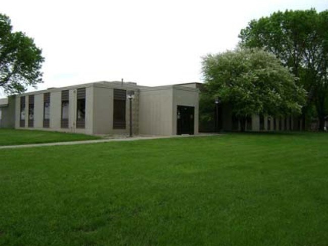


Property Detail
1220 N Dakota St
Sioux Falls, SD-MN
LOT 2 BLOCK 1 C-HAWKS ADD CITY OF CANTON
200.93.01.002
Lincoln
Commercialnec
South Dakota
MUNICIPALI
2
B and X Area of moderate flood hazard, usually the area between the limits of the 100-year and 500-year floods.
5.29 AC
2025
Sioux Falls
2025
Other Market Areas
010200
NEARBY LISTINGS FOR SALE OR LEASE
-
-
View all Canton listings for sale on LoopNet.com
DEMOGRAPHICS near 1220 N Dakota St
1 mile
3 mile
5 mile
2025 Total Population
2,804
3,890
4,360
2030 Population
3,116
4,314
4,831
Pop Growth 2025-2030
+ 11.13%
+ 10.90%
+ 10.80%
Average Age
42
42
42
2025 Total Households
1,114
1,545
1,716
HH Growth 2025-2030
+ 11.40%
+ 11.20%
+ 11.13%
Median Household Inc
$72,980
$69,081
$70,851
Avg Household Size
2.50
2.50
2.50
2025 Avg HH Vehicles
3.00
3.00
3.00
Median Home Value
$228,409
$254,046
$276,041
Median Year Built
1968
1968
1969
Nearby Places
Map Layers
Map Styles
 Street
 Aerial
Layers
 Traffic
 Biking
Places
Listings with unknown addresses are not visible on the map
- Restaurants
- Banks
- Shops
- Fitness
- Groceries
PUBLIC TRANSPORTATION
AIRPORT
Joe Foss Field
Drive
Walk
Distance
Joe Foss Field
40 min
26.5 mi
SALE & LEASE HISTORY
LISTING DATE
SALE/LEASE

Jan 11, 2017
For Sale
Feb 08, 2017
For Lease
Dec 06, 2018
For Sale
Nearby Properties
Address
Land Use
TOTAL SIZE
Lot Size
Zoning
Address
Land Use
TOTAL SIZE
Lot Size
Zoning
13.53 AC
A-1 AGRICU
Address
Land Use
TOTAL SIZE
Lot Size
Zoning
23.68 AC
I-1 LIGHT
Address
Land Use
TOTAL SIZE
Lot Size
Zoning
79.80 AC
A-1 AGRICU
Address
Land Use
TOTAL SIZE
Lot Size
Zoning
8 AC
MUNICIPALI
Address
Land Use
TOTAL SIZE
Lot Size
Zoning
5 AC
MUNICIPALI
Address
Land Use
TOTAL SIZE
Lot Size
Zoning
11.71 AC
MUNICIPALI
Address
Land Use
TOTAL SIZE
Lot Size
Zoning
2.50 AC
MUNICIPALI
Address
Land Use
TOTAL SIZE
Lot Size
Zoning
5.40 AC
MUNICIPALI
Address
Land Use
TOTAL SIZE
Lot Size
Zoning
16.29 AC
MUNICIPALI
Address
Land Use
TOTAL SIZE
Lot Size
Zoning
10 AC
C COMMERCI
Address
Land Use
TOTAL SIZE
Lot Size
Zoning
9.76 AC
MUNICIPALI
Address
Land Use
TOTAL SIZE
Lot Size
Zoning
1.42 AC
MUNICIPALI
Address
Land Use
TOTAL SIZE
Lot Size
Zoning
5 AC
MUNICIPALI
Address
Land Use
TOTAL SIZE
Lot Size
Zoning
14.01 AC
MUNICIPALI
Address
Land Use
TOTAL SIZE
Lot Size
Zoning
1.49 AC
MUNICIPALI
Address
Land Use
TOTAL SIZE
Lot Size
Zoning
1.77 AC
MUNICIPALI
Address
Land Use
TOTAL SIZE
Lot Size
Zoning
Address
Land Use
TOTAL SIZE
Lot Size
Zoning
6.13 AC
C COMMERCI
Address
Land Use
TOTAL SIZE
Lot Size
Zoning
2.40 AC
C COMMERCI
Address
Land Use
TOTAL SIZE
Lot Size
Zoning
9.25 AC
MUNICIPALI
Address
Land Use
TOTAL SIZE
Lot Size
Zoning
3.59 AC
C COMMERCI
Address
Land Use
TOTAL SIZE
Lot Size
Zoning
160.24 AC
A-1 AGRICU
Address
Land Use
TOTAL SIZE
Lot Size
Zoning
1.21 AC
MUNICIPALI
Address
Land Use
TOTAL SIZE
Lot Size
Zoning
2.80 AC
C COMMERCI
Address
Land Use
TOTAL SIZE
Lot Size
Zoning
1.24 AC
MUNICIPALI
Address
Land Use
TOTAL SIZE
Lot Size
Zoning
1.04 AC
MUNICIPALI
Address
Land Use
TOTAL SIZE
Lot Size
Zoning
1.96 AC
MUNICIPALI
Address
Land Use
TOTAL SIZE
Lot Size
Zoning
3 AC
C COMMERCI
Address
Land Use
TOTAL SIZE
Lot Size
Zoning
1.12 AC
C COMMERCI
The World's #1 Commercial Real Estate Marketplace
Connect with us
© 2026 CoStar Group
The information above has been obtained from sources believed reliable. While we do not doubt its accuracy we have not verified it and make no guarantee, warranty or representation about it. It is your responsibility to independently confirm its accuracy and completeness. Any projections, opinions, assumptions, or estimates used are for example only and do not represent the current or future performance of the property. The value of this transaction to you depends on tax and other factors which should be evaluated by your tax, financial, and legal advisors. You and your advisors should conduct a careful, independent investigation of the property to determine to your satisfaction the suitability of the property for your needs.