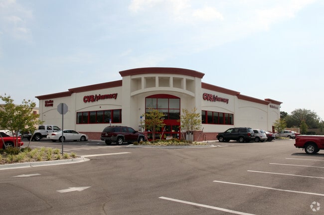
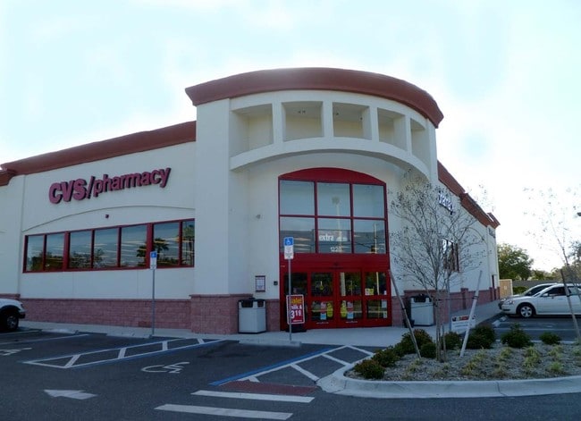
Property Record
1220 S Tamiami Trl, Osprey, FL 34229

Save to a Folder
{{folder.Name}}
{{folder.ListingIds.length}} Properties
{{folder.ListingIds.length}} Property
Create a New Folder
Property Detail
1220 S Tamiami Trl
0157-08-0021
COM AT NE COR OF SEC 15-38-18 TH S 00-00-41 W 1322.1 FT TH WLY ALG CURVE TO LEFT 51.99 FT TH N 24-50-54 W 156.12 FT TH S 65-09-06 W 19.86 FT FOR POB TH S 67-52-14 W 111.04 FT TH ALG CURVE TO
Storemultistory
SARASOTA
CG
Florida
B and X Area of moderate flood hazard, usually the area between the limits of the 100-year and 500-year floods.
1.31 AC
2024
Sarasota
2025
Tampa/St Petersburg
002102
North Port-Bradenton-Sarasota, FL
13,185 SF
NEARBY LISTINGS FOR SALE OR LEASE
DEMOGRAPHICS near 1220 S Tamiami Trl
1 mile
3 mile
5 mile
2025 Total Population
4,152
21,102
53,564
2030 Population
4,405
22,789
58,118
Pop Growth 2025-2030
+ 6.09%
+ 7.99%
+ 8.50%
Average Age
56
58
57
2025 Total Households
1,958
10,621
26,959
HH Growth 2025-2030
+ 6.23%
+ 8.08%
+ 8.55%
Median Household Inc
$89,605
$90,234
$85,263
Avg Household Size
2.00
1.90
1.90
2025 Avg HH Vehicles
2.00
2.00
2.00
Median Home Value
$697,393
$644,510
$607,584
Median Year Built
2002
1998
1992
Nearby Places
Map Layers
Map Styles
 Street
 Aerial
Layers
 Traffic
 Biking
Places
Listings with unknown addresses are not visible on the map
- Restaurants
- Banks
- Shops
- Fitness
- Groceries
PUBLIC TRANSPORTATION
AIRPORT
Sarasota/Bradenton International
Drive
Walk
Distance
Sarasota/Bradenton International
34 min
17.4 mi
Punta Gorda
Drive
Walk
Distance
Punta Gorda
52 min
41.4 mi
Freight Ports
Port Manatee
Drive
Walk
Distance
Port Manatee
52 min
40.3 mi
Nearby Properties
Address
Land Use
TOTAL SIZE
Lot Size
Zoning
Address
Land Use
TOTAL SIZE
Lot Size
Zoning
289,996 SF
20.95 AC
RMF3
Address
Land Use
TOTAL SIZE
Lot Size
Zoning
8,017 SF
56 AC
RMH
Address
Land Use
TOTAL SIZE
Lot Size
Zoning
8,562 SF
58.92 AC
RMH
Address
Land Use
TOTAL SIZE
Lot Size
Zoning
244,492 SF
73.19 AC
GU
Address
Land Use
TOTAL SIZE
Lot Size
Zoning
175,813 SF
10.09 AC
CG
Address
Land Use
TOTAL SIZE
Lot Size
Zoning
425,768 SF
18.41 AC
RMF2
Address
Land Use
TOTAL SIZE
Lot Size
Zoning
124,423 SF
76 AC
GU
Address
Land Use
TOTAL SIZE
Lot Size
Zoning
73,121 SF
426.09 AC
OUE2
Address
Land Use
TOTAL SIZE
Lot Size
Zoning
209,566 SF
18.63 AC
CG
Address
Land Use
TOTAL SIZE
Lot Size
Zoning
12,552 SF
6.73 AC
RE2
Address
Land Use
TOTAL SIZE
Lot Size
Zoning
17,028 SF
3.57 AC
RE2
Address
Land Use
TOTAL SIZE
Lot Size
Zoning
12,263 SF
3.38 AC
RE2
Address
Land Use
TOTAL SIZE
Lot Size
Zoning
88,509 SF
12.03 AC
CG
Address
Land Use
TOTAL SIZE
Lot Size
Zoning
8,407 SF
30.21 AC
RSF1
Address
Land Use
TOTAL SIZE
Lot Size
Zoning
16,879 SF
8.60 AC
RE2
Address
Land Use
TOTAL SIZE
Lot Size
Zoning
89,684 SF
2.42 AC
CG
Address
Land Use
TOTAL SIZE
Lot Size
Zoning
68,641 SF
6.40 AC
RTR
Address
Land Use
TOTAL SIZE
Lot Size
Zoning
40.20 AC
RMH
Address
Land Use
TOTAL SIZE
Lot Size
Zoning
314,254 SF
8.15 AC
RMF3
Address
Land Use
TOTAL SIZE
Lot Size
Zoning
16,033 SF
1.93 AC
RE1
Address
Land Use
TOTAL SIZE
Lot Size
Zoning
897 SF
11.41 AC
GU
Address
Land Use
TOTAL SIZE
Lot Size
Zoning
8,757 SF
2.61 AC
OUE2
Address
Land Use
TOTAL SIZE
Lot Size
Zoning
17,314 SF
1.71 AC
RE1
Address
Land Use
TOTAL SIZE
Lot Size
Zoning
8,188 SF
3.38 AC
CM
Address
Land Use
TOTAL SIZE
Lot Size
Zoning
27,472 SF
8.36 AC
GU
Address
Land Use
TOTAL SIZE
Lot Size
Zoning
68,190 SF
4.13 AC
CG
Address
Land Use
TOTAL SIZE
Lot Size
Zoning
74,091 SF
1.67 AC
CI
Address
Land Use
TOTAL SIZE
Lot Size
Zoning
95,124 SF
1.79 AC
CG
Address
Land Use
TOTAL SIZE
Lot Size
Zoning
8,870 SF
2.99 AC
RE2
Address
Land Use
TOTAL SIZE
Lot Size
Zoning
30,314 SF
20.28 AC
RSF1
The World's #1 Commercial Real Estate Marketplace
Connect with us
© 2026 CoStar Group
The information above has been obtained from sources believed reliable. While we do not doubt its accuracy we have not verified it and make no guarantee, warranty or representation about it. It is your responsibility to independently confirm its accuracy and completeness. Any projections, opinions, assumptions, or estimates used are for example only and do not represent the current or future performance of the property. The value of this transaction to you depends on tax and other factors which should be evaluated by your tax, financial, and legal advisors. You and your advisors should conduct a careful, independent investigation of the property to determine to your satisfaction the suitability of the property for your needs.