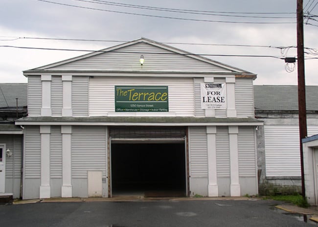
Property Record
1220 Spruce St, Reading, PA 19602
NEARBY LISTINGS FOR SALE OR LEASE
Property Detail
1220 Spruce St
Reading, PA
Berks
10-5316-30-18-8414
Pennsylvania
Sfr
0.04 AC
X
Berks
42011C0508G
Philadelphia
2,012 SF
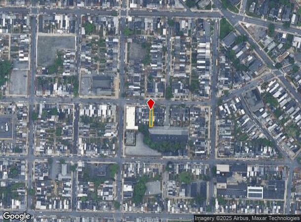
DEMOGRAPHICS near 1220 Spruce St
1 Mile
3 Mile
5 Mile
2024 Total Population
36,574
130,308
206,803
2029 Population
36,786
130,851
207,654
Pop Growth 2024-2029
+ 0.58%
+ 0.42%
+ 0.41%
Average Age
35
37
39
2024 Total Households
13,416
46,992
77,343
HH Growth 2024-2029
+ 0.56%
+ 0.46%
+ 0.43%
Median Household Inc
$32,670
$46,495
$58,880
Avg Household Size
2.60
2.60
2.50
2024 Avg HH Vehicles
1.00
1.00
2.00
Median Home Value
$63,231
$123,139
$173,521
Median Year Built
1948
1949
1957
Nearby Places
Map Layers
Map Styles
 Street
 Aerial
- Restaurants
- Banks
- Shops
- Fitness
- Groceries
PUBLIC TRANSPORTATION
AIRPORT
Lehigh Valley International
DRIVE
WALK
Distance
Lehigh Valley International
62 min
40.9 mi
Freight Ports
Port of Wilmington, RI
DRIVE
WALK
Distance
Port of Wilmington, RI
88 min
58.8 mi
SALE & LEASE HISTORY
LISTING DATE
SALE/LEASE

Jul 20, 2017
For Lease
Nearby Properties
Address
Land Use
TOTAL SIZE
Lot Size
Zoning
Address
Land Use
TOTAL SIZE
Lot Size
Zoning
33,761 SF
4.38 AC
Address
Land Use
TOTAL SIZE
Lot Size
Zoning
342,332 SF
3.30 AC
Address
Land Use
TOTAL SIZE
Lot Size
Zoning
144,696 SF
7.43 AC
Address
Land Use
TOTAL SIZE
Lot Size
Zoning
88,576 SF
1.80 AC
Address
Land Use
TOTAL SIZE
Lot Size
Zoning
209,584 SF
24.33 AC
Address
Land Use
TOTAL SIZE
Lot Size
Zoning
130,410 SF
23.02 AC
Address
Land Use
TOTAL SIZE
Lot Size
Zoning
138,752 SF
21.81 AC
Address
Land Use
TOTAL SIZE
Lot Size
Zoning
71,271 SF
1.42 AC
Address
Land Use
TOTAL SIZE
Lot Size
Zoning
310,014 SF
15.02 AC
Address
Land Use
TOTAL SIZE
Lot Size
Zoning
174,046 SF
6.92 AC
Address
Land Use
TOTAL SIZE
Lot Size
Zoning
62,907 SF
5.25 AC
Address
Land Use
TOTAL SIZE
Lot Size
Zoning
163,466 SF
19.19 AC
Address
Land Use
TOTAL SIZE
Lot Size
Zoning
188,801 SF
14.41 AC
Address
Land Use
TOTAL SIZE
Lot Size
Zoning
66,610 SF
5.38 AC
Address
Land Use
TOTAL SIZE
Lot Size
Zoning
27,055 SF
1.77 AC
Address
Land Use
TOTAL SIZE
Lot Size
Zoning
104,304 SF
9.77 AC
Address
Land Use
TOTAL SIZE
Lot Size
Zoning
295,427 SF
9.71 AC
Address
Land Use
TOTAL SIZE
Lot Size
Zoning
42,496 SF
10.43 AC
Address
Land Use
TOTAL SIZE
Lot Size
Zoning
105,272 SF
2.19 AC
Address
Land Use
TOTAL SIZE
Lot Size
Zoning
204,844 SF
16.33 AC
Address
Land Use
TOTAL SIZE
Lot Size
Zoning
129,050 SF
Address
Land Use
TOTAL SIZE
Lot Size
Zoning
57,750 SF
4.07 AC
Address
Land Use
TOTAL SIZE
Lot Size
Zoning
84,599 SF
28.56 AC
Address
Land Use
TOTAL SIZE
Lot Size
Zoning
20,481 SF
1.07 AC
Address
Land Use
TOTAL SIZE
Lot Size
Zoning
247,500 SF
16.49 AC
Address
Land Use
TOTAL SIZE
Lot Size
Zoning
29,144 SF
2.85 AC
Address
Land Use
TOTAL SIZE
Lot Size
Zoning
66,770 SF
4.12 AC
Address
Land Use
TOTAL SIZE
Lot Size
Zoning
68,075 SF
10.82 AC
Address
Land Use
TOTAL SIZE
Lot Size
Zoning
1,736,698 SF
28.54 AC
Address
Land Use
TOTAL SIZE
Lot Size
Zoning
76,773 SF
7.07 AC
The World's #1 Commercial Real Estate Marketplace
Connect with us
© 2025 CoStar Group
The information above has been obtained from sources believed reliable. While we do not doubt its accuracy we have not verified it and make no guarantee, warranty or representation about it. It is your responsibility to independently confirm its accuracy and completeness. Any projections, opinions, assumptions, or estimates used are for example only and do not represent the current or future performance of the property. The value of this transaction to you depends on tax and other factors which should be evaluated by your tax, financial, and legal advisors. You and your advisors should conduct a careful, independent investigation of the property to determine to your satisfaction the suitability of the property for your needs.