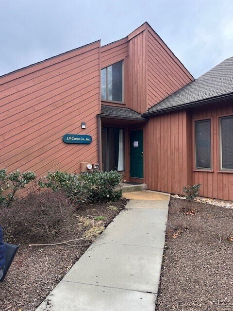
Property Record
1220 Valley Forge Rd, Phoenixville, PA 19460

This Property Is For Sale
NEARBY LISTINGS FOR SALE OR LEASE
Property Detail
1220 Valley Forge Rd
27-006-0518.0000
Valley Forge
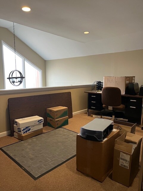
Officecondo
UNIT 18 & OFFICE
X
Chester
42029C0110G
Pennsylvania
2024
9.01 AC
2025
Exton/Whitelands
300501
Philadelphia
1,750 SF
Philadelphia-Camden-Wilmington, PA-NJ-DE-MD
DEMOGRAPHICS near 1220 Valley Forge Rd
1 Mile
3 Mile
5 Mile
2024 Total Population
3,999
41,967
115,919
2029 Population
4,156
43,337
119,807
Pop Growth 2024-2029
+ 3.93%
+ 3.26%
+ 3.35%
Average Age
40
40
41
2024 Total Households
1,306
17,080
46,912
HH Growth 2024-2029
+ 4.06%
+ 3.44%
+ 3.56%
Median Household Inc
$176,965
$105,105
$115,786
Avg Household Size
3.00
2.40
2.40
2024 Avg HH Vehicles
2.00
2.00
2.00
Median Home Value
$486,856
$383,944
$428,117
Median Year Built
1977
1979
1983
Nearby Places
- Restaurants
- Banks
- Shops
- Fitness
- Groceries
PUBLIC TRANSPORTATION
COMMUTER RAIL
Paoli (R5 - Southeastern Pennsylvania Transportation Authority Regional Rail (SEPTA Regional Rail))
DRIVE
WALK
Distance
Paoli (R5 - Southeastern Pennsylvania Transportation Authority Regional Rail (SEPTA Regional Rail))
13 min
5.7 mi
Daylesford (R5 - Southeastern Pennsylvania Transportation Authority Regional Rail (SEPTA Regional Rail))
DRIVE
WALK
Distance
Daylesford (R5 - Southeastern Pennsylvania Transportation Authority Regional Rail (SEPTA Regional Rail))
15 min
7.6 mi
AIRPORT
Philadelphia International
DRIVE
WALK
Distance
Philadelphia International
51 min
29.1 mi
Freight Ports
South Jersey Port
DRIVE
WALK
Distance
South Jersey Port
46 min
29.0 mi
Nearby Properties
Address
Land Use
TOTAL SIZE
Lot Size
Zoning
Address
Land Use
TOTAL SIZE
Lot Size
Zoning
50,149 SF
26.72 AC
I/L1
Address
Land Use
TOTAL SIZE
Lot Size
Zoning
58,212 SF
20.89 AC
M2
Address
Land Use
TOTAL SIZE
Lot Size
Zoning
1,145,005 SF
149.21 AC
IO
Address
Land Use
TOTAL SIZE
Lot Size
Zoning
404,279 SF
22 AC
PFZ
Address
Land Use
TOTAL SIZE
Lot Size
Zoning
1,470,449 SF
80.02 AC
R1
Address
Land Use
TOTAL SIZE
Lot Size
Zoning
363,603 SF
10.42 AC
LC
Address
Land Use
TOTAL SIZE
Lot Size
Zoning
420,080 SF
7.33 AC
FCE
Address
Land Use
TOTAL SIZE
Lot Size
Zoning
425,170 SF
23 AC
FCE
Address
Land Use
TOTAL SIZE
Lot Size
Zoning
435,884 SF
26.70 AC
R5
Address
Land Use
TOTAL SIZE
Lot Size
Zoning
204,483 SF
25.02 AC
IO
Address
Land Use
TOTAL SIZE
Lot Size
Zoning
248,028 SF
4.26 AC
HC
Address
Land Use
TOTAL SIZE
Lot Size
Zoning
811,455 SF
18.15 AC
M1
Address
Land Use
TOTAL SIZE
Lot Size
Zoning
152,792 SF
43.32 AC
FR
Address
Land Use
TOTAL SIZE
Lot Size
Zoning
2,112 SF
5.06 AC
LI/O
Address
Land Use
TOTAL SIZE
Lot Size
Zoning
1,305,221 SF
21.99 AC
M1
Address
Land Use
TOTAL SIZE
Lot Size
Zoning
7.35 AC
FCE
Address
Land Use
TOTAL SIZE
Lot Size
Zoning
132,002 SF
0.41 AC
LICO1
Address
Land Use
TOTAL SIZE
Lot Size
Zoning
108,852 SF
19.80 AC
C
Address
Land Use
TOTAL SIZE
Lot Size
Zoning
225,716 SF
46.49 AC
R1
Address
Land Use
TOTAL SIZE
Lot Size
Zoning
47,276 SF
20.60 AC
R2
Address
Land Use
TOTAL SIZE
Lot Size
Zoning
122,645 SF
51 AC
FR
Address
Land Use
TOTAL SIZE
Lot Size
Zoning
230,880 SF
10.70 AC
APT
Address
Land Use
TOTAL SIZE
Lot Size
Zoning
102,279 SF
17.15 AC
R1
Address
Land Use
TOTAL SIZE
Lot Size
Zoning
143,400 SF
13.10 AC
MR
Address
Land Use
TOTAL SIZE
Lot Size
Zoning
90,300 SF
2.70 AC
PFZ
Address
Land Use
TOTAL SIZE
Lot Size
Zoning
44,885 SF
449.42 AC
AG
Address
Land Use
TOTAL SIZE
Lot Size
Zoning
86,632 SF
3.88 AC
M1
Address
Land Use
TOTAL SIZE
Lot Size
Zoning
126,833 SF
11.92 AC
GC
Address
Land Use
TOTAL SIZE
Lot Size
Zoning
13,269 SF
602.36 AC
AG
Address
Land Use
TOTAL SIZE
Lot Size
Zoning
122,036 SF
8.61 AC
M1
The World's #1 Commercial Real Estate Marketplace
Connect with us
© 2025 CoStar Group
The information above has been obtained from sources believed reliable. While we do not doubt its accuracy we have not verified it and make no guarantee, warranty or representation about it. It is your responsibility to independently confirm its accuracy and completeness. Any projections, opinions, assumptions, or estimates used are for example only and do not represent the current or future performance of the property. The value of this transaction to you depends on tax and other factors which should be evaluated by your tax, financial, and legal advisors. You and your advisors should conduct a careful, independent investigation of the property to determine to your satisfaction the suitability of the property for your needs.