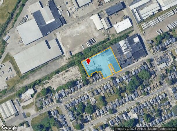
Property Record
1220 W 20Th St, Erie, PA 16502

NEARBY LISTINGS FOR SALE OR LEASE
Property Detail
1220 W 20Th St
16-031-029.0-204.00
1220 W 20 ST 1.5332 AC
Publicstorage
Erie
X
Pennsylvania
42049C0205E
1.53 AC
2025
Greater Erie
2025
Erie
001100
Erie, PA
5,800 SF
DEMOGRAPHICS near 1220 W 20Th St
1 Mile
3 Mile
5 Mile
2024 Total Population
17,351
98,893
148,324
2029 Population
17,105
98,005
146,722
Pop Growth 2024-2029
(1.42%)
(0.90%)
(1.08%)
Average Age
38
40
40
2024 Total Households
7,312
41,603
62,408
HH Growth 2024-2029
(1.60%)
(0.98%)
(1.17%)
Median Household Inc
$46,071
$45,900
$50,711
Avg Household Size
2.30
2.20
2.20
2024 Avg HH Vehicles
1.00
1.00
1.00
Median Home Value
$70,129
$119,410
$132,947
Median Year Built
1947
1953
1957
Nearby Places
Map Layers
Map Styles
 Street
 Aerial
- Restaurants
- Banks
- Shops
- Fitness
- Groceries
PUBLIC TRANSPORTATION
COMMUTER RAIL
Erie Amtrak Station (Lake Shore Limited - Amtrak)
DRIVE
WALK
Distance
Erie Amtrak Station (Lake Shore Limited - Amtrak)
4 min
1.9 mi
AIRPORT
Erie International/Tom Ridge Field
DRIVE
WALK
Distance
Erie International/Tom Ridge Field
10 min
4.8 mi
Freight Ports
Port of Toledo
DRIVE
WALK
Distance
Port of Toledo
252 min
214.4 mi
SALE & LEASE HISTORY
LISTING DATE
SALE/LEASE

Aug 10, 2017
For Lease
Aug 08, 2017
For Lease
Apr 24, 2020
For Lease
Apr 07, 2017
For Lease
Nearby Properties
Address
Land Use
TOTAL SIZE
Lot Size
Zoning
Address
Land Use
TOTAL SIZE
Lot Size
Zoning
35,529 SF
84.04 AC
BB
Address
Land Use
TOTAL SIZE
Lot Size
Zoning
31,764 SF
46.83 AC
R3
Address
Land Use
TOTAL SIZE
Lot Size
Zoning
583,648 SF
5.55 AC
WC2
Address
Land Use
TOTAL SIZE
Lot Size
Zoning
2.73 AC
C3
Address
Land Use
TOTAL SIZE
Lot Size
Zoning
172,806 SF
1.88 AC
WC2
Address
Land Use
TOTAL SIZE
Lot Size
Zoning
630,344 SF
7.57 AC
RLB
Address
Land Use
TOTAL SIZE
Lot Size
Zoning
12.27 AC
WM
Address
Land Use
TOTAL SIZE
Lot Size
Zoning
5 AC
RLB
Address
Land Use
TOTAL SIZE
Lot Size
Zoning
3.38 AC
RLB
Address
Land Use
TOTAL SIZE
Lot Size
Zoning
3.10 AC
WC
Address
Land Use
TOTAL SIZE
Lot Size
Zoning
189,344 SF
2.14 AC
C3
Address
Land Use
TOTAL SIZE
Lot Size
Zoning
138,119 SF
11.39 AC
Address
Land Use
TOTAL SIZE
Lot Size
Zoning
103,358 SF
2.77 AC
WC
Address
Land Use
TOTAL SIZE
Lot Size
Zoning
800 SF
10.05 AC
R2
Address
Land Use
TOTAL SIZE
Lot Size
Zoning
108,080 SF
4.83 AC
AR
Address
Land Use
TOTAL SIZE
Lot Size
Zoning
375,929 SF
5.02 AC
C3
Address
Land Use
TOTAL SIZE
Lot Size
Zoning
10,960 SF
29.82 AC
DR
Address
Land Use
TOTAL SIZE
Lot Size
Zoning
148,615 SF
19.77 AC
Address
Land Use
TOTAL SIZE
Lot Size
Zoning
227,718 SF
47.43 AC
DB
Address
Land Use
TOTAL SIZE
Lot Size
Zoning
1.56 AC
C3
Address
Land Use
TOTAL SIZE
Lot Size
Zoning
170,870 SF
4.51 AC
RLB
Address
Land Use
TOTAL SIZE
Lot Size
Zoning
117,879 SF
13.47 AC
M1
Address
Land Use
TOTAL SIZE
Lot Size
Zoning
2.45 AC
RLB
Address
Land Use
TOTAL SIZE
Lot Size
Zoning
171,306 SF
6.30 AC
AR
Address
Land Use
TOTAL SIZE
Lot Size
Zoning
127,756 SF
7.21 AC
RLB
Address
Land Use
TOTAL SIZE
Lot Size
Zoning
2,754 SF
26.83 AC
DB
Address
Land Use
TOTAL SIZE
Lot Size
Zoning
171,966 SF
13.99 AC
RB
Address
Land Use
TOTAL SIZE
Lot Size
Zoning
65,000 SF
12.11 AC
AB
Address
Land Use
TOTAL SIZE
Lot Size
Zoning
163,596 SF
14.31 AC
C2
Address
Land Use
TOTAL SIZE
Lot Size
Zoning
0.66 AC
C3
The World's #1 Commercial Real Estate Marketplace
Connect with us
© 2026 CoStar Group
The information above has been obtained from sources believed reliable. While we do not doubt its accuracy we have not verified it and make no guarantee, warranty or representation about it. It is your responsibility to independently confirm its accuracy and completeness. Any projections, opinions, assumptions, or estimates used are for example only and do not represent the current or future performance of the property. The value of this transaction to you depends on tax and other factors which should be evaluated by your tax, financial, and legal advisors. You and your advisors should conduct a careful, independent investigation of the property to determine to your satisfaction the suitability of the property for your needs.