Property Record
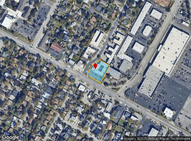
1220 W Anderson Ln, Austin, TX 78757
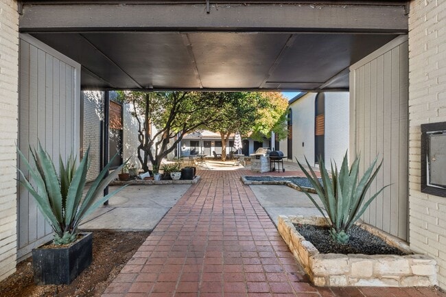

This Property Is For Sale
NEARBY LISTINGS FOR SALE OR LEASE
Property Detail
1220 W Anderson Ln
Austin-Round Rock-San Marcos, TX
Sunset View Sec 3
239645
LOT 6-7 SUNSET VIEW SEC 3
Multifamilydwelling
Travis
X
Texas
48453C0455J
6-7
2024
0.79 AC
2025
Wooten
040500
Austin
22,692 SF
DEMOGRAPHICS near 1220 W Anderson Ln
1 mile
3 mile
5 mile
2024 Total Population
19,960
159,628
363,064
2029 Population
21,640
172,980
394,189
Pop Growth 2024-2029
+ 8.42%
+ 8.36%
+ 8.57%
Average Age
37
37
36
2024 Total Households
8,776
69,778
159,114
HH Growth 2024-2029
+ 9.28%
+ 9.16%
+ 9.50%
Median Household Inc
$74,263
$61,468
$68,183
Avg Household Size
2.20
2.20
2.10
2024 Avg HH Vehicles
2.00
2.00
2.00
Median Home Value
$497,449
$513,258
$544,084
Median Year Built
1977
1978
1986
Nearby Places
Map Layers
Map Styles
 Street
 Aerial
Transit
 Traffic
 Biking
Places
Listings with unknown addresses are not visible on the map
- Restaurants
- Banks
- Shops
- Fitness
- Groceries
PUBLIC TRANSPORTATION
COMMUTER RAIL
Drive
Walk
Distance
15 min
8.8 mi
AIRPORT
Austin-Bergstrom International
Drive
Walk
Distance
Austin-Bergstrom International
28 min
17.7 mi
Nearby Properties
Address
Land Use
TOTAL SIZE
Lot Size
Zoning
Address
Land Use
TOTAL SIZE
Lot Size
Zoning
230.30 AC
Address
Land Use
TOTAL SIZE
Lot Size
Zoning
74.69 AC
Address
Land Use
TOTAL SIZE
Lot Size
Zoning
1,234 SF
96.75 AC
Address
Land Use
TOTAL SIZE
Lot Size
Zoning
480,823 SF
18.46 AC
Address
Land Use
TOTAL SIZE
Lot Size
Zoning
354,008 SF
39.99 AC
Address
Land Use
TOTAL SIZE
Lot Size
Zoning
340,785 SF
1.89 AC
Address
Land Use
TOTAL SIZE
Lot Size
Zoning
346,319 SF
6.53 AC
Address
Land Use
TOTAL SIZE
Lot Size
Zoning
24.40 AC
Address
Land Use
TOTAL SIZE
Lot Size
Zoning
425,200 SF
2.49 AC
Address
Land Use
TOTAL SIZE
Lot Size
Zoning
314,319 SF
5.97 AC
Address
Land Use
TOTAL SIZE
Lot Size
Zoning
45.78 AC
Address
Land Use
TOTAL SIZE
Lot Size
Zoning
365,130 SF
18.15 AC
Address
Land Use
TOTAL SIZE
Lot Size
Zoning
286,276 SF
4.53 AC
Address
Land Use
TOTAL SIZE
Lot Size
Zoning
274,228 SF
4.95 AC
Address
Land Use
TOTAL SIZE
Lot Size
Zoning
276,772 SF
4.68 AC
Address
Land Use
TOTAL SIZE
Lot Size
Zoning
32.82 AC
Address
Land Use
TOTAL SIZE
Lot Size
Zoning
343,751 SF
3.65 AC
Address
Land Use
TOTAL SIZE
Lot Size
Zoning
467,647 SF
3.54 AC
Address
Land Use
TOTAL SIZE
Lot Size
Zoning
299,957 SF
22.02 AC
Address
Land Use
TOTAL SIZE
Lot Size
Zoning
332,202 SF
31.81 AC
Address
Land Use
TOTAL SIZE
Lot Size
Zoning
521,820 SF
4.68 AC
Address
Land Use
TOTAL SIZE
Lot Size
Zoning
16.79 AC
Address
Land Use
TOTAL SIZE
Lot Size
Zoning
18.45 AC
Address
Land Use
TOTAL SIZE
Lot Size
Zoning
244,809 SF
5.45 AC
Address
Land Use
TOTAL SIZE
Lot Size
Zoning
248,325 SF
2.46 AC
Address
Land Use
TOTAL SIZE
Lot Size
Zoning
16.11 AC
Address
Land Use
TOTAL SIZE
Lot Size
Zoning
267,091 SF
3.90 AC
Address
Land Use
TOTAL SIZE
Lot Size
Zoning
268,950 SF
3.95 AC
Address
Land Use
TOTAL SIZE
Lot Size
Zoning
231,434 SF
1.45 AC
Address
Land Use
TOTAL SIZE
Lot Size
Zoning
263,177 SF
4.65 AC
The World's #1 Commercial Real Estate Marketplace
Connect with us
© 2026 CoStar Group
The information above has been obtained from sources believed reliable. While we do not doubt its accuracy we have not verified it and make no guarantee, warranty or representation about it. It is your responsibility to independently confirm its accuracy and completeness. Any projections, opinions, assumptions, or estimates used are for example only and do not represent the current or future performance of the property. The value of this transaction to you depends on tax and other factors which should be evaluated by your tax, financial, and legal advisors. You and your advisors should conduct a careful, independent investigation of the property to determine to your satisfaction the suitability of the property for your needs.