Property Record
12200 Dixie Hwy, Louisville, KY 40272
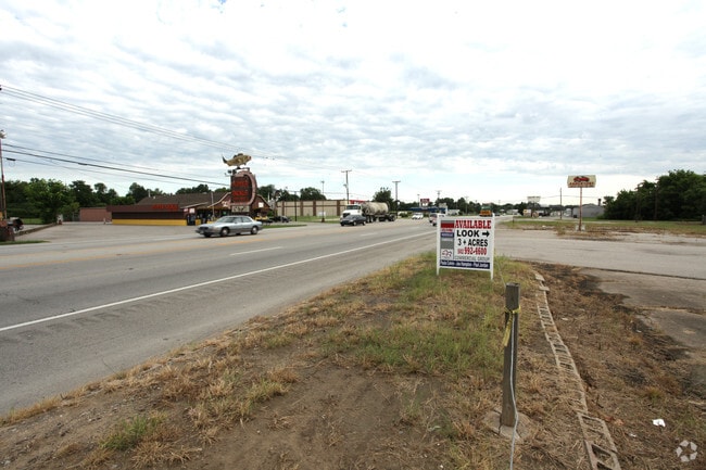


This Property Is For Sale
NEARBY LISTINGS FOR SALE OR LEASE
Property Detail
12200 Dixie Hwy
Louisville/Jefferson County, KY-IN
Residual 2 Minor Plat
105200100000
RESIDUAL TRACT 2 MINOR PLAT DB 9647 X 81, 61.95 AC +/-
Mobilehomepark
Jefferson
AE
Kentucky
21111C0121F
61.95 AC
2025
W Outlying Jefferson Cnty
2025
Louisville
012103
DEMOGRAPHICS near 12200 Dixie Hwy
1 Mile
3 Mile
5 Mile
2024 Total Population
5,582
17,630
40,549
2029 Population
5,790
18,054
41,320
Pop Growth 2024-2029
+ 3.73%
+ 2.40%
+ 1.90%
Average Age
39
39
40
2024 Total Households
2,109
6,828
15,853
HH Growth 2024-2029
+ 3.75%
+ 2.50%
+ 2.00%
Median Household Inc
$52,567
$61,534
$64,277
Avg Household Size
2.60
2.50
2.50
2024 Avg HH Vehicles
2.00
2.00
2.00
Median Home Value
$135,869
$161,511
$171,225
Median Year Built
1960
1972
1967
Nearby Places
Map Layers
Map Styles
 Street
 Aerial
- Restaurants
- Banks
- Shops
- Fitness
- Groceries
PUBLIC TRANSPORTATION
AIRPORT
Louisville Muhammad Ali International
DRIVE
WALK
Distance
Louisville Muhammad Ali International
21 min
12.2 mi
Freight Ports
Port of Toledo
DRIVE
WALK
Distance
Port of Toledo
377 min
319.3 mi
Nearby Properties
Address
Land Use
TOTAL SIZE
Lot Size
Zoning
Address
Land Use
TOTAL SIZE
Lot Size
Zoning
330,000 SF
21.31 AC
EZ1-ENTERP
Address
Land Use
TOTAL SIZE
Lot Size
Zoning
230,424 SF
27.05 AC
EZ1-ENTERP
Address
Land Use
TOTAL SIZE
Lot Size
Zoning
1,160 SF
118.93 AC
R1-RESIDEN
Address
Land Use
TOTAL SIZE
Lot Size
Zoning
Address
Land Use
TOTAL SIZE
Lot Size
Zoning
56.98 AC
R4-RESIDEN
Address
Land Use
TOTAL SIZE
Lot Size
Zoning
23.42 AC
R1-RESIDEN
Address
Land Use
TOTAL SIZE
Lot Size
Zoning
418,872 SF
19.81 AC
EZ1-ENTERP
Address
Land Use
TOTAL SIZE
Lot Size
Zoning
17,072 SF
13.53 AC
R5A-RESIDE
Address
Land Use
TOTAL SIZE
Lot Size
Zoning
21.41 AC
R5A-RESIDE
Address
Land Use
TOTAL SIZE
Lot Size
Zoning
40 AC
R4-RESIDEN
Address
Land Use
TOTAL SIZE
Lot Size
Zoning
1,440 SF
13.06 AC
R4-RESIDEN
Address
Land Use
TOTAL SIZE
Lot Size
Zoning
20.23 AC
Address
Land Use
TOTAL SIZE
Lot Size
Zoning
234,597 SF
29.65 AC
C1-COMMERC
Address
Land Use
TOTAL SIZE
Lot Size
Zoning
14,604 SF
8.47 AC
R4-RESIDEN
Address
Land Use
TOTAL SIZE
Lot Size
Zoning
6.51 AC
C1-COMMERC
Address
Land Use
TOTAL SIZE
Lot Size
Zoning
113,242 SF
11.95 AC
EZ1-ENTERP
Address
Land Use
TOTAL SIZE
Lot Size
Zoning
Address
Land Use
TOTAL SIZE
Lot Size
Zoning
121,723 SF
11.15 AC
C2-COMMERC
Address
Land Use
TOTAL SIZE
Lot Size
Zoning
212,116 SF
13.89 AC
EZ1-ENTERP
Address
Land Use
TOTAL SIZE
Lot Size
Zoning
150,000 SF
10.33 AC
Address
Land Use
TOTAL SIZE
Lot Size
Zoning
4,500 SF
13.64 AC
C2-COMMERC
Address
Land Use
TOTAL SIZE
Lot Size
Zoning
82,388 SF
7.98 AC
Address
Land Use
TOTAL SIZE
Lot Size
Zoning
8,572 SF
7.15 AC
R7-RESIDEN
Address
Land Use
TOTAL SIZE
Lot Size
Zoning
154,400 SF
11.15 AC
EZ1-ENTERP
Address
Land Use
TOTAL SIZE
Lot Size
Zoning
110,072 SF
10.39 AC
C2-COMMERC
Address
Land Use
TOTAL SIZE
Lot Size
Zoning
61,074 SF
6.65 AC
R4-RESIDEN
Address
Land Use
TOTAL SIZE
Lot Size
Zoning
10,516 SF
6.47 AC
R7-RESIDEN
Address
Land Use
TOTAL SIZE
Lot Size
Zoning
97,407 SF
6.14 AC
C1-COMMERC
Address
Land Use
TOTAL SIZE
Lot Size
Zoning
109,600 SF
7.09 AC
EZ1-ENTERP
Address
Land Use
TOTAL SIZE
Lot Size
Zoning
99,000 SF
11.57 AC
The World's #1 Commercial Real Estate Marketplace
Connect with us
© 2026 CoStar Group
The information above has been obtained from sources believed reliable. While we do not doubt its accuracy we have not verified it and make no guarantee, warranty or representation about it. It is your responsibility to independently confirm its accuracy and completeness. Any projections, opinions, assumptions, or estimates used are for example only and do not represent the current or future performance of the property. The value of this transaction to you depends on tax and other factors which should be evaluated by your tax, financial, and legal advisors. You and your advisors should conduct a careful, independent investigation of the property to determine to your satisfaction the suitability of the property for your needs.