Property Record
12200 Upper Fredericktown Rd, Mount Vernon, OH 43050


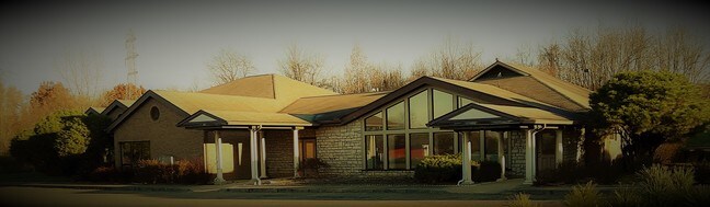
Property Detail
12200 Upper Fredericktown Rd
54-00925.001
13 7 3&4 PT OF 8 & SE OF 22 6.00A
Hospitalprivate
Knox
B and X Area of moderate flood hazard, usually the area between the limits of the 100-year and 500-year floods.
Ohio
2025
6 AC
2025
Other Market Areas
007100
Mount Vernon, OH
10,455 SF
NEARBY LISTINGS FOR SALE OR LEASE
DEMOGRAPHICS near 12200 Upper Fredericktown Rd
1 mile
3 mile
5 mile
2025 Total Population
2,374
18,668
26,727
2030 Population
2,420
18,983
27,145
Pop Growth 2025-2030
+ 1.94%
+ 1.69%
+ 1.56%
Average Age
43
41
42
2025 Total Households
1,018
7,626
10,887
HH Growth 2025-2030
+ 1.96%
+ 1.69%
+ 1.61%
Median Household Inc
$52,666
$56,117
$61,580
Avg Household Size
2.30
2.30
2.30
2025 Avg HH Vehicles
2.00
2.00
2.00
Median Home Value
$189,769
$181,255
$191,078
Median Year Built
1972
1957
1962
Nearby Places
Map Layers
Map Styles
 Street
 Aerial
Layers
 Traffic
 Biking
Places
Listings with unknown addresses are not visible on the map
- Restaurants
- Banks
- Shops
- Fitness
- Groceries
PUBLIC TRANSPORTATION
AIRPORT
John Glenn Columbus International
Drive
Walk
Distance
John Glenn Columbus International
60 min
45.8 mi
SALE & LEASE HISTORY
LISTING DATE
SALE/LEASE

Oct 26, 2017
For Sale
Nov 23, 2018
For Lease
Nearby Properties
Address
Land Use
TOTAL SIZE
Lot Size
Zoning
Address
Land Use
TOTAL SIZE
Lot Size
Zoning
118,756 SF
80 AC
Address
Land Use
TOTAL SIZE
Lot Size
Zoning
95,818 SF
4.51 AC
Address
Land Use
TOTAL SIZE
Lot Size
Zoning
4,238 SF
11.38 AC
Address
Land Use
TOTAL SIZE
Lot Size
Zoning
88,043 SF
11.54 AC
Address
Land Use
TOTAL SIZE
Lot Size
Zoning
Address
Land Use
TOTAL SIZE
Lot Size
Zoning
1,303 SF
0.10 AC
Address
Land Use
TOTAL SIZE
Lot Size
Zoning
126,416 SF
21.20 AC
Address
Land Use
TOTAL SIZE
Lot Size
Zoning
102,480 SF
18.21 AC
Address
Land Use
TOTAL SIZE
Lot Size
Zoning
57,271 SF
102.03 AC
Address
Land Use
TOTAL SIZE
Lot Size
Zoning
28,872 SF
0.14 AC
Address
Land Use
TOTAL SIZE
Lot Size
Zoning
95,336 SF
12.99 AC
Address
Land Use
TOTAL SIZE
Lot Size
Zoning
65,802 SF
1.03 AC
Address
Land Use
TOTAL SIZE
Lot Size
Zoning
47,923 SF
7.38 AC
Address
Land Use
TOTAL SIZE
Lot Size
Zoning
21,399 SF
0.25 AC
Address
Land Use
TOTAL SIZE
Lot Size
Zoning
48,821 SF
0.20 AC
Address
Land Use
TOTAL SIZE
Lot Size
Zoning
70,674 SF
4.76 AC
Address
Land Use
TOTAL SIZE
Lot Size
Zoning
Address
Land Use
TOTAL SIZE
Lot Size
Zoning
21,712 SF
0.13 AC
Address
Land Use
TOTAL SIZE
Lot Size
Zoning
96,000 SF
18.09 AC
Address
Land Use
TOTAL SIZE
Lot Size
Zoning
32,238 SF
33.17 AC
Address
Land Use
TOTAL SIZE
Lot Size
Zoning
24,283 SF
3.98 AC
Address
Land Use
TOTAL SIZE
Lot Size
Zoning
26,496 SF
0.21 AC
Address
Land Use
TOTAL SIZE
Lot Size
Zoning
47,317 SF
2.78 AC
Address
Land Use
TOTAL SIZE
Lot Size
Zoning
Address
Land Use
TOTAL SIZE
Lot Size
Zoning
32,830 SF
2.36 AC
Address
Land Use
TOTAL SIZE
Lot Size
Zoning
3,172 SF
6.58 AC
Address
Land Use
TOTAL SIZE
Lot Size
Zoning
19,556 SF
0.20 AC
Address
Land Use
TOTAL SIZE
Lot Size
Zoning
18,150 SF
0.17 AC
Address
Land Use
TOTAL SIZE
Lot Size
Zoning
22,348 SF
17.68 AC
Address
Land Use
TOTAL SIZE
Lot Size
Zoning
54,476 SF
6.44 AC
The World's #1 Commercial Real Estate Marketplace
Connect with us
© 2026 CoStar Group
The information above has been obtained from sources believed reliable. While we do not doubt its accuracy we have not verified it and make no guarantee, warranty or representation about it. It is your responsibility to independently confirm its accuracy and completeness. Any projections, opinions, assumptions, or estimates used are for example only and do not represent the current or future performance of the property. The value of this transaction to you depends on tax and other factors which should be evaluated by your tax, financial, and legal advisors. You and your advisors should conduct a careful, independent investigation of the property to determine to your satisfaction the suitability of the property for your needs.