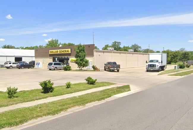
Property Record
1241 Knoll Pointe Pl, Springfield, IL 62703
NEARBY LISTINGS FOR SALE OR LEASE
Property Detail
1241 Knoll Pointe Pl
Springfield, IL
South Grand Pointe 2Nd Add
14-36.0-354-001
LOT 81 SOUTH GRAND POINTE 2ND ADDN (25078 SQ FT)
Commercialnec
Sangamon
X
Illinois
17167C0265F
81
2024
0.57 AC
2024
Springfield/Decatur
001600
Other Market Areas
DEMOGRAPHICS near 1241 Knoll Pointe Pl
1 Mile
3 Mile
5 Mile
2024 Total Population
6,391
62,259
113,254
2029 Population
6,472
62,368
112,911
Pop Growth 2024-2029
+ 1.27%
+ 0.18%
(0.30%)
Average Age
36
39
41
2024 Total Households
2,481
27,528
50,610
HH Growth 2024-2029
+ 1.13%
+ 0.13%
(0.38%)
Median Household Inc
$29,898
$46,773
$55,485
Avg Household Size
2.50
2.10
2.10
2024 Avg HH Vehicles
1.00
1.00
2.00
Median Home Value
$63,816
$88,946
$124,042
Median Year Built
1954
1954
1963
Nearby Places
Map Layers
Map Styles
 Street
 Aerial
- Restaurants
- Banks
- Shops
- Fitness
- Groceries
PUBLIC TRANSPORTATION
COMMUTER RAIL
Springfield (Lincoln Service - Amtrak, Lincoln Service Missouri River Runner - Amtrak, Texas Eagle - Amtrak)
DRIVE
WALK
Distance
Springfield (Lincoln Service - Amtrak, Lincoln Service Missouri River Runner - Amtrak, Texas Eagle - Amtrak)
8 min
2.9 mi
AIRPORT
Abraham Lincoln Capital
DRIVE
WALK
Distance
Abraham Lincoln Capital
16 min
6.5 mi
Freight Ports
Port Milwaukee
DRIVE
WALK
Distance
Port Milwaukee
312 min
273.9 mi
SALE & LEASE HISTORY
LISTING DATE
SALE/LEASE

Mar 04, 2021
For Sale
Nearby Properties
Address
Land Use
TOTAL SIZE
Lot Size
Zoning
Address
Land Use
TOTAL SIZE
Lot Size
Zoning
2.36 AC
Address
Land Use
TOTAL SIZE
Lot Size
Zoning
4.50 AC
Address
Land Use
TOTAL SIZE
Lot Size
Zoning
1.90 AC
Address
Land Use
TOTAL SIZE
Lot Size
Zoning
3.17 AC
Address
Land Use
TOTAL SIZE
Lot Size
Zoning
1.16 AC
Address
Land Use
TOTAL SIZE
Lot Size
Zoning
1.05 AC
Address
Land Use
TOTAL SIZE
Lot Size
Zoning
Address
Land Use
TOTAL SIZE
Lot Size
Zoning
Address
Land Use
TOTAL SIZE
Lot Size
Zoning
Address
Land Use
TOTAL SIZE
Lot Size
Zoning
Address
Land Use
TOTAL SIZE
Lot Size
Zoning
Address
Land Use
TOTAL SIZE
Lot Size
Zoning
Address
Land Use
TOTAL SIZE
Lot Size
Zoning
12.88 AC
Address
Land Use
TOTAL SIZE
Lot Size
Zoning
Address
Land Use
TOTAL SIZE
Lot Size
Zoning
Address
Land Use
TOTAL SIZE
Lot Size
Zoning
1.22 AC
Address
Land Use
TOTAL SIZE
Lot Size
Zoning
Address
Land Use
TOTAL SIZE
Lot Size
Zoning
0.29 AC
Address
Land Use
TOTAL SIZE
Lot Size
Zoning
Address
Land Use
TOTAL SIZE
Lot Size
Zoning
15.24 AC
Address
Land Use
TOTAL SIZE
Lot Size
Zoning
6.34 AC
Address
Land Use
TOTAL SIZE
Lot Size
Zoning
Address
Land Use
TOTAL SIZE
Lot Size
Zoning
Address
Land Use
TOTAL SIZE
Lot Size
Zoning
9.42 AC
Address
Land Use
TOTAL SIZE
Lot Size
Zoning
2.46 AC
Address
Land Use
TOTAL SIZE
Lot Size
Zoning
4.04 AC
Address
Land Use
TOTAL SIZE
Lot Size
Zoning
1.39 AC
Address
Land Use
TOTAL SIZE
Lot Size
Zoning
Address
Land Use
TOTAL SIZE
Lot Size
Zoning
Address
Land Use
TOTAL SIZE
Lot Size
Zoning
2.38 AC
The World's #1 Commercial Real Estate Marketplace
Connect with us
© 2025 CoStar Group
The information above has been obtained from sources believed reliable. While we do not doubt its accuracy we have not verified it and make no guarantee, warranty or representation about it. It is your responsibility to independently confirm its accuracy and completeness. Any projections, opinions, assumptions, or estimates used are for example only and do not represent the current or future performance of the property. The value of this transaction to you depends on tax and other factors which should be evaluated by your tax, financial, and legal advisors. You and your advisors should conduct a careful, independent investigation of the property to determine to your satisfaction the suitability of the property for your needs.