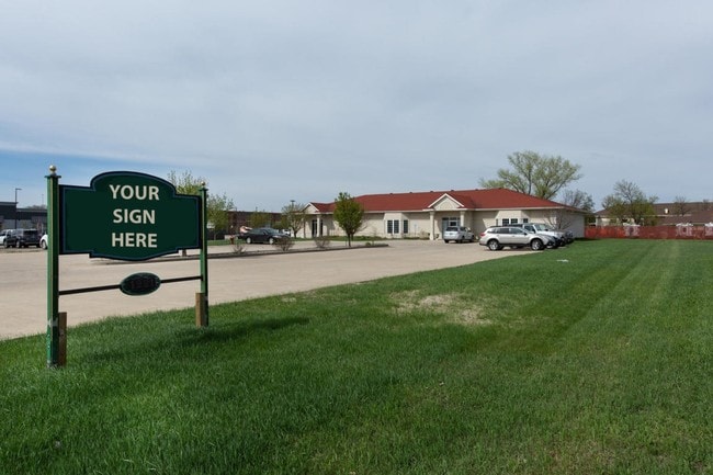
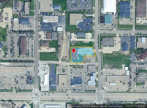
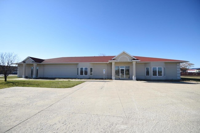
Property Record
1221 28Th St S, Fargo, ND 58103
NEARBY LISTINGS FOR SALE OR LEASE
Property Detail
1221 28Th St S
Fargo, ND-MN
Mortons
01-2050-00161-000
LOT: 8 BLOCK: B ADDITION: MORTONS ADDITIONAL: MORTON'S SUBD PT LT 8 BLK B DESC AS COMM AT FOUND IRON MONUMENT WHICH
Storebuilding
Cass
X
North Dakota
38017C0777G
8,140
2024
0.85 AC
2024
Westgate
000601
Other Market Areas
6,192 SF
DEMOGRAPHICS near 1221 28Th St S
1 Mile
3 Mile
5 Mile
2024 Total Population
10,761
101,589
207,985
2029 Population
11,470
108,186
220,893
Pop Growth 2024-2029
+ 6.59%
+ 6.49%
+ 6.21%
Average Age
39
37
36
2024 Total Households
5,228
45,935
88,539
HH Growth 2024-2029
+ 6.87%
+ 7.26%
+ 6.89%
Median Household Inc
$54,124
$51,638
$62,764
Avg Household Size
1.90
2.00
2.20
2024 Avg HH Vehicles
2.00
2.00
2.00
Median Home Value
$185,506
$218,147
$247,063
Median Year Built
1978
1984
1991
Nearby Places
Map Layers
Map Styles
 Street
 Aerial
- Restaurants
- Banks
- Shops
- Fitness
- Groceries
PUBLIC TRANSPORTATION
COMMUTER RAIL
Fargo Amtrak Station (Empire Builder - Amtrak)
DRIVE
WALK
Distance
Fargo Amtrak Station (Empire Builder - Amtrak)
8 min
3.3 mi
AIRPORT
Hector International
DRIVE
WALK
Distance
Hector International
14 min
6.5 mi
Freight Ports
Port Milwaukee
DRIVE
WALK
Distance
Port Milwaukee
630 min
573.8 mi
SALE & LEASE HISTORY
LISTING DATE
SALE/LEASE

Oct 30, 2018
For Lease
May 29, 2018
For Sale
Nearby Properties
Address
Land Use
TOTAL SIZE
Lot Size
Zoning
Address
Land Use
TOTAL SIZE
Lot Size
Zoning
40.49 AC
Address
Land Use
TOTAL SIZE
Lot Size
Zoning
53.42 AC
Address
Land Use
TOTAL SIZE
Lot Size
Zoning
161,184 SF
10.51 AC
GC
Address
Land Use
TOTAL SIZE
Lot Size
Zoning
408,617 SF
9.33 AC
GC
Address
Land Use
TOTAL SIZE
Lot Size
Zoning
121,584 SF
5.64 AC
MR3
Address
Land Use
TOTAL SIZE
Lot Size
Zoning
230,272 SF
21.77 AC
GC
Address
Land Use
TOTAL SIZE
Lot Size
Zoning
621,097 SF
49.49 AC
LI
Address
Land Use
TOTAL SIZE
Lot Size
Zoning
162,875 SF
12.32 AC
MR3
Address
Land Use
TOTAL SIZE
Lot Size
Zoning
107,995 SF
1 AC
DMU
Address
Land Use
TOTAL SIZE
Lot Size
Zoning
2.77 AC
Address
Land Use
TOTAL SIZE
Lot Size
Zoning
0.22 AC
Address
Land Use
TOTAL SIZE
Lot Size
Zoning
3.31 AC
Address
Land Use
TOTAL SIZE
Lot Size
Zoning
0.17 AC
Address
Land Use
TOTAL SIZE
Lot Size
Zoning
Address
Land Use
TOTAL SIZE
Lot Size
Zoning
2.91 AC
Address
Land Use
TOTAL SIZE
Lot Size
Zoning
163,398 SF
1.92 AC
LC
Address
Land Use
TOTAL SIZE
Lot Size
Zoning
109,174 SF
1.25 AC
UMU
Address
Land Use
TOTAL SIZE
Lot Size
Zoning
163,195 SF
11.95 AC
GC
Address
Land Use
TOTAL SIZE
Lot Size
Zoning
Address
Land Use
TOTAL SIZE
Lot Size
Zoning
131,309 SF
6.62 AC
GC
Address
Land Use
TOTAL SIZE
Lot Size
Zoning
64,653 SF
2.20 AC
MR3
Address
Land Use
TOTAL SIZE
Lot Size
Zoning
6.02 AC
Address
Land Use
TOTAL SIZE
Lot Size
Zoning
34,100 SF
1.46 AC
MR3
Address
Land Use
TOTAL SIZE
Lot Size
Zoning
45.33 AC
GC
Address
Land Use
TOTAL SIZE
Lot Size
Zoning
2.07 AC
Address
Land Use
TOTAL SIZE
Lot Size
Zoning
48,300 SF
2.33 AC
MR3
Address
Land Use
TOTAL SIZE
Lot Size
Zoning
26,909 SF
11.65 AC
LC
Address
Land Use
TOTAL SIZE
Lot Size
Zoning
Address
Land Use
TOTAL SIZE
Lot Size
Zoning
217,776 SF
31.82 AC
GC
Address
Land Use
TOTAL SIZE
Lot Size
Zoning
12.33 AC
PAC
The World's #1 Commercial Real Estate Marketplace
Connect with us
© 2025 CoStar Group
The information above has been obtained from sources believed reliable. While we do not doubt its accuracy we have not verified it and make no guarantee, warranty or representation about it. It is your responsibility to independently confirm its accuracy and completeness. Any projections, opinions, assumptions, or estimates used are for example only and do not represent the current or future performance of the property. The value of this transaction to you depends on tax and other factors which should be evaluated by your tax, financial, and legal advisors. You and your advisors should conduct a careful, independent investigation of the property to determine to your satisfaction the suitability of the property for your needs.