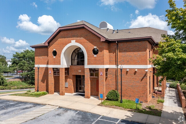
Property Record
1221 Clairmont Rd, Decatur, GA 30030

NEARBY LISTINGS FOR SALE OR LEASE
Property Detail
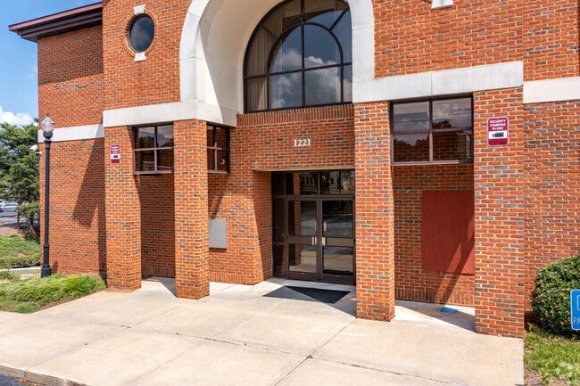
1221 Clairmont Rd
18-051-08-005
103 X 276 X 125 X 328 0.79AC
Financialbuilding
DeKalb
X
Georgia
13089C0066K
5
2025
0.79 AC
2025
Northlake/I-85
022304
Atlanta
11,271 SF
Atlanta-Sandy Springs-Roswell, GA
DEMOGRAPHICS near 1221 Clairmont Rd
1 Mile
3 Mile
5 Mile
2024 Total Population
15,694
122,813
388,425
2029 Population
15,791
123,093
392,739
Pop Growth 2024-2029
+ 0.62%
+ 0.23%
+ 1.11%
Average Age
39
38
37
2024 Total Households
6,536
53,309
178,961
HH Growth 2024-2029
+ 0.83%
+ 0.27%
+ 1.39%
Median Household Inc
$127,270
$107,560
$90,326
Avg Household Size
2.20
2.20
2.00
2024 Avg HH Vehicles
2.00
2.00
1.00
Median Home Value
$613,078
$577,887
$473,091
Median Year Built
1965
1974
1982
Nearby Places
Map Layers
Map Styles
 Street
 Aerial
- Restaurants
- Banks
- Shops
- Fitness
- Groceries
PUBLIC TRANSPORTATION
COMMUTER RAIL
Atlanta (Crescent - Amtrak)
DRIVE
WALK
Distance
Atlanta (Crescent - Amtrak)
15 min
6.7 mi
AIRPORT
Hartsfield - Jackson Atlanta International
DRIVE
WALK
Distance
Hartsfield - Jackson Atlanta International
28 min
15.8 mi
Freight Ports
Georgia Ports - Savannah
DRIVE
WALK
Distance
Georgia Ports - Savannah
286 min
250.4 mi
SALE & LEASE HISTORY
LISTING DATE
SALE/LEASE

Mar 30, 2021
For Lease
Nearby Properties
Address
Land Use
TOTAL SIZE
Lot Size
Zoning
Address
Land Use
TOTAL SIZE
Lot Size
Zoning
2,612 SF
137.60 AC
X
Address
Land Use
TOTAL SIZE
Lot Size
Zoning
345,125 SF
7.73 AC
C1
Address
Land Use
TOTAL SIZE
Lot Size
Zoning
123,089 SF
5.07 AC
MU-4
Address
Land Use
TOTAL SIZE
Lot Size
Zoning
589,761 SF
22.67 AC
RM-HD
Address
Land Use
TOTAL SIZE
Lot Size
Zoning
188,469 SF
4.06 AC
C-1
Address
Land Use
TOTAL SIZE
Lot Size
Zoning
431,259 SF
48.90 AC
RM100
Address
Land Use
TOTAL SIZE
Lot Size
Zoning
230,911 SF
6.29 AC
X
Address
Land Use
TOTAL SIZE
Lot Size
Zoning
123,732 SF
0.51 AC
RM75
Address
Land Use
TOTAL SIZE
Lot Size
Zoning
327,098 SF
4.92 AC
X
Address
Land Use
TOTAL SIZE
Lot Size
Zoning
729,294 SF
0.01 AC
X
Address
Land Use
TOTAL SIZE
Lot Size
Zoning
393,333 SF
5.37 AC
X
Address
Land Use
TOTAL SIZE
Lot Size
Zoning
99,770 SF
2.14 AC
Address
Land Use
TOTAL SIZE
Lot Size
Zoning
158,294 SF
9.41 AC
OI
Address
Land Use
TOTAL SIZE
Lot Size
Zoning
174,052 SF
4.15 AC
MU-5
Address
Land Use
TOTAL SIZE
Lot Size
Zoning
290,130 SF
6.13 AC
R100
Address
Land Use
TOTAL SIZE
Lot Size
Zoning
225,500 SF
9.74 AC
RM75
Address
Land Use
TOTAL SIZE
Lot Size
Zoning
165,458 SF
4.80 AC
R85
Address
Land Use
TOTAL SIZE
Lot Size
Zoning
67,882 SF
4.77 AC
X
Address
Land Use
TOTAL SIZE
Lot Size
Zoning
357,531 SF
11.51 AC
RM75
Address
Land Use
TOTAL SIZE
Lot Size
Zoning
202,577 SF
2.97 AC
OI
Address
Land Use
TOTAL SIZE
Lot Size
Zoning
360,321 SF
24.90 AC
RM85
Address
Land Use
TOTAL SIZE
Lot Size
Zoning
249,774 SF
15.57 AC
RM-HD
Address
Land Use
TOTAL SIZE
Lot Size
Zoning
334,127 SF
0.01 AC
X
Address
Land Use
TOTAL SIZE
Lot Size
Zoning
166,663 SF
8.65 AC
X
Address
Land Use
TOTAL SIZE
Lot Size
Zoning
259,834 SF
3.56 AC
OI
Address
Land Use
TOTAL SIZE
Lot Size
Zoning
296,175 SF
18.95 AC
RM100
Address
Land Use
TOTAL SIZE
Lot Size
Zoning
198,241 SF
13.33 AC
RM75
Address
Land Use
TOTAL SIZE
Lot Size
Zoning
244,293 SF
2.09 AC
C-2
Address
Land Use
TOTAL SIZE
Lot Size
Zoning
298,763 SF
3.27 AC
M
Address
Land Use
TOTAL SIZE
Lot Size
Zoning
185,074 SF
10.49 AC
RM-HD
The World's #1 Commercial Real Estate Marketplace
Connect with us
© 2026 CoStar Group
The information above has been obtained from sources believed reliable. While we do not doubt its accuracy we have not verified it and make no guarantee, warranty or representation about it. It is your responsibility to independently confirm its accuracy and completeness. Any projections, opinions, assumptions, or estimates used are for example only and do not represent the current or future performance of the property. The value of this transaction to you depends on tax and other factors which should be evaluated by your tax, financial, and legal advisors. You and your advisors should conduct a careful, independent investigation of the property to determine to your satisfaction the suitability of the property for your needs.