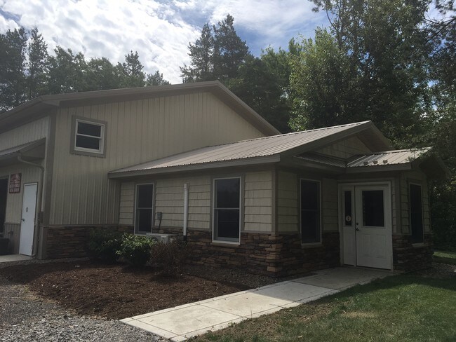
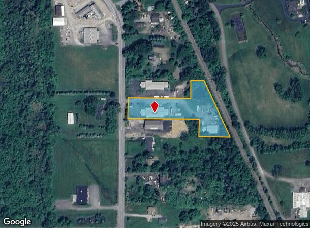
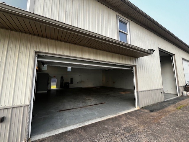
Property Record
1221 Maple Rd, Elma, NY 14059

NEARBY LISTINGS FOR SALE OR LEASE
Property Detail
1221 Maple Rd
144200-155-000-0002-020-120
Buffalo Creek Reservation
Distributionwarehouseregional
Erie
X
New York
36029C0386H
20.120
2025
1.51 AC
2024
Outlying Erie County
014101
Buffalo/Niagara Falls
5,750 SF
Buffalo-Cheektowaga, NY
DEMOGRAPHICS near 1221 Maple Rd
1 Mile
3 Mile
5 Mile
2024 Total Population
747
15,133
32,615
2029 Population
742
15,089
32,576
Pop Growth 2024-2029
(0.67%)
(0.29%)
(0.12%)
Average Age
46
45
45
2024 Total Households
302
6,214
13,279
HH Growth 2024-2029
(0.99%)
(0.39%)
(0.20%)
Median Household Inc
$95,160
$89,847
$90,939
Avg Household Size
2.40
2.40
2.40
2024 Avg HH Vehicles
2.00
2.00
2.00
Median Home Value
$314,151
$309,485
$300,371
Median Year Built
1968
1959
1969
Nearby Places
Map Layers
Map Styles
 Street
 Aerial
- Restaurants
- Banks
- Shops
- Fitness
- Groceries
PUBLIC TRANSPORTATION
AIRPORT
Buffalo Niagara International
DRIVE
WALK
Distance
Buffalo Niagara International
26 min
14.2 mi
Niagara Falls International
DRIVE
WALK
Distance
Niagara Falls International
51 min
32.8 mi
SALE & LEASE HISTORY
LISTING DATE
SALE/LEASE

Sep 25, 2016
For Lease
Oct 28, 2019
For Lease
Jul 14, 2025
For Lease
Nearby Properties
Address
Land Use
TOTAL SIZE
Lot Size
Zoning
Address
Land Use
TOTAL SIZE
Lot Size
Zoning
121,465 SF
4.20 AC
Address
Land Use
TOTAL SIZE
Lot Size
Zoning
1,409 SF
2.70 AC
Address
Land Use
TOTAL SIZE
Lot Size
Zoning
167,315 SF
5.32 AC
Address
Land Use
TOTAL SIZE
Lot Size
Zoning
129,572 SF
13.10 AC
Address
Land Use
TOTAL SIZE
Lot Size
Zoning
60,651 SF
2.01 AC
Address
Land Use
TOTAL SIZE
Lot Size
Zoning
178,744 SF
27.90 AC
Address
Land Use
TOTAL SIZE
Lot Size
Zoning
42,750 SF
1.10 AC
Address
Land Use
TOTAL SIZE
Lot Size
Zoning
Address
Land Use
TOTAL SIZE
Lot Size
Zoning
124,495 SF
6.15 AC
Address
Land Use
TOTAL SIZE
Lot Size
Zoning
21,572 SF
2.76 AC
Address
Land Use
TOTAL SIZE
Lot Size
Zoning
13,364 SF
407.01 AC
N000
Address
Land Use
TOTAL SIZE
Lot Size
Zoning
15,990 SF
2.09 AC
Address
Land Use
TOTAL SIZE
Lot Size
Zoning
34,575 SF
2.12 AC
Address
Land Use
TOTAL SIZE
Lot Size
Zoning
55,413 SF
3.19 AC
Address
Land Use
TOTAL SIZE
Lot Size
Zoning
142,587 SF
15.62 AC
Address
Land Use
TOTAL SIZE
Lot Size
Zoning
13,874 SF
1.69 AC
Address
Land Use
TOTAL SIZE
Lot Size
Zoning
5,246 SF
2.42 AC
Address
Land Use
TOTAL SIZE
Lot Size
Zoning
Address
Land Use
TOTAL SIZE
Lot Size
Zoning
36,244 SF
1.80 AC
Address
Land Use
TOTAL SIZE
Lot Size
Zoning
117,130 SF
55.30 AC
Address
Land Use
TOTAL SIZE
Lot Size
Zoning
13,708 SF
1.30 AC
Address
Land Use
TOTAL SIZE
Lot Size
Zoning
864 SF
16.90 AC
Address
Land Use
TOTAL SIZE
Lot Size
Zoning
13,286 SF
1 AC
Address
Land Use
TOTAL SIZE
Lot Size
Zoning
12,473 SF
3.15 AC
Address
Land Use
TOTAL SIZE
Lot Size
Zoning
459 SF
27.81 AC
Address
Land Use
TOTAL SIZE
Lot Size
Zoning
Address
Land Use
TOTAL SIZE
Lot Size
Zoning
52.20 AC
RC
Address
Land Use
TOTAL SIZE
Lot Size
Zoning
211,575 SF
39.30 AC
Address
Land Use
TOTAL SIZE
Lot Size
Zoning
26,770 SF
1 AC
Address
Land Use
TOTAL SIZE
Lot Size
Zoning
13,867 SF
2.36 AC
05 - COMME
The World's #1 Commercial Real Estate Marketplace
Connect with us
© 2026 CoStar Group
The information above has been obtained from sources believed reliable. While we do not doubt its accuracy we have not verified it and make no guarantee, warranty or representation about it. It is your responsibility to independently confirm its accuracy and completeness. Any projections, opinions, assumptions, or estimates used are for example only and do not represent the current or future performance of the property. The value of this transaction to you depends on tax and other factors which should be evaluated by your tax, financial, and legal advisors. You and your advisors should conduct a careful, independent investigation of the property to determine to your satisfaction the suitability of the property for your needs.