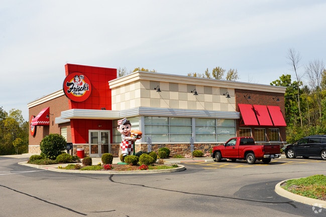
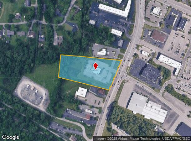
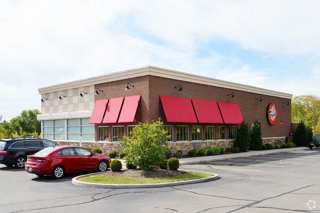
Property Record
1221 N Fairfield Rd, Dayton, OH 45432
NEARBY LISTINGS FOR SALE OR LEASE
Property Detail
1221 N Fairfield Rd
Dayton, OH
Fairfield
B42-0005-0007-0-0120-00
FRISCHS SUBDIVISION LOT 1 3.174AC .003 DED R/W N FAIRFIELD RD
Restaurantdrivein
Greene
X
Ohio
39057C0106E
1
2024
3.17 AC
2024
East Dayton
210202
Cincinnati/Dayton
4,637 SF
DEMOGRAPHICS near 1221 N Fairfield Rd
1 Mile
3 Mile
5 Mile
2024 Total Population
4,442
43,039
134,747
2029 Population
4,513
43,828
136,181
Pop Growth 2024-2029
+ 1.60%
+ 1.83%
+ 1.06%
Average Age
44
43
40
2024 Total Households
1,773
16,669
56,957
HH Growth 2024-2029
+ 1.52%
+ 1.78%
+ 0.99%
Median Household Inc
$103,783
$110,217
$73,177
Avg Household Size
2.50
2.50
2.30
2024 Avg HH Vehicles
2.00
2.00
2.00
Median Home Value
$214,400
$243,056
$181,262
Median Year Built
1968
1976
1969
Nearby Places
Map Layers
Map Styles
 Street
 Aerial
- Restaurants
- Banks
- Shops
- Fitness
- Groceries
PUBLIC TRANSPORTATION
AIRPORT
James M Cox Dayton International
DRIVE
WALK
Distance
James M Cox Dayton International
33 min
20.4 mi
SALE & LEASE HISTORY
LISTING DATE
SALE/LEASE

Apr 25, 2025
For Lease
Apr 25, 2025
For Sale
Nearby Properties
Address
Land Use
TOTAL SIZE
Lot Size
Zoning
Address
Land Use
TOTAL SIZE
Lot Size
Zoning
552,803 SF
29.77 AC
CPUD882
Address
Land Use
TOTAL SIZE
Lot Size
Zoning
752,874 SF
74.85 AC
Address
Land Use
TOTAL SIZE
Lot Size
Zoning
53.48 AC
RP1
Address
Land Use
TOTAL SIZE
Lot Size
Zoning
49,316 SF
30.39 AC
CPUD933
Address
Land Use
TOTAL SIZE
Lot Size
Zoning
130,247 SF
14.12 AC
Address
Land Use
TOTAL SIZE
Lot Size
Zoning
Address
Land Use
TOTAL SIZE
Lot Size
Zoning
3,243 SF
22.88 AC
R-PUD 97-3
Address
Land Use
TOTAL SIZE
Lot Size
Zoning
88,522 SF
12.96 AC
Address
Land Use
TOTAL SIZE
Lot Size
Zoning
145,500 SF
32.62 AC
A1
Address
Land Use
TOTAL SIZE
Lot Size
Zoning
47,424 SF
22.77 AC
RPUD917
Address
Land Use
TOTAL SIZE
Lot Size
Zoning
1,008 SF
7 AC
R1A
Address
Land Use
TOTAL SIZE
Lot Size
Zoning
32,852 SF
18.80 AC
C-PUD 94-4
Address
Land Use
TOTAL SIZE
Lot Size
Zoning
45,522 SF
10.22 AC
Address
Land Use
TOTAL SIZE
Lot Size
Zoning
121,392 SF
12.47 AC
Address
Land Use
TOTAL SIZE
Lot Size
Zoning
76,038 SF
12.59 AC
CPUD971
Address
Land Use
TOTAL SIZE
Lot Size
Zoning
89,176 SF
17.52 AC
Address
Land Use
TOTAL SIZE
Lot Size
Zoning
108,274 SF
25.09 AC
RPUD427
Address
Land Use
TOTAL SIZE
Lot Size
Zoning
45,954 SF
9.46 AC
Address
Land Use
TOTAL SIZE
Lot Size
Zoning
24,992 SF
17 AC
MULTIPLE
Address
Land Use
TOTAL SIZE
Lot Size
Zoning
20,144 SF
76.94 AC
A1
Address
Land Use
TOTAL SIZE
Lot Size
Zoning
73,040 SF
12.99 AC
RPUD901
Address
Land Use
TOTAL SIZE
Lot Size
Zoning
Address
Land Use
TOTAL SIZE
Lot Size
Zoning
7,694 SF
20.52 AC
MULTIPLE
Address
Land Use
TOTAL SIZE
Lot Size
Zoning
134,260 SF
11.75 AC
Address
Land Use
TOTAL SIZE
Lot Size
Zoning
127,820 SF
15.36 AC
RPUD901
Address
Land Use
TOTAL SIZE
Lot Size
Zoning
72,824 SF
26.88 AC
A1
Address
Land Use
TOTAL SIZE
Lot Size
Zoning
318,166 SF
49.51 AC
Address
Land Use
TOTAL SIZE
Lot Size
Zoning
51,648 SF
9.36 AC
R-PUD 95-2
Address
Land Use
TOTAL SIZE
Lot Size
Zoning
14.82 AC
Address
Land Use
TOTAL SIZE
Lot Size
Zoning
45,428 SF
3.23 AC
CPUD981
The World's #1 Commercial Real Estate Marketplace
Connect with us
© 2025 CoStar Group
The information above has been obtained from sources believed reliable. While we do not doubt its accuracy we have not verified it and make no guarantee, warranty or representation about it. It is your responsibility to independently confirm its accuracy and completeness. Any projections, opinions, assumptions, or estimates used are for example only and do not represent the current or future performance of the property. The value of this transaction to you depends on tax and other factors which should be evaluated by your tax, financial, and legal advisors. You and your advisors should conduct a careful, independent investigation of the property to determine to your satisfaction the suitability of the property for your needs.