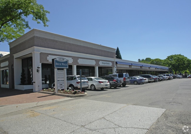
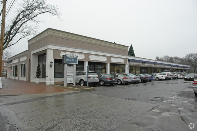
Property Record
1221 Post Rd, Fairfield, CT 06824
NEARBY LISTINGS FOR SALE OR LEASE
Property Detail
1221 Post Rd
Commercialbuilding
Fairfield
X
Connecticut
09001C0419G
1.54 AC
2025
Fairfield
2025
Westchester/So Connecticut
060700
Bridgeport-Stamford-Danbury, CT
24,597 SF
FAIR-000180-000000-000014
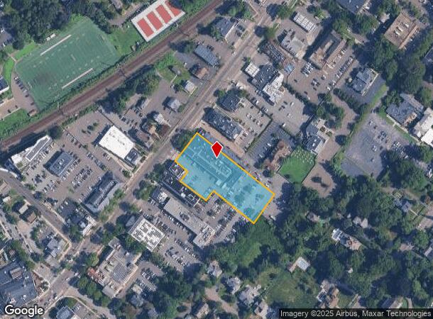
DEMOGRAPHICS near 1221 Post Rd
1 mile
3 mile
5 mile
2024 Total Population
13,924
59,016
153,610
2029 Population
14,021
59,510
153,885
Pop Growth 2024-2029
+ 0.70%
+ 0.84%
+ 0.18%
Average Age
36
39
38
2024 Total Households
3,982
21,426
54,677
HH Growth 2024-2029
+ 1.18%
+ 0.87%
+ 0.12%
Median Household Inc
$163,929
$114,389
$75,263
Avg Household Size
2.60
2.50
2.60
2024 Avg HH Vehicles
2.00
2.00
2.00
Median Home Value
$788,062
$667,096
$549,836
Median Year Built
1956
1960
1956
Nearby Places
Map Layers
Map Styles
 Street
 Aerial
Transit
 Traffic
 Biking
Places
Listings with unknown addresses are not visible on the map
- Restaurants
- Banks
- Shops
- Fitness
- Groceries
PUBLIC TRANSPORTATION
COMMUTER RAIL
Fairfield Station (New Haven Line - Metro-North Commuter Railroad Company (Metro-North))
Drive
Walk
Distance
Fairfield Station (New Haven Line - Metro-North Commuter Railroad Company (Metro-North))
1 min
9 min
0.3 mi
Drive
Walk
Distance
4 min
1.8 mi
AIRPORT
Tweed/New Haven
Drive
Walk
Distance
Tweed/New Haven
42 min
27.2 mi
Westchester County
Drive
Walk
Distance
Westchester County
47 min
30.0 mi
Long Island MacArthur
Drive
Walk
Distance
Long Island MacArthur
115 min
38.7 mi
Nearby Properties
Address
Land Use
TOTAL SIZE
Lot Size
Zoning
Address
Land Use
TOTAL SIZE
Lot Size
Zoning
124 AC
FPD
Address
Land Use
TOTAL SIZE
Lot Size
Zoning
111 AC
RA
Address
Land Use
TOTAL SIZE
Lot Size
Zoning
19.43 AC
A
Address
Land Use
TOTAL SIZE
Lot Size
Zoning
1,183 SF
2.33 AC
DID
Address
Land Use
TOTAL SIZE
Lot Size
Zoning
213,826 SF
18.30 AC
A
Address
Land Use
TOTAL SIZE
Lot Size
Zoning
10.28 AC
DID
Address
Land Use
TOTAL SIZE
Lot Size
Zoning
260,992 SF
4.19 AC
ILI
Address
Land Use
TOTAL SIZE
Lot Size
Zoning
85,050 SF
6.76 AC
GBD
Address
Land Use
TOTAL SIZE
Lot Size
Zoning
144,086 SF
3.12 AC
DRD
Address
Land Use
TOTAL SIZE
Lot Size
Zoning
115,006 SF
2.51 AC
DCD
Address
Land Use
TOTAL SIZE
Lot Size
Zoning
12.47 AC
AA
Address
Land Use
TOTAL SIZE
Lot Size
Zoning
23.70 AC
AAA
Address
Land Use
TOTAL SIZE
Lot Size
Zoning
14.90 AC
RC
Address
Land Use
TOTAL SIZE
Lot Size
Zoning
16.73 AC
DCD
Address
Land Use
TOTAL SIZE
Lot Size
Zoning
6.43 AC
DCD
Address
Land Use
TOTAL SIZE
Lot Size
Zoning
92,057 SF
10.20 AC
B
Address
Land Use
TOTAL SIZE
Lot Size
Zoning
5.84 AC
DCD
Address
Land Use
TOTAL SIZE
Lot Size
Zoning
73,120 SF
22.33 AC
DID
Address
Land Use
TOTAL SIZE
Lot Size
Zoning
68,288 SF
15.36 AC
R3
Address
Land Use
TOTAL SIZE
Lot Size
Zoning
76,811 SF
4.25 AC
RC
Address
Land Use
TOTAL SIZE
Lot Size
Zoning
Address
Land Use
TOTAL SIZE
Lot Size
Zoning
9.63 AC
AA
Address
Land Use
TOTAL SIZE
Lot Size
Zoning
19,939 SF
4.56 AC
AAA
Address
Land Use
TOTAL SIZE
Lot Size
Zoning
125 AC
RC
Address
Land Use
TOTAL SIZE
Lot Size
Zoning
18,313 SF
4.10 AC
RA-1
Address
Land Use
TOTAL SIZE
Lot Size
Zoning
66,254 SF
22.74 AC
AA
Address
Land Use
TOTAL SIZE
Lot Size
Zoning
5.82 AC
AA
Address
Land Use
TOTAL SIZE
Lot Size
Zoning
77,764 SF
A
Address
Land Use
TOTAL SIZE
Lot Size
Zoning
98,056 SF
9.19 AC
DCD
Address
Land Use
TOTAL SIZE
Lot Size
Zoning
15,542 SF
3.54 AC
A
The World's #1 Commercial Real Estate Marketplace
Connect with us
© 2026 CoStar Group
The information above has been obtained from sources believed reliable. While we do not doubt its accuracy we have not verified it and make no guarantee, warranty or representation about it. It is your responsibility to independently confirm its accuracy and completeness. Any projections, opinions, assumptions, or estimates used are for example only and do not represent the current or future performance of the property. The value of this transaction to you depends on tax and other factors which should be evaluated by your tax, financial, and legal advisors. You and your advisors should conduct a careful, independent investigation of the property to determine to your satisfaction the suitability of the property for your needs.