Property Record
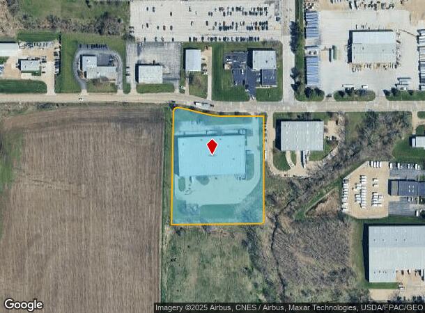
1221 W 76Th St, Davenport, IA 52806

NEARBY LISTINGS FOR SALE OR LEASE
Property Detail
1221 W 76Th St
Davenport-Moline-Rock Island, IA-IL
Scott Co Reg Ind Pk Add
X0201-09A
SCOTT CO REG IND PK ADD LOT: 001 SCOTT CO REG IND PK4TH ADD (A REPLAT OFLOTS 4,5,6 SCOTT COREG IND PK 2ND ADD)
Warehouse
Scott
X
Iowa
19163C0355H
4-6
2025
4.06 AC
2025
Greater Davenport
012801
Davenport/Moline/Rock Island
45,241 SF
DEMOGRAPHICS near 1221 W 76Th St
1 Mile
3 Mile
5 Mile
2024 Total Population
3,696
31,724
100,088
2029 Population
3,702
31,589
99,448
Pop Growth 2024-2029
+ 0.16%
(0.43%)
(0.64%)
Average Age
38
40
39
2024 Total Households
1,429
13,146
41,257
HH Growth 2024-2029
0.00%
(0.51%)
(0.69%)
Median Household Inc
$58,509
$59,919
$58,694
Avg Household Size
2.50
2.30
2.30
2024 Avg HH Vehicles
2.00
2.00
2.00
Median Home Value
$167,283
$176,575
$168,987
Median Year Built
1980
1979
1969
Nearby Places
Map Layers
Map Styles
 Street
 Aerial
- Restaurants
- Banks
- Shops
- Fitness
- Groceries
PUBLIC TRANSPORTATION
AIRPORT
Quad Cities International
DRIVE
WALK
Distance
Quad Cities International
31 min
16.1 mi
Freight Ports
Port Milwaukee
DRIVE
WALK
Distance
Port Milwaukee
241 min
212.4 mi
SALE & LEASE HISTORY
LISTING DATE
SALE/LEASE

Sep 25, 2016
For Lease
Oct 18, 2016
For Lease
Nearby Properties
Address
Land Use
TOTAL SIZE
Lot Size
Zoning
Address
Land Use
TOTAL SIZE
Lot Size
Zoning
2,615,134 SF
120.68 AC
Address
Land Use
TOTAL SIZE
Lot Size
Zoning
2,545,300 SF
159.73 AC
Address
Land Use
TOTAL SIZE
Lot Size
Zoning
3,360 SF
42.55 AC
Address
Land Use
TOTAL SIZE
Lot Size
Zoning
300,100 SF
14.87 AC
Address
Land Use
TOTAL SIZE
Lot Size
Zoning
128,100 SF
14.65 AC
Address
Land Use
TOTAL SIZE
Lot Size
Zoning
45,602 SF
149.61 AC
Address
Land Use
TOTAL SIZE
Lot Size
Zoning
27,225 SF
40.34 AC
Address
Land Use
TOTAL SIZE
Lot Size
Zoning
27,306 SF
50.57 AC
Address
Land Use
TOTAL SIZE
Lot Size
Zoning
688 SF
56.76 AC
Address
Land Use
TOTAL SIZE
Lot Size
Zoning
247,966 SF
14.14 AC
Address
Land Use
TOTAL SIZE
Lot Size
Zoning
300,718 SF
14.71 AC
Address
Land Use
TOTAL SIZE
Lot Size
Zoning
472,569 SF
47.24 AC
Address
Land Use
TOTAL SIZE
Lot Size
Zoning
12,500 SF
578.76 AC
Address
Land Use
TOTAL SIZE
Lot Size
Zoning
123,823 SF
6.46 AC
Address
Land Use
TOTAL SIZE
Lot Size
Zoning
4,804 SF
202 AC
Address
Land Use
TOTAL SIZE
Lot Size
Zoning
25,176 SF
13.85 AC
Address
Land Use
TOTAL SIZE
Lot Size
Zoning
8,000 SF
4.59 AC
Address
Land Use
TOTAL SIZE
Lot Size
Zoning
197,946 SF
18.64 AC
Address
Land Use
TOTAL SIZE
Lot Size
Zoning
4,800 SF
18.86 AC
Address
Land Use
TOTAL SIZE
Lot Size
Zoning
99,540 SF
10.95 AC
Address
Land Use
TOTAL SIZE
Lot Size
Zoning
111,452 SF
40 AC
Address
Land Use
TOTAL SIZE
Lot Size
Zoning
50,880 SF
11.36 AC
Address
Land Use
TOTAL SIZE
Lot Size
Zoning
422,688 SF
16.44 AC
Address
Land Use
TOTAL SIZE
Lot Size
Zoning
348,893 SF
15.30 AC
Address
Land Use
TOTAL SIZE
Lot Size
Zoning
78,037 SF
17.06 AC
Address
Land Use
TOTAL SIZE
Lot Size
Zoning
16,563 SF
12.71 AC
Address
Land Use
TOTAL SIZE
Lot Size
Zoning
25,200 SF
23.19 AC
Address
Land Use
TOTAL SIZE
Lot Size
Zoning
43,360 SF
2.92 AC
Address
Land Use
TOTAL SIZE
Lot Size
Zoning
6,774 SF
8.20 AC
Address
Land Use
TOTAL SIZE
Lot Size
Zoning
98,297 SF
14.73 AC
The World's #1 Commercial Real Estate Marketplace
Connect with us
© 2025 CoStar Group
The information above has been obtained from sources believed reliable. While we do not doubt its accuracy we have not verified it and make no guarantee, warranty or representation about it. It is your responsibility to independently confirm its accuracy and completeness. Any projections, opinions, assumptions, or estimates used are for example only and do not represent the current or future performance of the property. The value of this transaction to you depends on tax and other factors which should be evaluated by your tax, financial, and legal advisors. You and your advisors should conduct a careful, independent investigation of the property to determine to your satisfaction the suitability of the property for your needs.