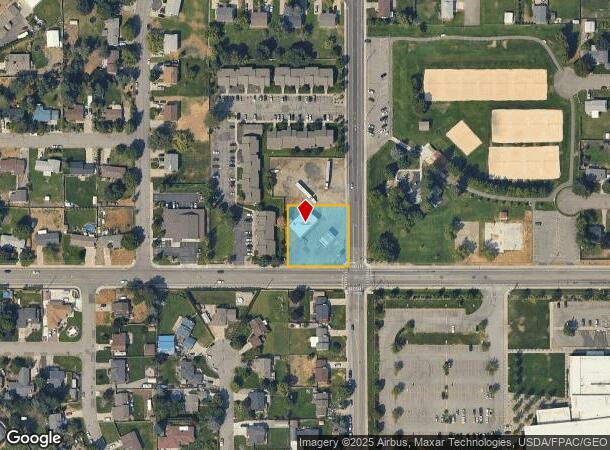
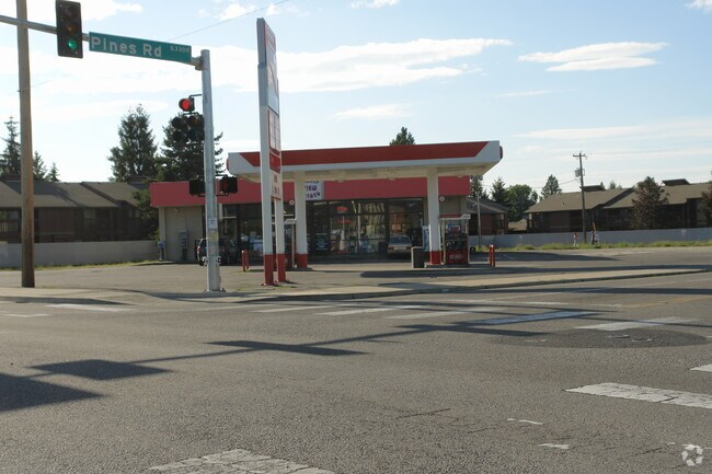
Property Record
12220 E 32Nd Ave, Spokane, WA 99206

NEARBY LISTINGS FOR SALE OR LEASE
Property Detail
12220 E 32Nd Ave
Spokane-Spokane Valley, WA
Skyview Ac
45284.2010
SKYVIEW AC S160FT OF E160FT L10 B20
Storebuilding
Spokane
X
Washington
53063C0590D
10
2025
0.59 AC
2025
Valley
012600
Spokane
2,546 SF
DEMOGRAPHICS near 12220 E 32Nd Ave
1 Mile
3 Mile
5 Mile
2024 Total Population
11,893
60,648
120,375
2029 Population
12,611
64,379
128,670
Pop Growth 2024-2029
+ 6.04%
+ 6.15%
+ 6.89%
Average Age
40
41
40
2024 Total Households
4,415
23,740
47,734
HH Growth 2024-2029
+ 6.16%
+ 6.32%
+ 7.05%
Median Household Inc
$81,157
$68,242
$67,774
Avg Household Size
2.70
2.50
2.40
2024 Avg HH Vehicles
2.00
2.00
2.00
Median Home Value
$370,151
$350,555
$350,501
Median Year Built
1975
1978
1980
Nearby Places
Map Layers
Map Styles
 Street
 Aerial
- Restaurants
- Banks
- Shops
- Fitness
- Groceries
PUBLIC TRANSPORTATION
COMMUTER RAIL
DRIVE
WALK
Distance
19 min
10.0 mi
AIRPORT
Spokane International
DRIVE
WALK
Distance
Spokane International
26 min
15.8 mi
Nearby Properties
Address
Land Use
TOTAL SIZE
Lot Size
Zoning
Address
Land Use
TOTAL SIZE
Lot Size
Zoning
473,651 SF
76.70 AC
R-2
Address
Land Use
TOTAL SIZE
Lot Size
Zoning
237,094 SF
58.56 AC
R-3
Address
Land Use
TOTAL SIZE
Lot Size
Zoning
260,345 SF
23.70 AC
MDR
Address
Land Use
TOTAL SIZE
Lot Size
Zoning
161,130 SF
6.45 AC
GO
Address
Land Use
TOTAL SIZE
Lot Size
Zoning
240,663 SF
8.90 AC
MF-2
Address
Land Use
TOTAL SIZE
Lot Size
Zoning
84,600 SF
17.95 AC
MF-1
Address
Land Use
TOTAL SIZE
Lot Size
Zoning
136,518 SF
7.96 AC
O
Address
Land Use
TOTAL SIZE
Lot Size
Zoning
100,060 SF
14.94 AC
R-3
Address
Land Use
TOTAL SIZE
Lot Size
Zoning
69,202 SF
9.99 AC
R-2
Address
Land Use
TOTAL SIZE
Lot Size
Zoning
87,848 SF
7.36 AC
MF-2
Address
Land Use
TOTAL SIZE
Lot Size
Zoning
107,279 SF
7.31 AC
MF-2
Address
Land Use
TOTAL SIZE
Lot Size
Zoning
72,443 SF
8.90 AC
R-3
Address
Land Use
TOTAL SIZE
Lot Size
Zoning
126,906 SF
20.25 AC
LDR
Address
Land Use
TOTAL SIZE
Lot Size
Zoning
87,989 SF
5.38 AC
MF-2
Address
Land Use
TOTAL SIZE
Lot Size
Zoning
149,106 SF
4.99 AC
MF-2
Address
Land Use
TOTAL SIZE
Lot Size
Zoning
143,772 SF
10.67 AC
MF-2
Address
Land Use
TOTAL SIZE
Lot Size
Zoning
157,232 SF
3.28 AC
MF-2
Address
Land Use
TOTAL SIZE
Lot Size
Zoning
70,265 SF
9.64 AC
R-2
Address
Land Use
TOTAL SIZE
Lot Size
Zoning
110,850 SF
6.24 AC
MF-2
Address
Land Use
TOTAL SIZE
Lot Size
Zoning
47,612 SF
3.38 AC
CMU
Address
Land Use
TOTAL SIZE
Lot Size
Zoning
98,774 SF
5.26 AC
MF-2
Address
Land Use
TOTAL SIZE
Lot Size
Zoning
105,659 SF
4.40 AC
MF-1
Address
Land Use
TOTAL SIZE
Lot Size
Zoning
150,715 SF
7.82 AC
MF-2
Address
Land Use
TOTAL SIZE
Lot Size
Zoning
114,418 SF
5.62 AC
MF-2
Address
Land Use
TOTAL SIZE
Lot Size
Zoning
68,600 SF
5.25 AC
MF-2
Address
Land Use
TOTAL SIZE
Lot Size
Zoning
110,078 SF
7.23 AC
MF-2
Address
Land Use
TOTAL SIZE
Lot Size
Zoning
109,016 SF
8.01 AC
MF-2
Address
Land Use
TOTAL SIZE
Lot Size
Zoning
111,895 SF
5.45 AC
MF-2
Address
Land Use
TOTAL SIZE
Lot Size
Zoning
100,035 SF
5.74 AC
CMU
Address
Land Use
TOTAL SIZE
Lot Size
Zoning
21,502 SF
4.68 AC
GO
The World's #1 Commercial Real Estate Marketplace
Connect with us
© 2026 CoStar Group
The information above has been obtained from sources believed reliable. While we do not doubt its accuracy we have not verified it and make no guarantee, warranty or representation about it. It is your responsibility to independently confirm its accuracy and completeness. Any projections, opinions, assumptions, or estimates used are for example only and do not represent the current or future performance of the property. The value of this transaction to you depends on tax and other factors which should be evaluated by your tax, financial, and legal advisors. You and your advisors should conduct a careful, independent investigation of the property to determine to your satisfaction the suitability of the property for your needs.