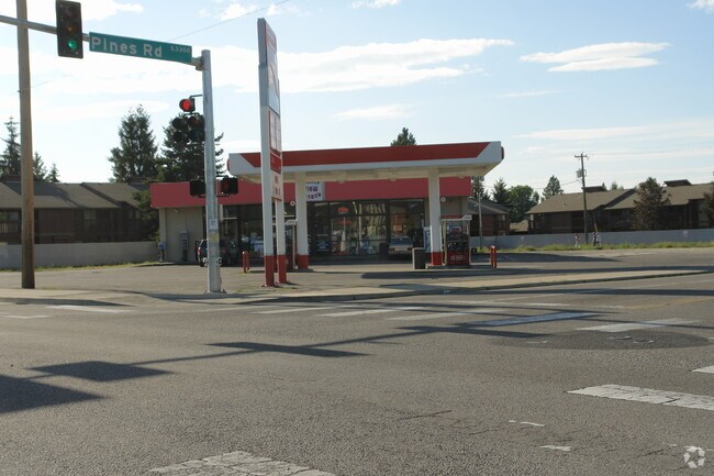
Property Record
12220 E 32Nd Ave, Spokane, WA 99206


Save to a Folder
{{folder.Name}}
{{folder.ListingIds.length}} Properties
{{folder.ListingIds.length}} Property
Create a New Folder
Property Detail
12220 E 32Nd Ave
45284.2010
SKYVIEW AC S160FT OF E160FT L10 B20
Storebuilding
SPOKANE
NC
Washington
B and X Area of moderate flood hazard, usually the area between the limits of the 100-year and 500-year floods.
10
2026
0.59 AC
2026
Valley
012600
Spokane
2,546 SF
Spokane-Spokane Valley, WA
NEARBY LISTINGS FOR SALE OR LEASE
DEMOGRAPHICS near 12220 E 32Nd Ave
1 mile
3 mile
5 mile
2025 Total Population
11,841
60,792
119,092
2030 Population
12,092
61,901
121,935
Pop Growth 2025-2030
+ 2.12%
+ 1.82%
+ 2.39%
Average Age
41
41
40
2025 Total Households
4,327
23,750
47,161
HH Growth 2025-2030
+ 1.94%
+ 1.77%
+ 2.35%
Median Household Inc
$96,686
$79,799
$77,844
Avg Household Size
2.70
2.50
2.50
2025 Avg HH Vehicles
2.00
2.00
2.00
Median Home Value
$433,245
$423,458
$424,738
Median Year Built
1976
1978
1982
Nearby Places
Map Layers
Map Styles
 Street
 Aerial
Layers
 Traffic
 Biking
Places
Listings with unknown addresses are not visible on the map
- Restaurants
- Banks
- Shops
- Fitness
- Groceries
PUBLIC TRANSPORTATION
AIRPORT
Spokane International
Drive
Walk
Distance
Spokane International
26 min
15.9 mi
Freight Ports
Port of Everett
Drive
Walk
Distance
Port of Everett
354 min
311.5 mi
Nearby Properties
Address
Land Use
TOTAL SIZE
Lot Size
Zoning
Address
Land Use
TOTAL SIZE
Lot Size
Zoning
473,651 SF
76.70 AC
R-2
Address
Land Use
TOTAL SIZE
Lot Size
Zoning
374,043 SF
58.56 AC
R-3
Address
Land Use
TOTAL SIZE
Lot Size
Zoning
260,345 SF
23.70 AC
MDR
Address
Land Use
TOTAL SIZE
Lot Size
Zoning
240,663 SF
8.90 AC
MF-2
Address
Land Use
TOTAL SIZE
Lot Size
Zoning
161,130 SF
6.45 AC
GO
Address
Land Use
TOTAL SIZE
Lot Size
Zoning
Address
Land Use
TOTAL SIZE
Lot Size
Zoning
84,600 SF
17.95 AC
MF-1
Address
Land Use
TOTAL SIZE
Lot Size
Zoning
136,518 SF
7.96 AC
O
Address
Land Use
TOTAL SIZE
Lot Size
Zoning
100,060 SF
14.94 AC
R-3
Address
Land Use
TOTAL SIZE
Lot Size
Zoning
68,150 SF
9.99 AC
R-2
Address
Land Use
TOTAL SIZE
Lot Size
Zoning
72,635 SF
8.90 AC
R-3
Address
Land Use
TOTAL SIZE
Lot Size
Zoning
Address
Land Use
TOTAL SIZE
Lot Size
Zoning
87,848 SF
7.36 AC
MF-2
Address
Land Use
TOTAL SIZE
Lot Size
Zoning
Address
Land Use
TOTAL SIZE
Lot Size
Zoning
157,232 SF
3.28 AC
MF-2
Address
Land Use
TOTAL SIZE
Lot Size
Zoning
70,265 SF
9.64 AC
R-2
Address
Land Use
TOTAL SIZE
Lot Size
Zoning
141,372 SF
10.67 AC
MF-2
Address
Land Use
TOTAL SIZE
Lot Size
Zoning
107,279 SF
7.31 AC
MF-2
Address
Land Use
TOTAL SIZE
Lot Size
Zoning
126,906 SF
20.25 AC
LDR
Address
Land Use
TOTAL SIZE
Lot Size
Zoning
47,612 SF
3.38 AC
CMU
Address
Land Use
TOTAL SIZE
Lot Size
Zoning
98,774 SF
5.26 AC
MF-2
Address
Land Use
TOTAL SIZE
Lot Size
Zoning
Address
Land Use
TOTAL SIZE
Lot Size
Zoning
146,226 SF
4.99 AC
MF-2
Address
Land Use
TOTAL SIZE
Lot Size
Zoning
87,989 SF
5.38 AC
MF-2
Address
Land Use
TOTAL SIZE
Lot Size
Zoning
107,441 SF
4.40 AC
MF-1
Address
Land Use
TOTAL SIZE
Lot Size
Zoning
111,126 SF
6.24 AC
MF-2
Address
Land Use
TOTAL SIZE
Lot Size
Zoning
114,418 SF
5.62 AC
MF-2
Address
Land Use
TOTAL SIZE
Lot Size
Zoning
Address
Land Use
TOTAL SIZE
Lot Size
Zoning
107,419 SF
7.82 AC
MF-2
Address
Land Use
TOTAL SIZE
Lot Size
Zoning
21,502 SF
4.68 AC
GO
The World's #1 Commercial Real Estate Marketplace
Connect with us
© 2026 CoStar Group
The information above has been obtained from sources believed reliable. While we do not doubt its accuracy we have not verified it and make no guarantee, warranty or representation about it. It is your responsibility to independently confirm its accuracy and completeness. Any projections, opinions, assumptions, or estimates used are for example only and do not represent the current or future performance of the property. The value of this transaction to you depends on tax and other factors which should be evaluated by your tax, financial, and legal advisors. You and your advisors should conduct a careful, independent investigation of the property to determine to your satisfaction the suitability of the property for your needs.