Property Record
12226 Farmers Blvd, Springfield Gardens, NY 11413
NEARBY LISTINGS FOR SALE OR LEASE
Property Detail
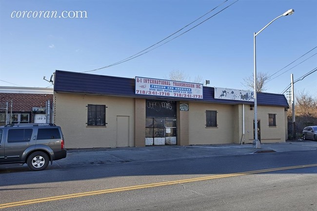
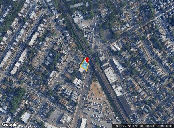
12226 Farmers Blvd
12458-0128
Map New Netherland Subdivision 4Th Ward
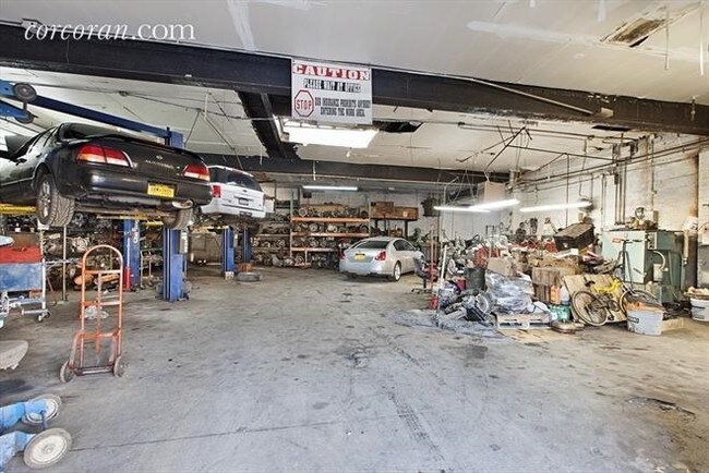
Autorepair
Queens
X
New York
3604970242F
128
2024
0.13 AC
2025
South Queens
036600
Long Island (New York)
4,540 SF
New York-Jersey City-White Plains, NY-NJ
DEMOGRAPHICS near 12226 Farmers Blvd
1 Mile
3 Mile
5 Mile
2024 Total Population
58,509
444,572
1,031,731
2029 Population
54,117
412,183
965,508
Pop Growth 2024-2029
(7.51%)
(7.29%)
(6.42%)
Average Age
43
41
41
2024 Total Households
20,021
135,343
331,583
HH Growth 2024-2029
(7.66%)
(7.65%)
(6.64%)
Median Household Inc
$71,197
$79,053
$86,440
Avg Household Size
2.80
3.10
3.00
2024 Avg HH Vehicles
1.00
1.00
1.00
Median Home Value
$560,520
$626,187
$657,044
Median Year Built
1955
1951
1951
Nearby Places
- Restaurants
- Banks
- Shops
- Fitness
- Groceries
PUBLIC TRANSPORTATION
COMMUTER RAIL
Locust Manor Station (Far Rockaway Branch - Long Island Rail Road)
DRIVE
WALK
Distance
Locust Manor Station (Far Rockaway Branch - Long Island Rail Road)
2 min
12 min
0.7 mi
Saint Albans Station (West Hempstead Branch - Long Island Rail Road)
DRIVE
WALK
Distance
Saint Albans Station (West Hempstead Branch - Long Island Rail Road)
3 min
14 min
0.7 mi
AIRPORT
John F Kennedy International
DRIVE
WALK
Distance
John F Kennedy International
10 min
4.6 mi
LaGuardia
DRIVE
WALK
Distance
LaGuardia
19 min
10.9 mi
Newark Liberty International
DRIVE
WALK
Distance
Newark Liberty International
45 min
30.6 mi
Freight Ports
NY - Red Hook Container Terminal
DRIVE
WALK
Distance
NY - Red Hook Container Terminal
30 min
16.0 mi
SALE & LEASE HISTORY
LISTING DATE
SALE/LEASE

Sep 23, 2016
For Sale
Oct 14, 2016
For Sale
Oct 14, 2016
For Sale
Feb 27, 2017
For Lease
Nearby Properties
Address
Land Use
TOTAL SIZE
Lot Size
Zoning
Address
Land Use
TOTAL SIZE
Lot Size
Zoning
124.60 AC
M1-1
Address
Land Use
TOTAL SIZE
Lot Size
Zoning
294.47 AC
PARK
Address
Land Use
TOTAL SIZE
Lot Size
Zoning
731,247 SF
56.09 AC
R3-2
Address
Land Use
TOTAL SIZE
Lot Size
Zoning
738,000 SF
1.92 AC
C6-3
Address
Land Use
TOTAL SIZE
Lot Size
Zoning
291,589 SF
1.55 AC
C6-3
Address
Land Use
TOTAL SIZE
Lot Size
Zoning
320,535 SF
1.52 AC
C4-4A
Address
Land Use
TOTAL SIZE
Lot Size
Zoning
384,249 SF
5.56 AC
R5
Address
Land Use
TOTAL SIZE
Lot Size
Zoning
364,424 SF
C5-3
Address
Land Use
TOTAL SIZE
Lot Size
Zoning
478,384 SF
1.23 AC
C6-3
Address
Land Use
TOTAL SIZE
Lot Size
Zoning
360,000 SF
8.78 AC
R6
Address
Land Use
TOTAL SIZE
Lot Size
Zoning
569,583 SF
2.28 AC
C4-5X
Address
Land Use
TOTAL SIZE
Lot Size
Zoning
230,580 SF
3.41 AC
C8-1
Address
Land Use
TOTAL SIZE
Lot Size
Zoning
460,540 SF
0.69 AC
C6-4
Address
Land Use
TOTAL SIZE
Lot Size
Zoning
535,609 SF
0.82 AC
C6-4
Address
Land Use
TOTAL SIZE
Lot Size
Zoning
208,952 SF
9.03 AC
M1-1
Address
Land Use
TOTAL SIZE
Lot Size
Zoning
240,000 SF
14.50 AC
R4
Address
Land Use
TOTAL SIZE
Lot Size
Zoning
295,904 SF
0.63 AC
C6-3
Address
Land Use
TOTAL SIZE
Lot Size
Zoning
240,000 SF
1.91 AC
C6-3
Address
Land Use
TOTAL SIZE
Lot Size
Zoning
285,170 SF
12.63 AC
R3-1
Address
Land Use
TOTAL SIZE
Lot Size
Zoning
471,648 SF
1.46 AC
C6-3
Address
Land Use
TOTAL SIZE
Lot Size
Zoning
27.23 AC
PARK
Address
Land Use
TOTAL SIZE
Lot Size
Zoning
50,000 SF
52.45 AC
PARK
Address
Land Use
TOTAL SIZE
Lot Size
Zoning
175,040 SF
10.19 AC
R3X
Address
Land Use
TOTAL SIZE
Lot Size
Zoning
199,864 SF
1.76 AC
C4-5X
Address
Land Use
TOTAL SIZE
Lot Size
Zoning
160,551 SF
0.68 AC
C4-2
Address
Land Use
TOTAL SIZE
Lot Size
Zoning
129,378 SF
4.86 AC
R2A
Address
Land Use
TOTAL SIZE
Lot Size
Zoning
187,000 SF
3.24 AC
R4-1
Address
Land Use
TOTAL SIZE
Lot Size
Zoning
304,128 SF
3.70 AC
R6
Address
Land Use
TOTAL SIZE
Lot Size
Zoning
260,000 SF
3.10 AC
M1-4
Address
Land Use
TOTAL SIZE
Lot Size
Zoning
41,756 SF
1.02 AC
R5D
The World's #1 Commercial Real Estate Marketplace
Connect with us
© 2025 CoStar Group
The information above has been obtained from sources believed reliable. While we do not doubt its accuracy we have not verified it and make no guarantee, warranty or representation about it. It is your responsibility to independently confirm its accuracy and completeness. Any projections, opinions, assumptions, or estimates used are for example only and do not represent the current or future performance of the property. The value of this transaction to you depends on tax and other factors which should be evaluated by your tax, financial, and legal advisors. You and your advisors should conduct a careful, independent investigation of the property to determine to your satisfaction the suitability of the property for your needs.