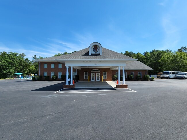
Property Record
1224 Old Cherokee Rd, Lexington, SC 29072
NEARBY LISTINGS FOR SALE OR LEASE
Property Detail
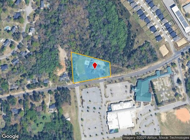
1224 Old Cherokee Rd
004200-01-017
PT TRACT 2
Daycare
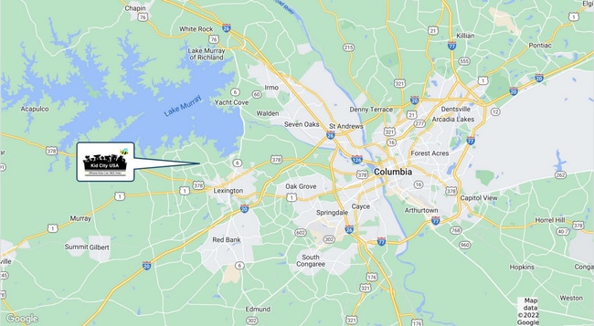
Lexington
X
South Carolina
45063C0120J
2.13 AC
2025
Lexington
2024
Columbia
021047
Columbia, SC
9,918 SF
DEMOGRAPHICS near 1224 Old Cherokee Rd
1 Mile
3 Mile
5 Mile
2024 Total Population
4,698
28,335
59,787
2029 Population
5,144
30,926
65,140
Pop Growth 2024-2029
+ 9.49%
+ 9.14%
+ 8.95%
Average Age
41
41
40
2024 Total Households
1,658
10,846
22,864
HH Growth 2024-2029
+ 9.65%
+ 9.37%
+ 9.18%
Median Household Inc
$103,618
$87,086
$88,830
Avg Household Size
2.70
2.50
2.50
2024 Avg HH Vehicles
2.00
2.00
2.00
Median Home Value
$290,509
$268,190
$257,792
Median Year Built
1999
1999
1999
Nearby Places
Map Layers
Map Styles
 Street
 Aerial
- Restaurants
- Banks
- Shops
- Fitness
- Groceries
PUBLIC TRANSPORTATION
AIRPORT
Columbia Metro
DRIVE
WALK
Distance
Columbia Metro
33 min
15.2 mi
Freight Ports
North Charleston Terminal
DRIVE
WALK
Distance
North Charleston Terminal
135 min
113.1 mi
SALE & LEASE HISTORY
LISTING DATE
SALE/LEASE

Jun 06, 2022
For Sale
Jan 04, 2023
For Sale
Nearby Properties
Address
Land Use
TOTAL SIZE
Lot Size
Zoning
Address
Land Use
TOTAL SIZE
Lot Size
Zoning
78,966 SF
10.34 AC
Address
Land Use
TOTAL SIZE
Lot Size
Zoning
3,406 SF
19.99 AC
HDR
Address
Land Use
TOTAL SIZE
Lot Size
Zoning
204,927 SF
24.82 AC
GC
Address
Land Use
TOTAL SIZE
Lot Size
Zoning
45,171 SF
8.38 AC
ID
Address
Land Use
TOTAL SIZE
Lot Size
Zoning
64,281 SF
11.71 AC
GC
Address
Land Use
TOTAL SIZE
Lot Size
Zoning
102,553 SF
13.30 AC
GC
Address
Land Use
TOTAL SIZE
Lot Size
Zoning
9,792 SF
7.47 AC
HDR
Address
Land Use
TOTAL SIZE
Lot Size
Zoning
96,585 SF
2.62 AC
ID
Address
Land Use
TOTAL SIZE
Lot Size
Zoning
41,883 SF
21.77 AC
ID
Address
Land Use
TOTAL SIZE
Lot Size
Zoning
49,494 SF
9.98 AC
ID
Address
Land Use
TOTAL SIZE
Lot Size
Zoning
62,141 SF
7.28 AC
GC
Address
Land Use
TOTAL SIZE
Lot Size
Zoning
78,665 SF
7.58 AC
GC
Address
Land Use
TOTAL SIZE
Lot Size
Zoning
33,218 SF
4.40 AC
GC
Address
Land Use
TOTAL SIZE
Lot Size
Zoning
15,343 SF
1.30 AC
GC
Address
Land Use
TOTAL SIZE
Lot Size
Zoning
18,300 SF
3.33 AC
RD
Address
Land Use
TOTAL SIZE
Lot Size
Zoning
1,572 SF
21.04 AC
GC
Address
Land Use
TOTAL SIZE
Lot Size
Zoning
35,109 SF
11.06 AC
GC
Address
Land Use
TOTAL SIZE
Lot Size
Zoning
3,810 SF
1.58 AC
ID
Address
Land Use
TOTAL SIZE
Lot Size
Zoning
59,201 SF
7.76 AC
GC
Address
Land Use
TOTAL SIZE
Lot Size
Zoning
2,100 SF
5.91 AC
LC
Address
Land Use
TOTAL SIZE
Lot Size
Zoning
79.51 AC
GC
Address
Land Use
TOTAL SIZE
Lot Size
Zoning
86,573 SF
4.92 AC
Address
Land Use
TOTAL SIZE
Lot Size
Zoning
38,716 SF
2.07 AC
GC
Address
Land Use
TOTAL SIZE
Lot Size
Zoning
1,378 SF
125.89 AC
RD
Address
Land Use
TOTAL SIZE
Lot Size
Zoning
30,555 SF
3.20 AC
GC
Address
Land Use
TOTAL SIZE
Lot Size
Zoning
15,229 SF
5.71 AC
GC
Address
Land Use
TOTAL SIZE
Lot Size
Zoning
42,216 SF
2.52 AC
GC
Address
Land Use
TOTAL SIZE
Lot Size
Zoning
15.43 AC
GC
Address
Land Use
TOTAL SIZE
Lot Size
Zoning
14,287 SF
3.09 AC
GC
Address
Land Use
TOTAL SIZE
Lot Size
Zoning
52,296 SF
2.75 AC
GC
The World's #1 Commercial Real Estate Marketplace
Connect with us
© 2025 CoStar Group
The information above has been obtained from sources believed reliable. While we do not doubt its accuracy we have not verified it and make no guarantee, warranty or representation about it. It is your responsibility to independently confirm its accuracy and completeness. Any projections, opinions, assumptions, or estimates used are for example only and do not represent the current or future performance of the property. The value of this transaction to you depends on tax and other factors which should be evaluated by your tax, financial, and legal advisors. You and your advisors should conduct a careful, independent investigation of the property to determine to your satisfaction the suitability of the property for your needs.