Property Record
100 Atlantic Ave, Long Beach, CA 90802
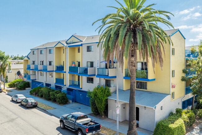
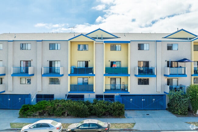
This Property Is For Sale
NEARBY LISTINGS FOR SALE OR LEASE
Property Detail
100 Atlantic Ave
Los Angeles-Long Beach-Glendale, CA
Long Beach Townsite
7281-028-001
Los Angeles
Condominium
California
X
0.52 AC
06037C1968G
Downtown Long Beach
820 SF
Los Angeles
DEMOGRAPHICS near 100 Atlantic Ave
1 Mile
3 Mile
5 Mile
2024 Total Population
64,358
225,299
362,874
2029 Population
63,315
219,022
351,810
Pop Growth 2024-2029
(1.62%)
(2.79%)
(3.05%)
Average Age
39
38
39
2024 Total Households
30,240
89,182
137,100
HH Growth 2024-2029
(1.57%)
(2.81%)
(3.12%)
Median Household Inc
$59,461
$63,945
$71,784
Avg Household Size
2.00
2.40
2.50
2024 Avg HH Vehicles
1.00
1.00
2.00
Median Home Value
$599,755
$708,018
$761,414
Median Year Built
1967
1962
1959
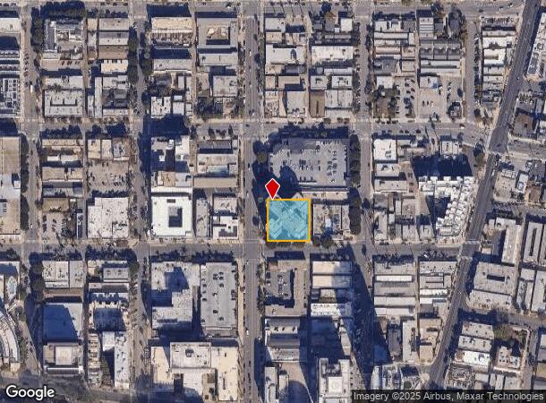
Nearby Places
Map Layers
Map Styles
 Street
 Aerial
- Restaurants
- Banks
- Shops
- Fitness
- Groceries
PUBLIC TRANSPORTATION
TRANSIT/SUBWAY
1St Street Station (Blue Line - Los Angeles County Metropolitan Transportation Authority (Metro))
DRIVE
WALK
Distance
1St Street Station (Blue Line - Los Angeles County Metropolitan Transportation Authority (Metro))
1 min
6 min
0.3 mi
Long Beach Transit Mall (Blue Line - Los Angeles County Metropolitan Transportation Authority (Metro))
DRIVE
WALK
Distance
Long Beach Transit Mall (Blue Line - Los Angeles County Metropolitan Transportation Authority (Metro))
2 min
9 min
0.5 mi
5Th Street Station (Blue Line - Los Angeles County Metropolitan Transportation Authority (Metro))
DRIVE
WALK
Distance
5Th Street Station (Blue Line - Los Angeles County Metropolitan Transportation Authority (Metro))
2 min
11 min
0.6 mi
Pacific Station (Blue Line - Los Angeles County Metropolitan Transportation Authority (Metro))
DRIVE
WALK
Distance
Pacific Station (Blue Line - Los Angeles County Metropolitan Transportation Authority (Metro))
2 min
14 min
0.8 mi
AIRPORT
Long Beach (Daugherty Field)
DRIVE
WALK
Distance
Long Beach (Daugherty Field)
11 min
4.8 mi
John Wayne/Orange County
DRIVE
WALK
Distance
John Wayne/Orange County
32 min
21.2 mi
Los Angeles International
DRIVE
WALK
Distance
Los Angeles International
33 min
22.6 mi
Freight Ports
Port of Long Beach
DRIVE
WALK
Distance
Port of Long Beach
0 min
0.2 mi
Nearby Properties
Address
Land Use
TOTAL SIZE
Lot Size
Zoning
Address
Land Use
TOTAL SIZE
Lot Size
Zoning
502,333 SF
21.89 AC
LBI
Address
Land Use
TOTAL SIZE
Lot Size
Zoning
402,342 SF
LBPD30
Address
Land Use
TOTAL SIZE
Lot Size
Zoning
845,760 SF
4.01 AC
LBPD6
Address
Land Use
TOTAL SIZE
Lot Size
Zoning
708,409 SF
3.15 AC
LBPD
Address
Land Use
TOTAL SIZE
Lot Size
Zoning
266,158 SF
1 AC
LBPD30
Address
Land Use
TOTAL SIZE
Lot Size
Zoning
617,114 SF
3.53 AC
LBPD
Address
Land Use
TOTAL SIZE
Lot Size
Zoning
918,344 SF
4.14 AC
LBPD30
Address
Land Use
TOTAL SIZE
Lot Size
Zoning
260,804 SF
1.71 AC
LBPD30
Address
Land Use
TOTAL SIZE
Lot Size
Zoning
982,195 SF
1.77 AC
LBPD30
Address
Land Use
TOTAL SIZE
Lot Size
Zoning
182,749 SF
LBPD30
Address
Land Use
TOTAL SIZE
Lot Size
Zoning
393,161 SF
1.11 AC
LBPD30
Address
Land Use
TOTAL SIZE
Lot Size
Zoning
372,367 SF
2.40 AC
LBPD30
Address
Land Use
TOTAL SIZE
Lot Size
Zoning
174,688 SF
0.88 AC
LBI*
Address
Land Use
TOTAL SIZE
Lot Size
Zoning
140,236 SF
9.21 AC
LBR4N
Address
Land Use
TOTAL SIZE
Lot Size
Zoning
311,796 SF
1.90 AC
LBPD30
Address
Land Use
TOTAL SIZE
Lot Size
Zoning
133,668 SF
0.76 AC
LBCH
Address
Land Use
TOTAL SIZE
Lot Size
Zoning
113,919 SF
0.72 AC
LBPD30
Address
Land Use
TOTAL SIZE
Lot Size
Zoning
9,629 SF
2.37 AC
LBPD30
Address
Land Use
TOTAL SIZE
Lot Size
Zoning
279,022 SF
1.80 AC
LBCB
Address
Land Use
TOTAL SIZE
Lot Size
Zoning
603,213 SF
4.70 AC
LBI
Address
Land Use
TOTAL SIZE
Lot Size
Zoning
152,584 SF
0.86 AC
LBPD30
Address
Land Use
TOTAL SIZE
Lot Size
Zoning
117,457 SF
0.75 AC
LBPD30
Address
Land Use
TOTAL SIZE
Lot Size
Zoning
84,054 SF
0.34 AC
LBPD
Address
Land Use
TOTAL SIZE
Lot Size
Zoning
74,452 SF
1.05 AC
LBPD30
Address
Land Use
TOTAL SIZE
Lot Size
Zoning
238,914 SF
12.97 AC
LBIP
Address
Land Use
TOTAL SIZE
Lot Size
Zoning
225,486 SF
2.26 AC
LBPD6
Address
Land Use
TOTAL SIZE
Lot Size
Zoning
204,748 SF
1.18 AC
LBPD30
Address
Land Use
TOTAL SIZE
Lot Size
Zoning
80,867 SF
0.55 AC
LBPD6
Address
Land Use
TOTAL SIZE
Lot Size
Zoning
414,067 SF
9.31 AC
LBCCA
The World's #1 Commercial Real Estate Marketplace
Connect with us
© 2026 CoStar Group
The information above has been obtained from sources believed reliable. While we do not doubt its accuracy we have not verified it and make no guarantee, warranty or representation about it. It is your responsibility to independently confirm its accuracy and completeness. Any projections, opinions, assumptions, or estimates used are for example only and do not represent the current or future performance of the property. The value of this transaction to you depends on tax and other factors which should be evaluated by your tax, financial, and legal advisors. You and your advisors should conduct a careful, independent investigation of the property to determine to your satisfaction the suitability of the property for your needs.