Property Record
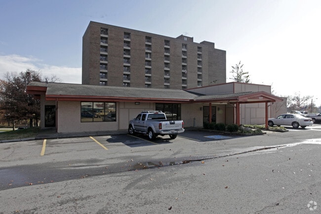
1225 Gallatin Pike S, Madison, TN 37115


NEARBY LISTINGS FOR SALE OR LEASE
Property Detail
1225 Gallatin Pike S
051-00-0-158
E SIDE GALLATIN PIKE S OF BERKLEY DRIVE
Religious
Davidson
X
Tennessee
47037C0251H
10.61 AC
0
Rivergate/Hendersonville
2025
Nashville
010702
Nashville-Davidson--Murfreesboro--Franklin, TN
62,037 SF
DEMOGRAPHICS near 1225 Gallatin Pike S
1 Mile
3 Mile
5 Mile
2024 Total Population
7,467
59,791
133,025
2029 Population
7,499
59,462
132,867
Pop Growth 2024-2029
+ 0.43%
(0.55%)
(0.12%)
Average Age
42
39
39
2024 Total Households
3,503
25,101
55,726
HH Growth 2024-2029
+ 0.11%
(0.89%)
(0.45%)
Median Household Inc
$44,483
$57,846
$60,166
Avg Household Size
2.00
2.30
2.30
2024 Avg HH Vehicles
2.00
2.00
2.00
Median Home Value
$331,574
$289,601
$320,276
Median Year Built
1973
1975
1977
Nearby Places
Map Layers
Map Styles
 Street
 Aerial
- Restaurants
- Banks
- Shops
- Fitness
- Groceries
PUBLIC TRANSPORTATION
COMMUTER RAIL
Riverfront (East Corridor Line - Tennessee Regional Transportation Authority Music City Star (Music City Star))
DRIVE
WALK
Distance
Riverfront (East Corridor Line - Tennessee Regional Transportation Authority Music City Star (Music City Star))
12 min
8.3 mi
Donelson (East Corridor Line - Tennessee Regional Transportation Authority Music City Star (Music City Star))
DRIVE
WALK
Distance
Donelson (East Corridor Line - Tennessee Regional Transportation Authority Music City Star (Music City Star))
13 min
8.7 mi
AIRPORT
Nashville International
DRIVE
WALK
Distance
Nashville International
20 min
12.8 mi
Freight Ports
Port of Mobile
DRIVE
WALK
Distance
Port of Mobile
495 min
453.5 mi
Nearby Properties
Address
Land Use
TOTAL SIZE
Lot Size
Zoning
Address
Land Use
TOTAL SIZE
Lot Size
Zoning
511,497 SF
171.79 AC
CA
Address
Land Use
TOTAL SIZE
Lot Size
Zoning
43,022 SF
17.02 AC
MULTIZONE
Address
Land Use
TOTAL SIZE
Lot Size
Zoning
26,434 SF
12.86 AC
RM20
Address
Land Use
TOTAL SIZE
Lot Size
Zoning
25,326 SF
16.89 AC
SP
Address
Land Use
TOTAL SIZE
Lot Size
Zoning
27,585 SF
18.20 AC
SP
Address
Land Use
TOTAL SIZE
Lot Size
Zoning
34,160 SF
9.20 AC
R10
Address
Land Use
TOTAL SIZE
Lot Size
Zoning
363,125 SF
51.28 AC
MULTI-ZONE
Address
Land Use
TOTAL SIZE
Lot Size
Zoning
37,730 SF
10.71 AC
RS10
Address
Land Use
TOTAL SIZE
Lot Size
Zoning
29,064 SF
15.11 AC
MULTIZONE
Address
Land Use
TOTAL SIZE
Lot Size
Zoning
11,088 SF
21.28 AC
RS7.5
Address
Land Use
TOTAL SIZE
Lot Size
Zoning
17,292 SF
12.35 AC
RM20
Address
Land Use
TOTAL SIZE
Lot Size
Zoning
28,547 SF
14.32 AC
SP
Address
Land Use
TOTAL SIZE
Lot Size
Zoning
42,864 SF
32.73 AC
CA
Address
Land Use
TOTAL SIZE
Lot Size
Zoning
125,064 SF
5.13 AC
CS
Address
Land Use
TOTAL SIZE
Lot Size
Zoning
30,534 SF
19.77 AC
SP
Address
Land Use
TOTAL SIZE
Lot Size
Zoning
336,784 SF
41.54 AC
IR
Address
Land Use
TOTAL SIZE
Lot Size
Zoning
197,988 SF
33.16 AC
R15
Address
Land Use
TOTAL SIZE
Lot Size
Zoning
154,143 SF
8.88 AC
OG
Address
Land Use
TOTAL SIZE
Lot Size
Zoning
195,436 SF
33.31 AC
CA
Address
Land Use
TOTAL SIZE
Lot Size
Zoning
20.60 AC
RS10
Address
Land Use
TOTAL SIZE
Lot Size
Zoning
17,214 SF
40.52 AC
RM9
Address
Land Use
TOTAL SIZE
Lot Size
Zoning
6,120 SF
17.46 AC
R10
Address
Land Use
TOTAL SIZE
Lot Size
Zoning
186,755 SF
6.08 AC
CA
Address
Land Use
TOTAL SIZE
Lot Size
Zoning
162,261 SF
6.20 AC
RM40
Address
Land Use
TOTAL SIZE
Lot Size
Zoning
162,500 SF
18.26 AC
IR
Address
Land Use
TOTAL SIZE
Lot Size
Zoning
13,950 SF
17.60 AC
R8
Address
Land Use
TOTAL SIZE
Lot Size
Zoning
3,312 SF
33.03 AC
IR
Address
Land Use
TOTAL SIZE
Lot Size
Zoning
191,221 SF
0.64 AC
MULTIZONE
Address
Land Use
TOTAL SIZE
Lot Size
Zoning
146,323 SF
4.48 AC
RM40
Address
Land Use
TOTAL SIZE
Lot Size
Zoning
93,000 SF
16.44 AC
IR
The World's #1 Commercial Real Estate Marketplace
Connect with us
© 2026 CoStar Group
The information above has been obtained from sources believed reliable. While we do not doubt its accuracy we have not verified it and make no guarantee, warranty or representation about it. It is your responsibility to independently confirm its accuracy and completeness. Any projections, opinions, assumptions, or estimates used are for example only and do not represent the current or future performance of the property. The value of this transaction to you depends on tax and other factors which should be evaluated by your tax, financial, and legal advisors. You and your advisors should conduct a careful, independent investigation of the property to determine to your satisfaction the suitability of the property for your needs.