Property Record
1219 W State St, New Castle, PA 16101

NEARBY LISTINGS FOR SALE OR LEASE
Property Detail
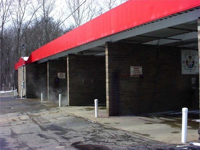
1219 W State St
New Castle, PA
New Castle Dist.1-8
06-051900
L 550B 552 B-I 550-B 552
Commercialnec
Lawrence
2025
Pennsylvania
2025
0.75 AC
000800
Other Market Areas
3,968 SF
DEMOGRAPHICS near 1219 W State St
1 Mile
3 Mile
5 Mile
2024 Total Population
5,467
34,404
47,032
2029 Population
5,435
34,027
46,426
Pop Growth 2024-2029
(0.59%)
(1.10%)
(1.29%)
Average Age
41
42
43
2024 Total Households
2,394
14,649
20,054
HH Growth 2024-2029
(0.67%)
(1.15%)
(1.34%)
Median Household Inc
$42,070
$49,842
$54,857
Avg Household Size
2.20
2.20
2.30
2024 Avg HH Vehicles
2.00
2.00
2.00
Median Home Value
$99,395
$89,576
$118,587
Median Year Built
1954
1950
1954
Nearby Places
Map Layers
Map Styles
 Street
 Aerial
- Restaurants
- Banks
- Shops
- Fitness
- Groceries
SALE & LEASE HISTORY
LISTING DATE
SALE/LEASE

Aug 16, 2018
For Sale
Nearby Properties
Address
Land Use
TOTAL SIZE
Lot Size
Zoning
Address
Land Use
TOTAL SIZE
Lot Size
Zoning
338,902 SF
7.73 AC
R2
Address
Land Use
TOTAL SIZE
Lot Size
Zoning
15,800 SF
8.67 AC
R
Address
Land Use
TOTAL SIZE
Lot Size
Zoning
197,123 SF
17.02 AC
B2
Address
Land Use
TOTAL SIZE
Lot Size
Zoning
156,482 SF
17.82 AC
R3
Address
Land Use
TOTAL SIZE
Lot Size
Zoning
62,974 SF
0.52 AC
T
Address
Land Use
TOTAL SIZE
Lot Size
Zoning
101,280 SF
36.22 AC
B2
Address
Land Use
TOTAL SIZE
Lot Size
Zoning
25,020 SF
104.18 AC
B2
Address
Land Use
TOTAL SIZE
Lot Size
Zoning
134,968 SF
13 AC
C
Address
Land Use
TOTAL SIZE
Lot Size
Zoning
73,297 SF
7.08 AC
M2
Address
Land Use
TOTAL SIZE
Lot Size
Zoning
69,253 SF
8.30 AC
B2
Address
Land Use
TOTAL SIZE
Lot Size
Zoning
14,557 SF
27.04 AC
B2
Address
Land Use
TOTAL SIZE
Lot Size
Zoning
50,251 SF
2.36 AC
B2
Address
Land Use
TOTAL SIZE
Lot Size
Zoning
6,552 SF
10.29 AC
R2
Address
Land Use
TOTAL SIZE
Lot Size
Zoning
168,346 SF
33.66 AC
M2
Address
Land Use
TOTAL SIZE
Lot Size
Zoning
50,535 SF
3.66 AC
Address
Land Use
TOTAL SIZE
Lot Size
Zoning
17,268 SF
38.14 AC
M2
Address
Land Use
TOTAL SIZE
Lot Size
Zoning
126,348 SF
12.09 AC
R
Address
Land Use
TOTAL SIZE
Lot Size
Zoning
48,023 SF
3 AC
R3
Address
Land Use
TOTAL SIZE
Lot Size
Zoning
61,800 SF
1.41 AC
T
Address
Land Use
TOTAL SIZE
Lot Size
Zoning
33,424 SF
4 AC
R1
Address
Land Use
TOTAL SIZE
Lot Size
Zoning
145,506 SF
3.15 AC
R2
Address
Land Use
TOTAL SIZE
Lot Size
Zoning
6,514 SF
11.50 AC
IP
Address
Land Use
TOTAL SIZE
Lot Size
Zoning
11,277 SF
140.30 AC
A
Address
Land Use
TOTAL SIZE
Lot Size
Zoning
127,544 SF
2 AC
T
Address
Land Use
TOTAL SIZE
Lot Size
Zoning
19,112 SF
3.60 AC
C1
Address
Land Use
TOTAL SIZE
Lot Size
Zoning
6,096 SF
17.40 AC
IP
Address
Land Use
TOTAL SIZE
Lot Size
Zoning
114,465 SF
15.37 AC
M1
Address
Land Use
TOTAL SIZE
Lot Size
Zoning
25,254 SF
4.09 AC
R3
Address
Land Use
TOTAL SIZE
Lot Size
Zoning
37,314 SF
1.37 AC
R3
Address
Land Use
TOTAL SIZE
Lot Size
Zoning
120,113 SF
0.99 AC
C2
The World's #1 Commercial Real Estate Marketplace
Connect with us
© 2025 CoStar Group
The information above has been obtained from sources believed reliable. While we do not doubt its accuracy we have not verified it and make no guarantee, warranty or representation about it. It is your responsibility to independently confirm its accuracy and completeness. Any projections, opinions, assumptions, or estimates used are for example only and do not represent the current or future performance of the property. The value of this transaction to you depends on tax and other factors which should be evaluated by your tax, financial, and legal advisors. You and your advisors should conduct a careful, independent investigation of the property to determine to your satisfaction the suitability of the property for your needs.