Property Record
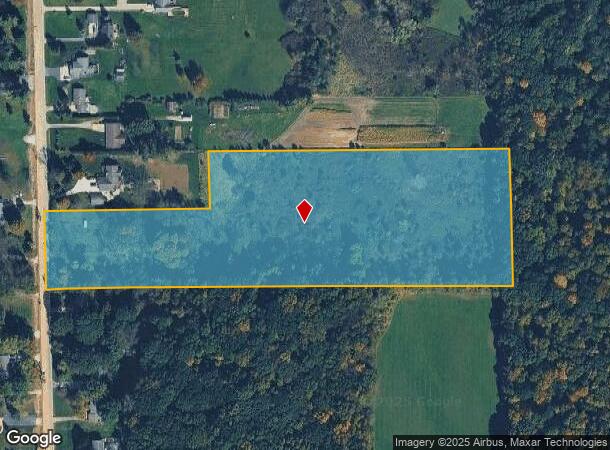
12253 Jennings Rd, Linden, MI 48451

NEARBY LISTINGS FOR SALE OR LEASE
Property Detail
12253 Jennings Rd
06-10-100-018
A PARCEL OF LAND BEG S 1 DEG 25 MIN 30 SEC E 2453 FT FROM NW COR OF SEC TH N 89 DEG 17 MIN E 475.48 FT TH N 1 DEG 37 MIN 08
Residentialacreage
Genesee
X
Michigan
26049C0426D
10.20 AC
2024
Flint
2025
Detroit
013110
Flint, MI
DEMOGRAPHICS near 12253 Jennings Rd
1 Mile
3 Mile
5 Mile
2024 Total Population
1,305
15,441
40,216
2029 Population
1,275
15,092
39,348
Pop Growth 2024-2029
(2.30%)
(2.26%)
(2.16%)
Average Age
45
43
42
2024 Total Households
528
6,268
16,306
HH Growth 2024-2029
(2.27%)
(2.23%)
(2.20%)
Median Household Inc
$98,161
$97,792
$88,420
Avg Household Size
2.40
2.40
2.40
2024 Avg HH Vehicles
2.00
2.00
2.00
Median Home Value
$283,986
$286,327
$261,526
Median Year Built
1990
1988
1987
Nearby Places
Map Layers
Map Styles
 Street
 Aerial
- Restaurants
- Banks
- Shops
- Fitness
- Groceries
PUBLIC TRANSPORTATION
AIRPORT
Bishop International
DRIVE
WALK
Distance
Bishop International
24 min
10.7 mi
Freight Ports
Port of Toledo
DRIVE
WALK
Distance
Port of Toledo
124 min
103.2 mi
SALE & LEASE HISTORY
LISTING DATE
SALE/LEASE

Jan 20, 2021
For Sale
Nearby Properties
Address
Land Use
TOTAL SIZE
Lot Size
Zoning
Address
Land Use
TOTAL SIZE
Lot Size
Zoning
572,804 SF
39.61 AC
SEVERAL
Address
Land Use
TOTAL SIZE
Lot Size
Zoning
135,840 SF
PUD
Address
Land Use
TOTAL SIZE
Lot Size
Zoning
167,681 SF
20.39 AC
HDR
Address
Land Use
TOTAL SIZE
Lot Size
Zoning
176,132 SF
27.71 AC
R-M
Address
Land Use
TOTAL SIZE
Lot Size
Zoning
3,380 SF
152.79 AC
R-5
Address
Land Use
TOTAL SIZE
Lot Size
Zoning
89,158 SF
7.87 AC
C-3
Address
Land Use
TOTAL SIZE
Lot Size
Zoning
104,867 SF
PERSONA
Address
Land Use
TOTAL SIZE
Lot Size
Zoning
754 SF
15.74 AC
PUD
Address
Land Use
TOTAL SIZE
Lot Size
Zoning
3,558 SF
10.01 AC
AG
Address
Land Use
TOTAL SIZE
Lot Size
Zoning
53,951 SF
8.08 AC
M-1
Address
Land Use
TOTAL SIZE
Lot Size
Zoning
14,784 SF
0.22 AC
Address
Land Use
TOTAL SIZE
Lot Size
Zoning
17.96 AC
PUD
Address
Land Use
TOTAL SIZE
Lot Size
Zoning
72,416 SF
14.26 AC
M-1
Address
Land Use
TOTAL SIZE
Lot Size
Zoning
Address
Land Use
TOTAL SIZE
Lot Size
Zoning
26,796 SF
160 AC
R-1
Address
Land Use
TOTAL SIZE
Lot Size
Zoning
1.17 AC
C-2
Address
Land Use
TOTAL SIZE
Lot Size
Zoning
24,134 SF
3.11 AC
GBD
Address
Land Use
TOTAL SIZE
Lot Size
Zoning
32,605 SF
8.10 AC
GBD
Address
Land Use
TOTAL SIZE
Lot Size
Zoning
37,344 SF
5.94 AC
SEVERAL
Address
Land Use
TOTAL SIZE
Lot Size
Zoning
1,860 SF
13.30 AC
R-MH
Address
Land Use
TOTAL SIZE
Lot Size
Zoning
13,950 SF
1.11 AC
GBD
Address
Land Use
TOTAL SIZE
Lot Size
Zoning
28.12 AC
R-MH
Address
Land Use
TOTAL SIZE
Lot Size
Zoning
37,288 SF
6.59 AC
C-3
Address
Land Use
TOTAL SIZE
Lot Size
Zoning
56,406 SF
7.15 AC
M-1
Address
Land Use
TOTAL SIZE
Lot Size
Zoning
31,768 SF
3.26 AC
M-2
Address
Land Use
TOTAL SIZE
Lot Size
Zoning
40,500 SF
4.74 AC
C-3
Address
Land Use
TOTAL SIZE
Lot Size
Zoning
10,994 SF
1.62 AC
OSD
Address
Land Use
TOTAL SIZE
Lot Size
Zoning
1,000 SF
3.71 AC
R-MH
Address
Land Use
TOTAL SIZE
Lot Size
Zoning
63,098 SF
9.06 AC
M-2
Address
Land Use
TOTAL SIZE
Lot Size
Zoning
21,784 SF
1.79 AC
OS
The World's #1 Commercial Real Estate Marketplace
Connect with us
© 2025 CoStar Group
The information above has been obtained from sources believed reliable. While we do not doubt its accuracy we have not verified it and make no guarantee, warranty or representation about it. It is your responsibility to independently confirm its accuracy and completeness. Any projections, opinions, assumptions, or estimates used are for example only and do not represent the current or future performance of the property. The value of this transaction to you depends on tax and other factors which should be evaluated by your tax, financial, and legal advisors. You and your advisors should conduct a careful, independent investigation of the property to determine to your satisfaction the suitability of the property for your needs.