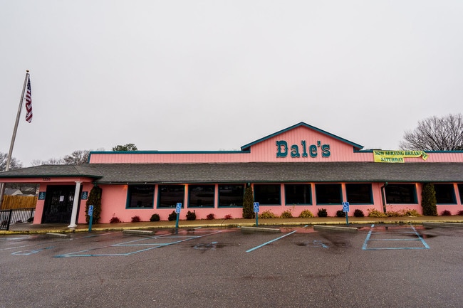
Property Record
1226 Main St, Southaven, MS 38671


NEARBY LISTINGS FOR SALE OR LEASE
Property Detail
1226 Main St
Memphis, TN-MS-AR
Southaven Inc
1086140000000500
14-1-8 SOUTHAVEN INC
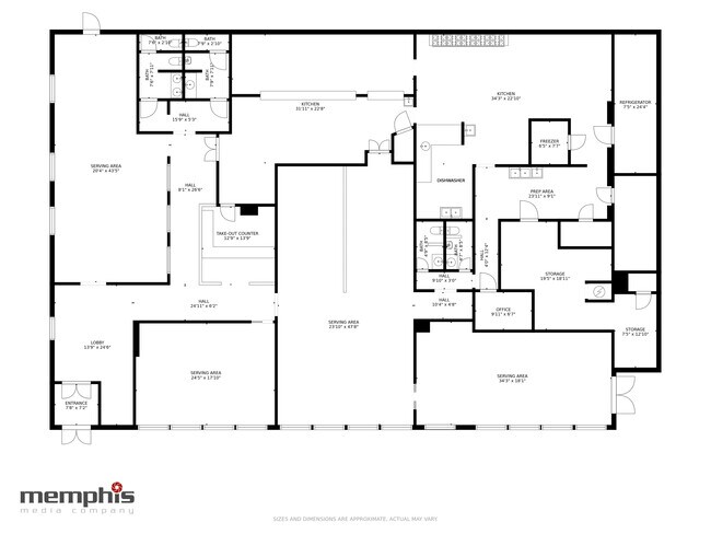
Restaurantbuilding
DeSoto
X
Mississippi
47157C0560F
5
2024
0.75 AC
2024
Southaven-Horn Lake
070411
Memphis
7,342 SF
DEMOGRAPHICS near 1226 Main St
1 Mile
3 Mile
5 Mile
2024 Total Population
8,556
56,679
138,021
2029 Population
8,909
58,875
143,921
Pop Growth 2024-2029
+ 4.13%
+ 3.87%
+ 4.27%
Average Age
39
38
38
2024 Total Households
3,166
21,616
52,532
HH Growth 2024-2029
+ 4.23%
+ 3.84%
+ 4.33%
Median Household Inc
$48,473
$44,805
$46,205
Avg Household Size
2.60
2.60
2.60
2024 Avg HH Vehicles
2.00
2.00
2.00
Median Home Value
$121,802
$121,498
$134,703
Median Year Built
1967
1973
1976
Nearby Places
Map Layers
Map Styles
 Street
 Aerial
- Restaurants
- Banks
- Shops
- Fitness
- Groceries
PUBLIC TRANSPORTATION
AIRPORT
Memphis International
DRIVE
WALK
Distance
Memphis International
12 min
6.5 mi
SALE & LEASE HISTORY
LISTING DATE
SALE/LEASE

Nov 11, 2019
For Sale
Nearby Properties
Address
Land Use
TOTAL SIZE
Lot Size
Zoning
Address
Land Use
TOTAL SIZE
Lot Size
Zoning
1,013,319 SF
38.86 AC
EMP
Address
Land Use
TOTAL SIZE
Lot Size
Zoning
732,894 SF
79.73 AC
WD
Address
Land Use
TOTAL SIZE
Lot Size
Zoning
1,009,363 SF
78.56 AC
EMP
Address
Land Use
TOTAL SIZE
Lot Size
Zoning
853,440 SF
39.22 AC
EMP
Address
Land Use
TOTAL SIZE
Lot Size
Zoning
321.59 AC
R-8
Address
Land Use
TOTAL SIZE
Lot Size
Zoning
144,078 SF
17.93 AC
RU-3
Address
Land Use
TOTAL SIZE
Lot Size
Zoning
14,075 SF
9.36 AC
RU-3
Address
Land Use
TOTAL SIZE
Lot Size
Zoning
63,842 SF
11 AC
R-6
Address
Land Use
TOTAL SIZE
Lot Size
Zoning
432,700 SF
28.16 AC
EMP
Address
Land Use
TOTAL SIZE
Lot Size
Zoning
1,040,736 SF
57.67 AC
M-1
Address
Land Use
TOTAL SIZE
Lot Size
Zoning
188,404 SF
59.17 AC
R-8
Address
Land Use
TOTAL SIZE
Lot Size
Zoning
165,227 SF
25.12 AC
RU-3
Address
Land Use
TOTAL SIZE
Lot Size
Zoning
43,476 SF
4.62 AC
CMU-3
Address
Land Use
TOTAL SIZE
Lot Size
Zoning
61,164 SF
36.95 AC
RU-3
Address
Land Use
TOTAL SIZE
Lot Size
Zoning
811,203 SF
47.71 AC
M-1
Address
Land Use
TOTAL SIZE
Lot Size
Zoning
230,103 SF
22.07 AC
CMU-2
Address
Land Use
TOTAL SIZE
Lot Size
Zoning
226,438 SF
19.52 AC
C-1
Address
Land Use
TOTAL SIZE
Lot Size
Zoning
39.98 AC
PUD
Address
Land Use
TOTAL SIZE
Lot Size
Zoning
79,658 SF
7 AC
RU-3
Address
Land Use
TOTAL SIZE
Lot Size
Zoning
741,634 SF
34.89 AC
PBP
Address
Land Use
TOTAL SIZE
Lot Size
Zoning
79,340 SF
7 AC
RU-3
Address
Land Use
TOTAL SIZE
Lot Size
Zoning
779,780 SF
46.22 AC
PBP
Address
Land Use
TOTAL SIZE
Lot Size
Zoning
111,541 SF
8.88 AC
R-8
Address
Land Use
TOTAL SIZE
Lot Size
Zoning
23,416 SF
5.81 AC
RU-3
Address
Land Use
TOTAL SIZE
Lot Size
Zoning
18,228 SF
6.17 AC
CMU-1
Address
Land Use
TOTAL SIZE
Lot Size
Zoning
611,307 SF
29.51 AC
PBP
Address
Land Use
TOTAL SIZE
Lot Size
Zoning
703,642 SF
37.11 AC
PBP
Address
Land Use
TOTAL SIZE
Lot Size
Zoning
167,607 SF
5.52 AC
CMU-2
Address
Land Use
TOTAL SIZE
Lot Size
Zoning
48,171 SF
6.97 AC
R-10
Address
Land Use
TOTAL SIZE
Lot Size
Zoning
618,927 SF
28.71 AC
PBP
The World's #1 Commercial Real Estate Marketplace
Connect with us
© 2025 CoStar Group
The information above has been obtained from sources believed reliable. While we do not doubt its accuracy we have not verified it and make no guarantee, warranty or representation about it. It is your responsibility to independently confirm its accuracy and completeness. Any projections, opinions, assumptions, or estimates used are for example only and do not represent the current or future performance of the property. The value of this transaction to you depends on tax and other factors which should be evaluated by your tax, financial, and legal advisors. You and your advisors should conduct a careful, independent investigation of the property to determine to your satisfaction the suitability of the property for your needs.