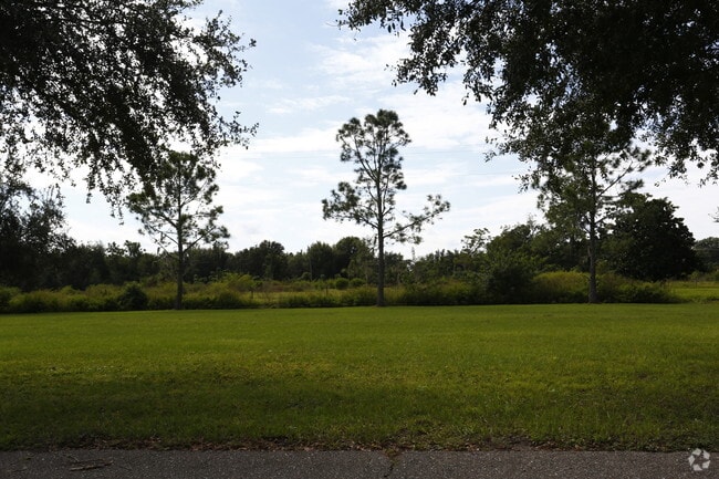
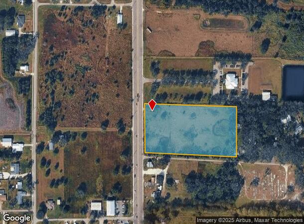
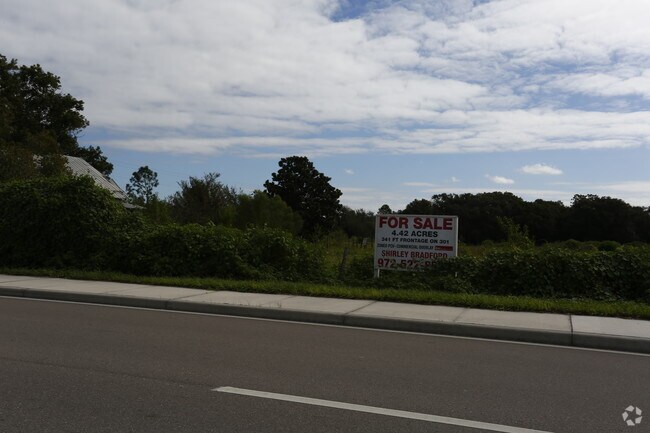
Property Record
12265 Us Highway 301 N, Parrish, FL 34219
NEARBY LISTINGS FOR SALE OR LEASE
Property Detail
12265 Us Highway 301 N
4276-0000-2
N1/2 OF S1/2 OF SW1/4 OF NE1/4; DB 323 P 251 FOR SR 43 R/W DESC AS FOLLOWS: THAT PT OF: N1/2 OF S1/2 OF SW1/4 OF NE1/4 SEC 29, TWN 33S, RNG 19E LYING WITHIN 40 FT
Commercialacreage
Manatee
X
Florida
12081C0183F
4.70 AC
2023
Manatee
2025
Tampa/St Petersburg
001913
North Port-Bradenton-Sarasota, FL
1,073 SF
DEMOGRAPHICS near 12265 Us Highway 301 N
1 mile
3 mile
5 mile
2024 Total Population
1,869
19,635
45,707
2029 Population
2,227
23,128
53,971
Pop Growth 2024-2029
+ 19.15%
+ 17.79%
+ 18.08%
Average Age
40
43
46
2024 Total Households
637
7,164
17,723
HH Growth 2024-2029
+ 18.21%
+ 16.78%
+ 17.15%
Median Household Inc
$112,394
$104,207
$90,329
Avg Household Size
2.80
2.70
2.50
2024 Avg HH Vehicles
2.00
2.00
2.00
Median Home Value
$367,666
$322,852
$328,842
Median Year Built
2010
2008
2006
Nearby Places
Map Layers
Map Styles
 Street
 Aerial
Transit
 Traffic
 Biking
Places
Listings with unknown addresses are not visible on the map
- Restaurants
- Banks
- Shops
- Fitness
- Groceries
PUBLIC TRANSPORTATION
AIRPORT
Sarasota/Bradenton International
Drive
Walk
Distance
Sarasota/Bradenton International
37 min
20.1 mi
St Pete-Clearwater International
Drive
Walk
Distance
St Pete-Clearwater International
57 min
40.1 mi
Tampa International
Drive
Walk
Distance
Tampa International
62 min
42.7 mi
Freight Ports
Port Manatee
Drive
Walk
Distance
Port Manatee
19 min
11.2 mi
Nearby Properties
Address
Land Use
TOTAL SIZE
Lot Size
Zoning
Address
Land Use
TOTAL SIZE
Lot Size
Zoning
16,661 SF
132.10 AC
RSMH-6
Address
Land Use
TOTAL SIZE
Lot Size
Zoning
137.34 AC
Address
Land Use
TOTAL SIZE
Lot Size
Zoning
47.43 AC
Address
Land Use
TOTAL SIZE
Lot Size
Zoning
Address
Land Use
TOTAL SIZE
Lot Size
Zoning
19,260 SF
140.65 AC
A GENERAL
Address
Land Use
TOTAL SIZE
Lot Size
Zoning
58,569 SF
19.67 AC
A GENERAL
Address
Land Use
TOTAL SIZE
Lot Size
Zoning
66,063 SF
9.24 AC
PD-C
Address
Land Use
TOTAL SIZE
Lot Size
Zoning
158.58 AC
Address
Land Use
TOTAL SIZE
Lot Size
Zoning
43,464 SF
14.47 AC
VIL VILLAG
Address
Land Use
TOTAL SIZE
Lot Size
Zoning
161,245 SF
12.11 AC
PD-MU
Address
Land Use
TOTAL SIZE
Lot Size
Zoning
43.81 AC
Address
Land Use
TOTAL SIZE
Lot Size
Zoning
50,580 SF
5.97 AC
Address
Land Use
TOTAL SIZE
Lot Size
Zoning
53,851 SF
6.32 AC
Address
Land Use
TOTAL SIZE
Lot Size
Zoning
30,101 SF
13.44 AC
PD-C
Address
Land Use
TOTAL SIZE
Lot Size
Zoning
76.98 AC
Address
Land Use
TOTAL SIZE
Lot Size
Zoning
36,700 SF
17 AC
A-1 SUBURB
Address
Land Use
TOTAL SIZE
Lot Size
Zoning
109.06 AC
Address
Land Use
TOTAL SIZE
Lot Size
Zoning
63,916 SF
1.53 AC
PD-MU
Address
Land Use
TOTAL SIZE
Lot Size
Zoning
3.11 AC
Address
Land Use
TOTAL SIZE
Lot Size
Zoning
4.07 AC
Address
Land Use
TOTAL SIZE
Lot Size
Zoning
13.36 AC
Address
Land Use
TOTAL SIZE
Lot Size
Zoning
53,448 SF
3 AC
PD-C
Address
Land Use
TOTAL SIZE
Lot Size
Zoning
86.71 AC
Address
Land Use
TOTAL SIZE
Lot Size
Zoning
25,842 SF
3.92 AC
Address
Land Use
TOTAL SIZE
Lot Size
Zoning
9,806 SF
4.04 AC
VIL VILLAG
Address
Land Use
TOTAL SIZE
Lot Size
Zoning
17,677 SF
9.52 AC
A-1 SUBURB
Address
Land Use
TOTAL SIZE
Lot Size
Zoning
113.80 AC
Address
Land Use
TOTAL SIZE
Lot Size
Zoning
4,200 SF
0.13 AC
AM_R-2
Address
Land Use
TOTAL SIZE
Lot Size
Zoning
293,048 SF
42.24 AC
A-1 SUBURB
Address
Land Use
TOTAL SIZE
Lot Size
Zoning
10,303 SF
1.26 AC
PD-MU
The World's #1 Commercial Real Estate Marketplace
Connect with us
© 2026 CoStar Group
The information above has been obtained from sources believed reliable. While we do not doubt its accuracy we have not verified it and make no guarantee, warranty or representation about it. It is your responsibility to independently confirm its accuracy and completeness. Any projections, opinions, assumptions, or estimates used are for example only and do not represent the current or future performance of the property. The value of this transaction to you depends on tax and other factors which should be evaluated by your tax, financial, and legal advisors. You and your advisors should conduct a careful, independent investigation of the property to determine to your satisfaction the suitability of the property for your needs.