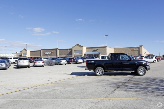
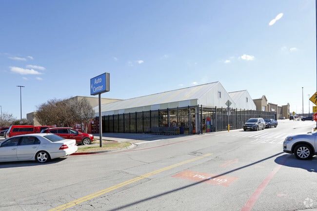
Property Record
1228 N Highway 377 Dr, Roanoke, TX 76262

Property Detail
1228 N Highway 377 Dr
Dallas-Fort Worth-Arlington, TX
HOMESTEAD RETAIL ADDN BLK 7 LOT 11B
R530070
Denton
Commercialnec
Texas
B and X Area of moderate flood hazard, usually the area between the limits of the 100-year and 500-year floods.
11b
2024
19.33 AC
2025
Trophy/Roanoke/W'Lake
020311
Dallas/Ft Worth
204,813 SF
NEARBY LISTINGS FOR SALE OR LEASE
DEMOGRAPHICS near 1228 N Highway 377 Dr
1 mile
3 mile
5 mile
2025 Total Population
10,029
31,843
84,841
2030 Population
11,289
35,857
93,412
Pop Growth 2025-2030
+ 12.56%
+ 12.61%
+ 10.10%
Average Age
38
39
38
2025 Total Households
3,721
11,102
28,498
HH Growth 2025-2030
+ 13.06%
+ 12.99%
+ 10.51%
Median Household Inc
$96,775
$153,880
$151,898
Avg Household Size
2.70
2.90
3.00
2025 Avg HH Vehicles
2.00
2.00
2.00
Median Home Value
$574,147
$668,027
$647,496
Median Year Built
2001
2008
2008
Nearby Places
Map Layers
Map Styles
 Street
 Aerial
Transit
 Traffic
 Biking
Places
Listings with unknown addresses are not visible on the map
- Restaurants
- Banks
- Shops
- Fitness
- Groceries
PUBLIC TRANSPORTATION
AIRPORT
Dallas-Fort Worth International
Drive
Walk
Distance
Dallas-Fort Worth International
22 min
16.5 mi
Dallas Love Field
Drive
Walk
Distance
Dallas Love Field
40 min
30.2 mi
Nearby Properties
Address
Land Use
TOTAL SIZE
Lot Size
Zoning
Address
Land Use
TOTAL SIZE
Lot Size
Zoning
1,213,448 SF
59.10 AC
Address
Land Use
TOTAL SIZE
Lot Size
Zoning
1,315,600 SF
106.95 AC
Address
Land Use
TOTAL SIZE
Lot Size
Zoning
413,316 SF
22.96 AC
Address
Land Use
TOTAL SIZE
Lot Size
Zoning
470,000 SF
11.91 AC
Address
Land Use
TOTAL SIZE
Lot Size
Zoning
495,170 SF
14.02 AC
Address
Land Use
TOTAL SIZE
Lot Size
Zoning
1,217,200 SF
56.35 AC
Address
Land Use
TOTAL SIZE
Lot Size
Zoning
455,935 SF
57.27 AC
Address
Land Use
TOTAL SIZE
Lot Size
Zoning
819,327 SF
143.07 AC
Address
Land Use
TOTAL SIZE
Lot Size
Zoning
261,836 SF
51.66 AC
Address
Land Use
TOTAL SIZE
Lot Size
Zoning
254,250 SF
6.21 AC
Address
Land Use
TOTAL SIZE
Lot Size
Zoning
1,603,686 SF
81.43 AC
Address
Land Use
TOTAL SIZE
Lot Size
Zoning
1,420,661 SF
40.78 AC
Address
Land Use
TOTAL SIZE
Lot Size
Zoning
301,718 SF
18.12 AC
10 G
Address
Land Use
TOTAL SIZE
Lot Size
Zoning
1,010,969 SF
76.73 AC
Address
Land Use
TOTAL SIZE
Lot Size
Zoning
291,475 SF
2.63 AC
Address
Land Use
TOTAL SIZE
Lot Size
Zoning
860,100 SF
40.02 AC
Address
Land Use
TOTAL SIZE
Lot Size
Zoning
371,473 SF
82.85 AC
Address
Land Use
TOTAL SIZE
Lot Size
Zoning
667,152 SF
34.50 AC
Address
Land Use
TOTAL SIZE
Lot Size
Zoning
756,180 SF
39.10 AC
Address
Land Use
TOTAL SIZE
Lot Size
Zoning
569,365 SF
68.61 AC
Address
Land Use
TOTAL SIZE
Lot Size
Zoning
607,962 SF
36.39 AC
Address
Land Use
TOTAL SIZE
Lot Size
Zoning
611,932 SF
30.05 AC
Address
Land Use
TOTAL SIZE
Lot Size
Zoning
490,627 SF
27.53 AC
Address
Land Use
TOTAL SIZE
Lot Size
Zoning
539,775 SF
28 AC
Address
Land Use
TOTAL SIZE
Lot Size
Zoning
557,161 SF
29.73 AC
Address
Land Use
TOTAL SIZE
Lot Size
Zoning
505,134 SF
25.40 AC
Address
Land Use
TOTAL SIZE
Lot Size
Zoning
461,930 SF
30.31 AC
Address
Land Use
TOTAL SIZE
Lot Size
Zoning
464,226 SF
18.69 AC
Address
Land Use
TOTAL SIZE
Lot Size
Zoning
450,000 SF
22.20 AC
Address
Land Use
TOTAL SIZE
Lot Size
Zoning
263,334 SF
38.93 AC
The World's #1 Commercial Real Estate Marketplace
Connect with us
© 2026 CoStar Group
The information above has been obtained from sources believed reliable. While we do not doubt its accuracy we have not verified it and make no guarantee, warranty or representation about it. It is your responsibility to independently confirm its accuracy and completeness. Any projections, opinions, assumptions, or estimates used are for example only and do not represent the current or future performance of the property. The value of this transaction to you depends on tax and other factors which should be evaluated by your tax, financial, and legal advisors. You and your advisors should conduct a careful, independent investigation of the property to determine to your satisfaction the suitability of the property for your needs.