Property Record
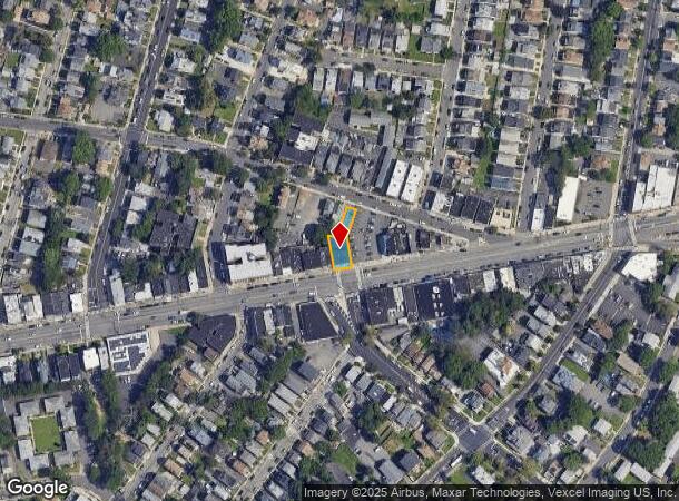
1228 Springfield Ave, Irvington, NJ 07111


NEARBY LISTINGS FOR SALE OR LEASE
Property Detail
1228 Springfield Ave
09-00030-0000-00007
50 X IRREG.
Storemultistory
Essex
X
New Jersey
34013C0151F
7
2023
0.10 AC
2025
Urban Essex
012200
Northern New Jersey
8,000 SF
Newark, NJ-PA
DEMOGRAPHICS near 1228 Springfield Ave
1 Mile
3 Mile
5 Mile
2024 Total Population
59,556
341,239
772,421
2029 Population
57,827
332,464
753,627
Pop Growth 2024-2029
(2.90%)
(2.57%)
(2.43%)
Average Age
38
38
38
2024 Total Households
21,434
121,409
279,121
HH Growth 2024-2029
(3.10%)
(2.69%)
(2.49%)
Median Household Inc
$56,946
$59,159
$60,796
Avg Household Size
2.70
2.70
2.60
2024 Avg HH Vehicles
1.00
1.00
1.00
Median Home Value
$265,462
$363,033
$387,871
Median Year Built
1953
1955
1958
Nearby Places
Map Layers
Map Styles
 Street
 Aerial
- Restaurants
- Banks
- Shops
- Fitness
- Groceries
PUBLIC TRANSPORTATION
COMMUTER RAIL
South Orange (Morris & Essex Gladstone Branch - NJ Transit Commuter Rail (NJ Transit), Morris & Essex Morristown Line - NJ Transit Commuter Rail (NJ Transit))
DRIVE
WALK
Distance
South Orange (Morris & Essex Gladstone Branch - NJ Transit Commuter Rail (NJ Transit), Morris & Essex Morristown Line - NJ Transit Commuter Rail (NJ Transit))
7 min
2.7 mi
Maplewood (Morris & Essex Gladstone Branch - NJ Transit Commuter Rail (NJ Transit), Morris & Essex Morristown Line - NJ Transit Commuter Rail (NJ Transit))
DRIVE
WALK
Distance
Maplewood (Morris & Essex Gladstone Branch - NJ Transit Commuter Rail (NJ Transit), Morris & Essex Morristown Line - NJ Transit Commuter Rail (NJ Transit))
8 min
2.7 mi
AIRPORT
Newark Liberty International
DRIVE
WALK
Distance
Newark Liberty International
11 min
6.4 mi
LaGuardia
DRIVE
WALK
Distance
LaGuardia
46 min
25.6 mi
John F Kennedy International
DRIVE
WALK
Distance
John F Kennedy International
57 min
33.8 mi
Freight Ports
Maher Terminal
DRIVE
WALK
Distance
Maher Terminal
15 min
7.5 mi
SALE & LEASE HISTORY
LISTING DATE
SALE/LEASE

Sep 24, 2016
For Sale
Oct 28, 2024
For Lease
Jun 12, 2017
For Lease
Dec 27, 2017
For Lease
Nearby Properties
Address
Land Use
TOTAL SIZE
Lot Size
Zoning
Address
Land Use
TOTAL SIZE
Lot Size
Zoning
57.23 AC
U
Address
Land Use
TOTAL SIZE
Lot Size
Zoning
926,120 SF
11.46 AC
Address
Land Use
TOTAL SIZE
Lot Size
Zoning
0.61 AC
Address
Land Use
TOTAL SIZE
Lot Size
Zoning
31.86 AC
Address
Land Use
TOTAL SIZE
Lot Size
Zoning
231 AC
R1-7
Address
Land Use
TOTAL SIZE
Lot Size
Zoning
219 AC
R1-7
Address
Land Use
TOTAL SIZE
Lot Size
Zoning
1,136 SF
6.51 AC
Address
Land Use
TOTAL SIZE
Lot Size
Zoning
32.27 AC
CCRC
Address
Land Use
TOTAL SIZE
Lot Size
Zoning
9.77 AC
Address
Land Use
TOTAL SIZE
Lot Size
Zoning
4.82 AC
Address
Land Use
TOTAL SIZE
Lot Size
Zoning
Address
Land Use
TOTAL SIZE
Lot Size
Zoning
0.23 AC
REDV
Address
Land Use
TOTAL SIZE
Lot Size
Zoning
4.60 AC
PRD
Address
Land Use
TOTAL SIZE
Lot Size
Zoning
13.80 AC
R1-5
Address
Land Use
TOTAL SIZE
Lot Size
Zoning
Address
Land Use
TOTAL SIZE
Lot Size
Zoning
16.14 AC
Address
Land Use
TOTAL SIZE
Lot Size
Zoning
310.45 AC
Address
Land Use
TOTAL SIZE
Lot Size
Zoning
7.03 AC
Address
Land Use
TOTAL SIZE
Lot Size
Zoning
Address
Land Use
TOTAL SIZE
Lot Size
Zoning
3.28 AC
Address
Land Use
TOTAL SIZE
Lot Size
Zoning
2.06 AC
Address
Land Use
TOTAL SIZE
Lot Size
Zoning
19,498 SF
0.67 AC
FVRZ
Address
Land Use
TOTAL SIZE
Lot Size
Zoning
Address
Land Use
TOTAL SIZE
Lot Size
Zoning
295,160 SF
3.72 AC
Address
Land Use
TOTAL SIZE
Lot Size
Zoning
Address
Land Use
TOTAL SIZE
Lot Size
Zoning
6.05 AC
RO
Address
Land Use
TOTAL SIZE
Lot Size
Zoning
0.01 AC
Address
Land Use
TOTAL SIZE
Lot Size
Zoning
3.64 AC
Address
Land Use
TOTAL SIZE
Lot Size
Zoning
6.57 AC
Address
Land Use
TOTAL SIZE
Lot Size
Zoning
The World's #1 Commercial Real Estate Marketplace
Connect with us
© 2025 CoStar Group
The information above has been obtained from sources believed reliable. While we do not doubt its accuracy we have not verified it and make no guarantee, warranty or representation about it. It is your responsibility to independently confirm its accuracy and completeness. Any projections, opinions, assumptions, or estimates used are for example only and do not represent the current or future performance of the property. The value of this transaction to you depends on tax and other factors which should be evaluated by your tax, financial, and legal advisors. You and your advisors should conduct a careful, independent investigation of the property to determine to your satisfaction the suitability of the property for your needs.