Property Record
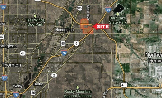
12280 Sable Blvd, Brighton, CO 80601
Property Detail
12280 Sable Blvd
Denver-Aurora-Centennial, CO
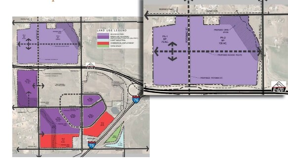
ADAMS CROSSING SUBDIVISION FILING NO 1 LOT 4
1569-31-0-00-010
ADAMS
Farms
Colorado
A Areas with a 1% annual chance of flooding and a 26% chance of flooding over the life of a 30-year mortgage.
4
2024
141.53 AC
2025
Northeast Denver
0085231083
Denver
937,629 SF
NEARBY LISTINGS FOR SALE OR LEASE
-
-
-
-
-
-
No Photo
-
-
View all Brighton listings for sale on LoopNet.com
DEMOGRAPHICS near 12280 Sable Blvd
1 mile
3 mile
5 mile
2024 Total Population
2,905
33,135
89,519
2029 Population
3,057
35,149
94,415
Pop Growth 2024-2029
+ 5.23%
+ 6.08%
+ 5.47%
Average Age
37
35
35
2024 Total Households
934
10,282
29,048
HH Growth 2024-2029
+ 5.46%
+ 6.18%
+ 5.57%
Median Household Inc
$128,553
$122,822
$107,687
Avg Household Size
3.10
3.20
3.00
2024 Avg HH Vehicles
3.00
2.00
2.00
Median Home Value
$583,705
$474,419
$469,828
Median Year Built
2005
2008
2006
Nearby Places
Map Layers
Map Styles
 Street
 Aerial
Transit
 Traffic
 Biking
Places
Listings with unknown addresses are not visible on the map
- Restaurants
- Banks
- Shops
- Fitness
- Groceries
PUBLIC TRANSPORTATION
COMMUTER RAIL
Northglenn - 112Th Station Track 2 (Union Station to Eastlake & 124th Station - Regional Transportation District)
Drive
Walk
Distance
Northglenn - 112Th Station Track 2 (Union Station to Eastlake & 124th Station - Regional Transportation District)
15 min
8.6 mi
Thornton Crossroads - 104Th Station Track 1 (Union Station to Eastlake & 124th Station - Regional Transportation District)
Drive
Walk
Distance
Thornton Crossroads - 104Th Station Track 1 (Union Station to Eastlake & 124th Station - Regional Transportation District)
14 min
8.7 mi
AIRPORT
Denver International
Drive
Walk
Distance
Denver International
20 min
14.6 mi
Freight Ports
Tulsa Port Of Catoosa
Drive
Walk
Distance
Tulsa Port Of Catoosa
727 min
708.8 mi
SALE & LEASE HISTORY
LISTING DATE
SALE/LEASE

Sep 24, 2016
For Sale
Feb 21, 2018
For Sale
Nearby Properties
Address
Land Use
TOTAL SIZE
Lot Size
Zoning
Address
Land Use
TOTAL SIZE
Lot Size
Zoning
279,946 SF
11.55 AC
Address
Land Use
TOTAL SIZE
Lot Size
Zoning
358,386 SF
76.08 AC
Address
Land Use
TOTAL SIZE
Lot Size
Zoning
121,103 SF
13.47 AC
Address
Land Use
TOTAL SIZE
Lot Size
Zoning
231,205 SF
10.46 AC
Address
Land Use
TOTAL SIZE
Lot Size
Zoning
Address
Land Use
TOTAL SIZE
Lot Size
Zoning
174.45 AC
Address
Land Use
TOTAL SIZE
Lot Size
Zoning
207,682 SF
7.16 AC
Address
Land Use
TOTAL SIZE
Lot Size
Zoning
64,715 SF
10.38 AC
Address
Land Use
TOTAL SIZE
Lot Size
Zoning
70,573 SF
6.42 AC
Address
Land Use
TOTAL SIZE
Lot Size
Zoning
122,399 SF
14.29 AC
Address
Land Use
TOTAL SIZE
Lot Size
Zoning
168,506 SF
21.67 AC
Address
Land Use
TOTAL SIZE
Lot Size
Zoning
55,810 SF
14.52 AC
Address
Land Use
TOTAL SIZE
Lot Size
Zoning
19,341 SF
74.46 AC
Address
Land Use
TOTAL SIZE
Lot Size
Zoning
133,072 SF
12.32 AC
Address
Land Use
TOTAL SIZE
Lot Size
Zoning
75,398 SF
8.82 AC
I2
Address
Land Use
TOTAL SIZE
Lot Size
Zoning
102,069 SF
3.26 AC
Address
Land Use
TOTAL SIZE
Lot Size
Zoning
104,395 SF
10.43 AC
Address
Land Use
TOTAL SIZE
Lot Size
Zoning
42,177 SF
17.73 AC
A3
Address
Land Use
TOTAL SIZE
Lot Size
Zoning
24.65 AC
A3
Address
Land Use
TOTAL SIZE
Lot Size
Zoning
44,077 SF
13.02 AC
Address
Land Use
TOTAL SIZE
Lot Size
Zoning
90,208 SF
7.19 AC
Address
Land Use
TOTAL SIZE
Lot Size
Zoning
108.96 AC
A3
Address
Land Use
TOTAL SIZE
Lot Size
Zoning
61,793 SF
9.28 AC
Address
Land Use
TOTAL SIZE
Lot Size
Zoning
Address
Land Use
TOTAL SIZE
Lot Size
Zoning
24.92 AC
I2
Address
Land Use
TOTAL SIZE
Lot Size
Zoning
12,842 SF
2.17 AC
Address
Land Use
TOTAL SIZE
Lot Size
Zoning
26,010 SF
8.68 AC
Address
Land Use
TOTAL SIZE
Lot Size
Zoning
33,926 SF
3.85 AC
Address
Land Use
TOTAL SIZE
Lot Size
Zoning
34,150 SF
3.64 AC
Address
Land Use
TOTAL SIZE
Lot Size
Zoning
17,160 SF
2.05 AC
The World's #1 Commercial Real Estate Marketplace
Connect with us
© 2026 CoStar Group
The information above has been obtained from sources believed reliable. While we do not doubt its accuracy we have not verified it and make no guarantee, warranty or representation about it. It is your responsibility to independently confirm its accuracy and completeness. Any projections, opinions, assumptions, or estimates used are for example only and do not represent the current or future performance of the property. The value of this transaction to you depends on tax and other factors which should be evaluated by your tax, financial, and legal advisors. You and your advisors should conduct a careful, independent investigation of the property to determine to your satisfaction the suitability of the property for your needs.