Property Record
12290 Green Meadow Dr, Columbia, MD 21044


Save to a Folder
{{folder.Name}}
{{folder.ListingIds.length}} Properties
{{folder.ListingIds.length}} Property
Create a New Folder
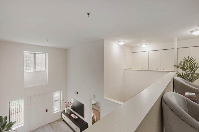
Property Detail
12290 Green Meadow Dr
15-068280
PAR L 4.527 A 12290 GREEN MEADOW DR VILL HKY RIDGE S 3 AR 4
Apartment
Howard
NT
Maryland
B and X Area of moderate flood hazard, usually the area between the limits of the 100-year and 500-year floods.
l
2025
4.52 AC
2025
Hickory Ridge
605601
Baltimore
140,191 SF
Baltimore-Columbia-Towson, MD
NEARBY LISTINGS FOR SALE OR LEASE
-
-
View all Columbia listings for sale on LoopNet.com
DEMOGRAPHICS near 12290 Green Meadow Dr
1 mile
3 mile
5 mile
2025 Total Population
13,072
63,011
145,770
2030 Population
13,232
63,858
147,449
Pop Growth 2025-2030
+ 1.22%
+ 1.34%
+ 1.15%
Average Age
41
41
41
2025 Total Households
5,187
24,385
54,651
HH Growth 2025-2030
+ 1.27%
+ 1.45%
+ 1.19%
Median Household Inc
$120,338
$135,351
$141,891
Avg Household Size
2.50
2.50
2.60
2025 Avg HH Vehicles
2.00
2.00
2.00
Median Home Value
$573,371
$634,354
$617,486
Median Year Built
1981
1983
1984
Nearby Places
Map Layers
Map Styles
 Street
 Aerial
Layers
 Traffic
 Biking
Places
Listings with unknown addresses are not visible on the map
- Restaurants
- Banks
- Shops
- Fitness
- Groceries
PUBLIC TRANSPORTATION
AIRPORT
Baltimore/Washington International Thurgood Marshall
Drive
Walk
Distance
Baltimore/Washington International Thurgood Marshall
30 min
19.1 mi
Ronald Reagan Washington Ntl
Drive
Walk
Distance
Ronald Reagan Washington Ntl
53 min
31.7 mi
Freight Ports
Port of Baltimore
Drive
Walk
Distance
Port of Baltimore
34 min
21.8 mi
Nearby Properties
Address
Land Use
TOTAL SIZE
Lot Size
Zoning
Address
Land Use
TOTAL SIZE
Lot Size
Zoning
454,000 SF
62.33 AC
NT
Address
Land Use
TOTAL SIZE
Lot Size
Zoning
37,584 SF
97.46 AC
POR
Address
Land Use
TOTAL SIZE
Lot Size
Zoning
51,405 SF
29.14 AC
NT
Address
Land Use
TOTAL SIZE
Lot Size
Zoning
47,815 SF
11.76 AC
NT
Address
Land Use
TOTAL SIZE
Lot Size
Zoning
172,360 SF
2.79 AC
NT
Address
Land Use
TOTAL SIZE
Lot Size
Zoning
514,261 SF
3.36 AC
NT
Address
Land Use
TOTAL SIZE
Lot Size
Zoning
218,688 SF
1.11 AC
NT
Address
Land Use
TOTAL SIZE
Lot Size
Zoning
230,401 SF
52.25 AC
NT
Address
Land Use
TOTAL SIZE
Lot Size
Zoning
357,008 SF
1.57 AC
NT
Address
Land Use
TOTAL SIZE
Lot Size
Zoning
137,340 SF
2.80 AC
NT
Address
Land Use
TOTAL SIZE
Lot Size
Zoning
163,814 SF
6.41 AC
NT
Address
Land Use
TOTAL SIZE
Lot Size
Zoning
34,368 SF
54.80 AC
PEC
Address
Land Use
TOTAL SIZE
Lot Size
Zoning
11,244 SF
23.20 AC
NT
Address
Land Use
TOTAL SIZE
Lot Size
Zoning
191,036 SF
4.25 AC
2R0
Address
Land Use
TOTAL SIZE
Lot Size
Zoning
210,772 SF
9.05 AC
NT
Address
Land Use
TOTAL SIZE
Lot Size
Zoning
214,009 SF
8.99 AC
NT
Address
Land Use
TOTAL SIZE
Lot Size
Zoning
243,836 SF
65.29 AC
NT
Address
Land Use
TOTAL SIZE
Lot Size
Zoning
27,423 SF
12.72 AC
NT
Address
Land Use
TOTAL SIZE
Lot Size
Zoning
213,120 SF
1.33 AC
NT
Address
Land Use
TOTAL SIZE
Lot Size
Zoning
17,880 SF
11.40 AC
NT
Address
Land Use
TOTAL SIZE
Lot Size
Zoning
19,253 SF
17.97 AC
RRDEO
Address
Land Use
TOTAL SIZE
Lot Size
Zoning
49,443 SF
27.21 AC
NT
Address
Land Use
TOTAL SIZE
Lot Size
Zoning
218,464 SF
35.31 AC
RSC
Address
Land Use
TOTAL SIZE
Lot Size
Zoning
32,898 SF
10.13 AC
NT
Address
Land Use
TOTAL SIZE
Lot Size
Zoning
208,312 SF
5.85 AC
NT
Address
Land Use
TOTAL SIZE
Lot Size
Zoning
23,139 SF
11 AC
NT
Address
Land Use
TOTAL SIZE
Lot Size
Zoning
27,105 SF
10 AC
NT
Address
Land Use
TOTAL SIZE
Lot Size
Zoning
532,274 SF
2.06 AC
NT
Address
Land Use
TOTAL SIZE
Lot Size
Zoning
24,894 SF
10.42 AC
NT
Address
Land Use
TOTAL SIZE
Lot Size
Zoning
35,709 SF
10.88 AC
NT
The World's #1 Commercial Real Estate Marketplace
Connect with us
© 2026 CoStar Group
The information above has been obtained from sources believed reliable. While we do not doubt its accuracy we have not verified it and make no guarantee, warranty or representation about it. It is your responsibility to independently confirm its accuracy and completeness. Any projections, opinions, assumptions, or estimates used are for example only and do not represent the current or future performance of the property. The value of this transaction to you depends on tax and other factors which should be evaluated by your tax, financial, and legal advisors. You and your advisors should conduct a careful, independent investigation of the property to determine to your satisfaction the suitability of the property for your needs.