Property Record
123 E Olive Ave, Monrovia, CA 91016
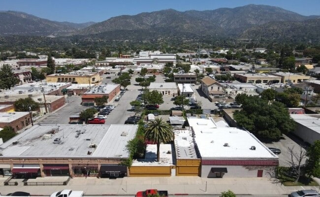


Property Detail
123 E Olive Ave
8516-027-019
MONROVIA LOT 18 BLK P
Storesoffices
Los Angeles
MOPD*
California
B and X Area of moderate flood hazard, usually the area between the limits of the 100-year and 500-year floods.
18
2024
0.18 AC
2025
Upper San Gabriel Valley
431100
Los Angeles
2,821 SF
Los Angeles-Long Beach-Glendale, CA
NEARBY LISTINGS FOR SALE OR LEASE
DEMOGRAPHICS near 123 E Olive Ave
1 mile
3 mile
5 mile
2025 Total Population
25,157
100,197
280,901
2030 Population
24,976
99,517
277,891
Pop Growth 2025-2030
(0.72%)
(0.68%)
(1.07%)
Average Age
41
43
42
2025 Total Households
9,480
34,804
90,133
HH Growth 2025-2030
(0.88%)
(0.83%)
(1.24%)
Median Household Inc
$94,820
$106,574
$99,781
Avg Household Size
2.60
2.80
3.00
2025 Avg HH Vehicles
2.00
2.00
2.00
Median Home Value
$835,313
$963,765
$892,094
Median Year Built
1960
1962
1960
Nearby Places
Map Layers
Map Styles
 Street
 Aerial
Layers
 Traffic
 Biking
Places
Listings with unknown addresses are not visible on the map
- Restaurants
- Banks
- Shops
- Fitness
- Groceries
PUBLIC TRANSPORTATION
TRANSIT/SUBWAY
Monrovia Station (Metro A-Line - Metro - Los Angeles)
Drive
Walk
Distance
Monrovia Station (Metro A-Line - Metro - Los Angeles)
2 min
20 min
1.1 mi
COMMUTER RAIL
El Monte (San Bernardino Line - Southern California Regional Rail Authority (Metrolink))
Drive
Walk
Distance
El Monte (San Bernardino Line - Southern California Regional Rail Authority (Metrolink))
12 min
6.1 mi
Baldwin Park (San Bernardino Line - Southern California Regional Rail Authority (Metrolink))
Drive
Walk
Distance
Baldwin Park (San Bernardino Line - Southern California Regional Rail Authority (Metrolink))
12 min
6.4 mi
AIRPORT
Bob Hope
Drive
Walk
Distance
Bob Hope
33 min
25.8 mi
Ontario International
Drive
Walk
Distance
Ontario International
37 min
28.5 mi
Long Beach (Daugherty Field)
Drive
Walk
Distance
Long Beach (Daugherty Field)
41 min
32.0 mi
Freight Ports
Port of Long Beach
Drive
Walk
Distance
Port of Long Beach
48 min
37.7 mi
SALE & LEASE HISTORY
LISTING DATE
SALE/LEASE

Sep 05, 2025
For Lease
Sep 05, 2025
For Sale
May 08, 2024
For Sale
Nearby Properties
Address
Land Use
TOTAL SIZE
Lot Size
Zoning
Address
Land Use
TOTAL SIZE
Lot Size
Zoning
945,101 SF
38.07 AC
ARC2DH-S1-
Address
Land Use
TOTAL SIZE
Lot Size
Zoning
453,050 SF
17.48 AC
DUH*
Address
Land Use
TOTAL SIZE
Lot Size
Zoning
636,006 SF
27.79 AC
IRM2*
Address
Land Use
TOTAL SIZE
Lot Size
Zoning
165,341 SF
2.70 AC
ARC2YY
Address
Land Use
TOTAL SIZE
Lot Size
Zoning
3.29 AC
DUSP
Address
Land Use
TOTAL SIZE
Lot Size
Zoning
357,639 SF
4.34 AC
DUSP
Address
Land Use
TOTAL SIZE
Lot Size
Zoning
127,085 SF
1.97 AC
MOCG-P/QP*
Address
Land Use
TOTAL SIZE
Lot Size
Zoning
473,624 SF
4.53 AC
DUH*
Address
Land Use
TOTAL SIZE
Lot Size
Zoning
100,253 SF
0.96 AC
DUH*
Address
Land Use
TOTAL SIZE
Lot Size
Zoning
95,530 SF
1.27 AC
MOM*
Address
Land Use
TOTAL SIZE
Lot Size
Zoning
888,572 SF
21.68 AC
IRM2*
Address
Land Use
TOTAL SIZE
Lot Size
Zoning
68,417 SF
0.78 AC
ARC2H*
Address
Land Use
TOTAL SIZE
Lot Size
Zoning
206,254 SF
0.77 AC
Address
Land Use
TOTAL SIZE
Lot Size
Zoning
635,556 SF
11.05 AC
ARC2
Address
Land Use
TOTAL SIZE
Lot Size
Zoning
241,189 SF
0.90 AC
ARC2*
Address
Land Use
TOTAL SIZE
Lot Size
Zoning
108,340 SF
8.99 AC
DUH
Address
Land Use
TOTAL SIZE
Lot Size
Zoning
24,015 SF
3.23 AC
ARCPD1*
Address
Land Use
TOTAL SIZE
Lot Size
Zoning
98,113 SF
6.07 AC
MOCG*
Address
Land Use
TOTAL SIZE
Lot Size
Zoning
465,988 SF
8.03 AC
MOM*
Address
Land Use
TOTAL SIZE
Lot Size
Zoning
134,018 SF
5.97 AC
MORH*
Address
Land Use
TOTAL SIZE
Lot Size
Zoning
53,168 SF
2.15 AC
DUR4*
Address
Land Use
TOTAL SIZE
Lot Size
Zoning
277,264 SF
18.18 AC
LCA1
Address
Land Use
TOTAL SIZE
Lot Size
Zoning
54,546 SF
1 AC
MOM*
Address
Land Use
TOTAL SIZE
Lot Size
Zoning
220,753 SF
3.75 AC
ARCPD1*
Address
Land Use
TOTAL SIZE
Lot Size
Zoning
12,576 SF
5.60 AC
IRM2*
Address
Land Use
TOTAL SIZE
Lot Size
Zoning
206,254 SF
0.60 AC
Address
Land Use
TOTAL SIZE
Lot Size
Zoning
205,013 SF
2.99 AC
MOP/QP*
Address
Land Use
TOTAL SIZE
Lot Size
Zoning
131,527 SF
3.75 AC
ARCPD1&H*
Address
Land Use
TOTAL SIZE
Lot Size
Zoning
146,165 SF
11.63 AC
DUM1
The World's #1 Commercial Real Estate Marketplace
Connect with us
© 2026 CoStar Group
The information above has been obtained from sources believed reliable. While we do not doubt its accuracy we have not verified it and make no guarantee, warranty or representation about it. It is your responsibility to independently confirm its accuracy and completeness. Any projections, opinions, assumptions, or estimates used are for example only and do not represent the current or future performance of the property. The value of this transaction to you depends on tax and other factors which should be evaluated by your tax, financial, and legal advisors. You and your advisors should conduct a careful, independent investigation of the property to determine to your satisfaction the suitability of the property for your needs.