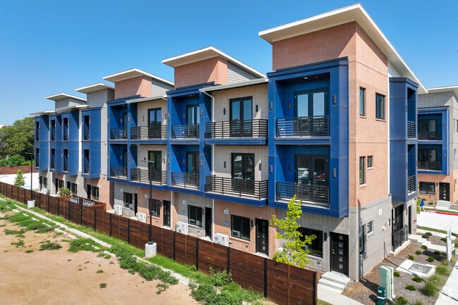
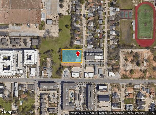
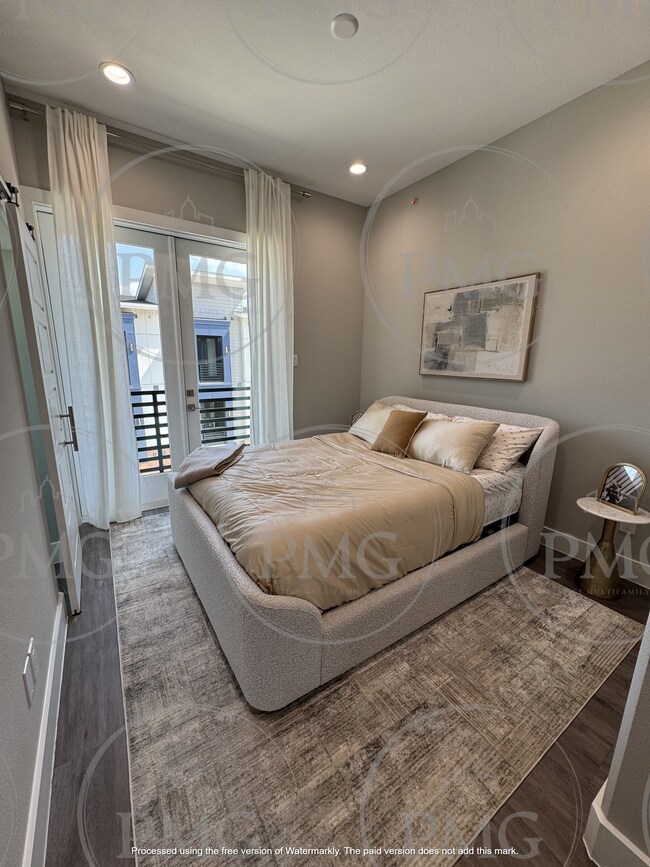
Property Record
123 Merritt St, Fort Worth, TX 76114
NEARBY LISTINGS FOR SALE OR LEASE
Property Detail
123 Merritt St
Dallas-Fort Worth-Arlington, TX
Hassett Gardens Addition
42777010
HASSETT GARDENS ADDITION LOT 145-B-3R
Multifamilydwelling
Tarrant
X
Texas
48439C0170L
145-b
2024
0.98 AC
2025
River District
100700
Dallas/Ft Worth
37,573 SF
DEMOGRAPHICS near 123 Merritt St
1 Mile
3 Mile
5 Mile
2024 Total Population
10,893
93,230
268,162
2029 Population
12,461
104,020
299,508
Pop Growth 2024-2029
+ 14.39%
+ 11.57%
+ 11.69%
Average Age
39
38
37
2024 Total Households
4,439
38,027
105,758
HH Growth 2024-2029
+ 15.12%
+ 12.25%
+ 12.44%
Median Household Inc
$64,668
$61,252
$59,327
Avg Household Size
2.50
2.40
2.40
2024 Avg HH Vehicles
2.00
2.00
2.00
Median Home Value
$298,643
$272,538
$267,192
Median Year Built
1967
1968
1978
Nearby Places
Map Layers
Map Styles
 Street
 Aerial
- Restaurants
- Banks
- Shops
- Fitness
- Groceries
PUBLIC TRANSPORTATION
COMMUTER RAIL
Fort Worth (Heartland Flyer - Amtrak, Texas Eagle - Amtrak)
DRIVE
WALK
Distance
Fort Worth (Heartland Flyer - Amtrak, Texas Eagle - Amtrak)
10 min
5.0 mi
Texas And Pacific (T&P) (Trinity Railway Express - Dallas Area Rapid Transit (DART))
DRIVE
WALK
Distance
Texas And Pacific (T&P) (Trinity Railway Express - Dallas Area Rapid Transit (DART))
11 min
5.2 mi
AIRPORT
Dallas-Fort Worth International
DRIVE
WALK
Distance
Dallas-Fort Worth International
40 min
28.7 mi
Freight Ports
Port of Shreveport
DRIVE
WALK
Distance
Port of Shreveport
257 min
235.3 mi
SALE & LEASE HISTORY
LISTING DATE
SALE/LEASE

May 06, 2025
For Sale
Nearby Properties
Address
Land Use
TOTAL SIZE
Lot Size
Zoning
Address
Land Use
TOTAL SIZE
Lot Size
Zoning
802,865 SF
17.38 AC
Address
Land Use
TOTAL SIZE
Lot Size
Zoning
616,686 SF
2.82 AC
Address
Land Use
TOTAL SIZE
Lot Size
Zoning
508,378 SF
6.02 AC
Address
Land Use
TOTAL SIZE
Lot Size
Zoning
788,621 SF
6.39 AC
Address
Land Use
TOTAL SIZE
Lot Size
Zoning
765,141 SF
56.28 AC
Address
Land Use
TOTAL SIZE
Lot Size
Zoning
336,310 SF
2.85 AC
Address
Land Use
TOTAL SIZE
Lot Size
Zoning
487,426 SF
4.18 AC
Address
Land Use
TOTAL SIZE
Lot Size
Zoning
469,191 SF
4.20 AC
Address
Land Use
TOTAL SIZE
Lot Size
Zoning
581,601 SF
3.77 AC
Address
Land Use
TOTAL SIZE
Lot Size
Zoning
462,036 SF
5.40 AC
Address
Land Use
TOTAL SIZE
Lot Size
Zoning
437,641 SF
6.60 AC
Address
Land Use
TOTAL SIZE
Lot Size
Zoning
411,395 SF
12.24 AC
Address
Land Use
TOTAL SIZE
Lot Size
Zoning
378,038 SF
7.01 AC
Address
Land Use
TOTAL SIZE
Lot Size
Zoning
401,487 SF
6.16 AC
Address
Land Use
TOTAL SIZE
Lot Size
Zoning
595,372 SF
12.24 AC
Address
Land Use
TOTAL SIZE
Lot Size
Zoning
220,000 SF
9.92 AC
Address
Land Use
TOTAL SIZE
Lot Size
Zoning
180,612 SF
Address
Land Use
TOTAL SIZE
Lot Size
Zoning
424,333 SF
12.59 AC
Address
Land Use
TOTAL SIZE
Lot Size
Zoning
183,899 SF
9.23 AC
Address
Land Use
TOTAL SIZE
Lot Size
Zoning
362,698 SF
4.59 AC
Address
Land Use
TOTAL SIZE
Lot Size
Zoning
232,014 SF
2.83 AC
Address
Land Use
TOTAL SIZE
Lot Size
Zoning
155,269 SF
Address
Land Use
TOTAL SIZE
Lot Size
Zoning
174,093 SF
0.14 AC
Address
Land Use
TOTAL SIZE
Lot Size
Zoning
271,065 SF
9.03 AC
Address
Land Use
TOTAL SIZE
Lot Size
Zoning
127,174 SF
13.82 AC
Address
Land Use
TOTAL SIZE
Lot Size
Zoning
190,669 SF
4.86 AC
Address
Land Use
TOTAL SIZE
Lot Size
Zoning
338,214 SF
12.34 AC
Address
Land Use
TOTAL SIZE
Lot Size
Zoning
152,640 SF
15.91 AC
Address
Land Use
TOTAL SIZE
Lot Size
Zoning
184,611 SF
1.32 AC
Address
Land Use
TOTAL SIZE
Lot Size
Zoning
296,522 SF
7.80 AC
The World's #1 Commercial Real Estate Marketplace
Connect with us
© 2025 CoStar Group
The information above has been obtained from sources believed reliable. While we do not doubt its accuracy we have not verified it and make no guarantee, warranty or representation about it. It is your responsibility to independently confirm its accuracy and completeness. Any projections, opinions, assumptions, or estimates used are for example only and do not represent the current or future performance of the property. The value of this transaction to you depends on tax and other factors which should be evaluated by your tax, financial, and legal advisors. You and your advisors should conduct a careful, independent investigation of the property to determine to your satisfaction the suitability of the property for your needs.