Property Record
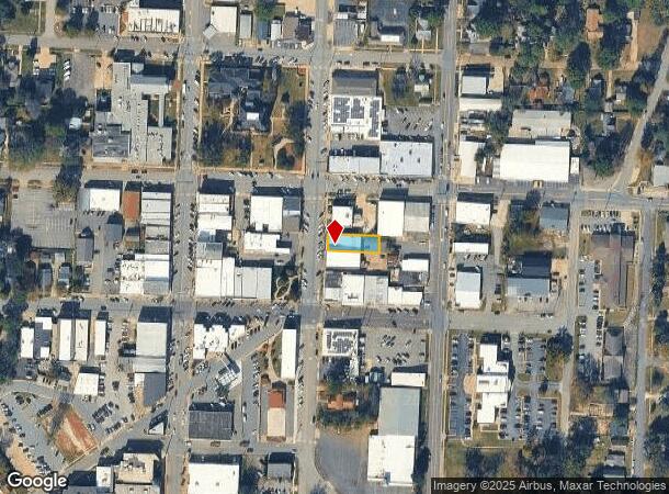
123 N Main St, Benton, AR 72015


NEARBY LISTINGS FOR SALE OR LEASE
Property Detail
123 N Main St
Little Rock-North Little Rock-Conway, AR
Original Town-Benton
800-00576-000
2005-28906
Storebuilding
Saline
X
Arkansas
05125C0355E
6
2025
0.17 AC
2025
Saline County
010101
Little Rock/N Little Rock
5,000 SF
DEMOGRAPHICS near 123 N Main St
1 Mile
3 Mile
5 Mile
2024 Total Population
7,265
28,118
47,286
2029 Population
7,918
30,466
51,131
Pop Growth 2024-2029
+ 8.99%
+ 8.35%
+ 8.13%
Average Age
38
38
39
2024 Total Households
3,058
11,065
18,853
HH Growth 2024-2029
+ 9.16%
+ 8.51%
+ 8.22%
Median Household Inc
$53,221
$63,818
$65,972
Avg Household Size
2.30
2.50
2.50
2024 Avg HH Vehicles
2.00
2.00
2.00
Median Home Value
$114,876
$161,981
$186,379
Median Year Built
1961
1983
1993
Nearby Places
Map Layers
Map Styles
 Street
 Aerial
- Restaurants
- Banks
- Shops
- Fitness
- Groceries
PUBLIC TRANSPORTATION
AIRPORT
Bill and Hillary Clinton Ntl/Adams Field
DRIVE
WALK
Distance
Bill and Hillary Clinton Ntl/Adams Field
31 min
25.9 mi
Freight Ports
Port of Shreveport
DRIVE
WALK
Distance
Port of Shreveport
224 min
210.1 mi
Nearby Properties
Address
Land Use
TOTAL SIZE
Lot Size
Zoning
Address
Land Use
TOTAL SIZE
Lot Size
Zoning
297,680 SF
16.96 AC
Address
Land Use
TOTAL SIZE
Lot Size
Zoning
137,445 SF
28.75 AC
Address
Land Use
TOTAL SIZE
Lot Size
Zoning
98,702 SF
0.67 AC
Address
Land Use
TOTAL SIZE
Lot Size
Zoning
78,845 SF
15.44 AC
Address
Land Use
TOTAL SIZE
Lot Size
Zoning
63,870 SF
7.97 AC
Address
Land Use
TOTAL SIZE
Lot Size
Zoning
99,812 SF
11.36 AC
Address
Land Use
TOTAL SIZE
Lot Size
Zoning
47,958 SF
1.54 AC
Address
Land Use
TOTAL SIZE
Lot Size
Zoning
10,211 SF
12.73 AC
Address
Land Use
TOTAL SIZE
Lot Size
Zoning
92,420 SF
11.55 AC
Address
Land Use
TOTAL SIZE
Lot Size
Zoning
14,760 SF
2.55 AC
Address
Land Use
TOTAL SIZE
Lot Size
Zoning
19,265 SF
2.06 AC
Address
Land Use
TOTAL SIZE
Lot Size
Zoning
40,650 SF
5.88 AC
Address
Land Use
TOTAL SIZE
Lot Size
Zoning
90,176 SF
7.32 AC
Address
Land Use
TOTAL SIZE
Lot Size
Zoning
10,017 SF
0.96 AC
Address
Land Use
TOTAL SIZE
Lot Size
Zoning
102,000 SF
4.93 AC
Address
Land Use
TOTAL SIZE
Lot Size
Zoning
1,416 SF
6.71 AC
Address
Land Use
TOTAL SIZE
Lot Size
Zoning
27,840 SF
5.62 AC
Address
Land Use
TOTAL SIZE
Lot Size
Zoning
29,260 SF
4.02 AC
Address
Land Use
TOTAL SIZE
Lot Size
Zoning
10,366 SF
2.30 AC
Address
Land Use
TOTAL SIZE
Lot Size
Zoning
7,949 SF
2.22 AC
Address
Land Use
TOTAL SIZE
Lot Size
Zoning
29,612 SF
2.78 AC
Address
Land Use
TOTAL SIZE
Lot Size
Zoning
20,384 SF
2.04 AC
Address
Land Use
TOTAL SIZE
Lot Size
Zoning
21,673 SF
5 AC
Address
Land Use
TOTAL SIZE
Lot Size
Zoning
45,560 SF
2.63 AC
Address
Land Use
TOTAL SIZE
Lot Size
Zoning
6,480 SF
0.69 AC
Address
Land Use
TOTAL SIZE
Lot Size
Zoning
19,038 SF
2.93 AC
Address
Land Use
TOTAL SIZE
Lot Size
Zoning
2,220 SF
0.55 AC
Address
Land Use
TOTAL SIZE
Lot Size
Zoning
19,336 SF
1.53 AC
Address
Land Use
TOTAL SIZE
Lot Size
Zoning
1,800 SF
3.26 AC
Address
Land Use
TOTAL SIZE
Lot Size
Zoning
19,656 SF
2.63 AC
The World's #1 Commercial Real Estate Marketplace
Connect with us
© 2025 CoStar Group
The information above has been obtained from sources believed reliable. While we do not doubt its accuracy we have not verified it and make no guarantee, warranty or representation about it. It is your responsibility to independently confirm its accuracy and completeness. Any projections, opinions, assumptions, or estimates used are for example only and do not represent the current or future performance of the property. The value of this transaction to you depends on tax and other factors which should be evaluated by your tax, financial, and legal advisors. You and your advisors should conduct a careful, independent investigation of the property to determine to your satisfaction the suitability of the property for your needs.