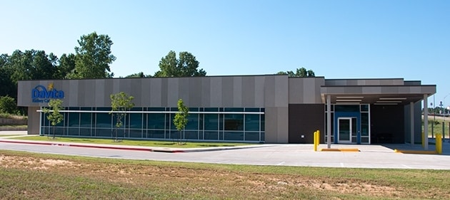
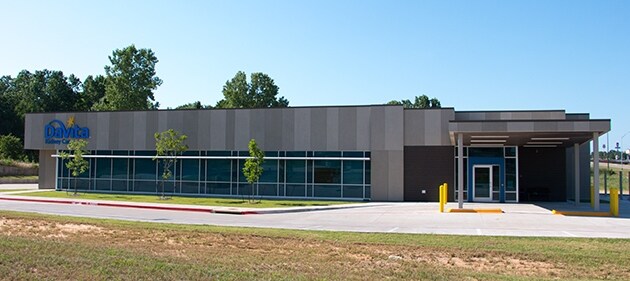
Property Record
123 N Us Highway 75, Denison, TX 75020

Property Detail
123 N Us Highway 75
Sherman-Denison, TX
WESTGATE ADDN SEC 5 PHASE ONE, BLOCK 1, LOT 2, ACRES 1.193
214499
Grayson
Commercialnec
Texas
B and X Area of moderate flood hazard, usually the area between the limits of the 100-year and 500-year floods.
2
2024
1.19 AC
2025
Denison
000800
Other Market Areas
9,747 SF
NEARBY LISTINGS FOR SALE OR LEASE
DEMOGRAPHICS near 123 N Us Highway 75
1 mile
3 mile
5 mile
2025 Total Population
4,031
22,657
36,015
2030 Population
4,423
24,854
39,465
Pop Growth 2025-2030
+ 9.72%
+ 9.70%
+ 9.58%
Average Age
43
41
41
2025 Total Households
1,630
9,012
14,295
HH Growth 2025-2030
+ 9.82%
+ 9.74%
+ 9.64%
Median Household Inc
$73,584
$61,381
$62,782
Avg Household Size
2.40
2.40
2.40
2025 Avg HH Vehicles
2.00
2.00
2.00
Median Home Value
$274,242
$214,988
$230,444
Median Year Built
1976
1973
1977
Nearby Places
Map Layers
Map Styles
 Street
 Aerial
Layers
 Traffic
 Biking
Places
Listings with unknown addresses are not visible on the map
- Restaurants
- Banks
- Shops
- Fitness
- Groceries
SALE & LEASE HISTORY
LISTING DATE
SALE/LEASE

Jun 30, 2017
For Sale
Aug 04, 2017
For Sale
Nearby Properties
Address
Land Use
TOTAL SIZE
Lot Size
Zoning
Address
Land Use
TOTAL SIZE
Lot Size
Zoning
362,322 SF
33.08 AC
Address
Land Use
TOTAL SIZE
Lot Size
Zoning
71,582 SF
23.83 AC
Address
Land Use
TOTAL SIZE
Lot Size
Zoning
66,077 SF
10 AC
Address
Land Use
TOTAL SIZE
Lot Size
Zoning
263,952 SF
34.25 AC
Address
Land Use
TOTAL SIZE
Lot Size
Zoning
69,762 SF
12.13 AC
Address
Land Use
TOTAL SIZE
Lot Size
Zoning
112,048 SF
8.66 AC
Address
Land Use
TOTAL SIZE
Lot Size
Zoning
54.88 AC
Address
Land Use
TOTAL SIZE
Lot Size
Zoning
63,575 SF
2.07 AC
Address
Land Use
TOTAL SIZE
Lot Size
Zoning
173,887 SF
20.23 AC
Address
Land Use
TOTAL SIZE
Lot Size
Zoning
70,845 SF
14.29 AC
Address
Land Use
TOTAL SIZE
Lot Size
Zoning
76,800 SF
5.02 AC
Address
Land Use
TOTAL SIZE
Lot Size
Zoning
52,950 SF
2 AC
Address
Land Use
TOTAL SIZE
Lot Size
Zoning
234,696 SF
29.16 AC
Address
Land Use
TOTAL SIZE
Lot Size
Zoning
66,216 SF
10.15 AC
Address
Land Use
TOTAL SIZE
Lot Size
Zoning
75,232 SF
23.82 AC
Address
Land Use
TOTAL SIZE
Lot Size
Zoning
97,136 SF
6.38 AC
Address
Land Use
TOTAL SIZE
Lot Size
Zoning
123,440 SF
9.29 AC
Address
Land Use
TOTAL SIZE
Lot Size
Zoning
67,952 SF
4.72 AC
Address
Land Use
TOTAL SIZE
Lot Size
Zoning
49,174 SF
1.90 AC
Address
Land Use
TOTAL SIZE
Lot Size
Zoning
47,508 SF
2.89 AC
Address
Land Use
TOTAL SIZE
Lot Size
Zoning
86,354 SF
7.91 AC
Address
Land Use
TOTAL SIZE
Lot Size
Zoning
141,948 SF
33.33 AC
Address
Land Use
TOTAL SIZE
Lot Size
Zoning
56,000 SF
13.48 AC
Address
Land Use
TOTAL SIZE
Lot Size
Zoning
258,717 SF
23.04 AC
Address
Land Use
TOTAL SIZE
Lot Size
Zoning
43,124 SF
6.56 AC
Address
Land Use
TOTAL SIZE
Lot Size
Zoning
62,598 SF
18.79 AC
Address
Land Use
TOTAL SIZE
Lot Size
Zoning
94,854 SF
6.81 AC
Address
Land Use
TOTAL SIZE
Lot Size
Zoning
242,926 SF
20.13 AC
Address
Land Use
TOTAL SIZE
Lot Size
Zoning
91,500 SF
8 AC
Address
Land Use
TOTAL SIZE
Lot Size
Zoning
37,857 SF
19.38 AC
The World's #1 Commercial Real Estate Marketplace
Connect with us
© 2026 CoStar Group
The information above has been obtained from sources believed reliable. While we do not doubt its accuracy we have not verified it and make no guarantee, warranty or representation about it. It is your responsibility to independently confirm its accuracy and completeness. Any projections, opinions, assumptions, or estimates used are for example only and do not represent the current or future performance of the property. The value of this transaction to you depends on tax and other factors which should be evaluated by your tax, financial, and legal advisors. You and your advisors should conduct a careful, independent investigation of the property to determine to your satisfaction the suitability of the property for your needs.