Property Record
123 Route 539, Allentown, NJ 08501
NEARBY LISTINGS FOR SALE OR LEASE
Property Detail
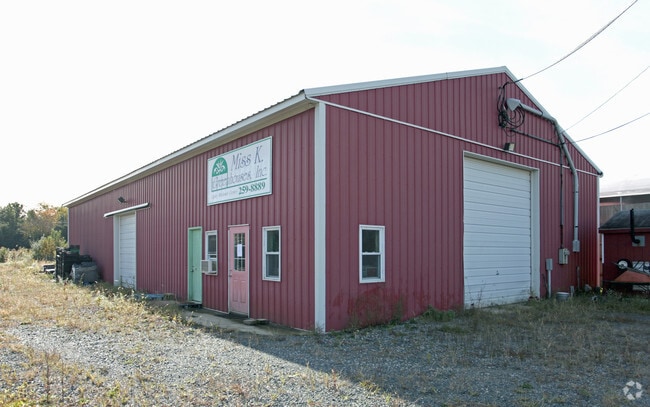
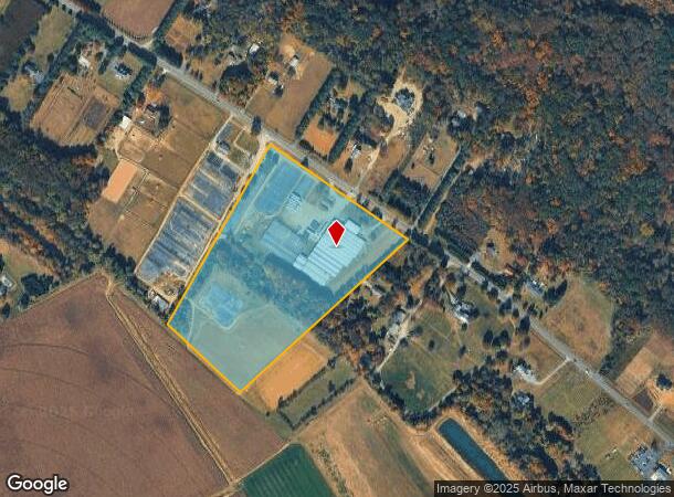
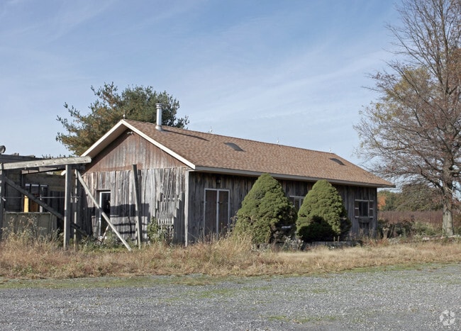
123 Route 539
51-00042-0000-00001-07-QFARM
Monmouth
Farms
New Jersey
X
1.7
34025C0245F
19.21 AC
2024
Western Monmouth
2025
Northern New Jersey
811900
New York-Jersey City-White Plains, NY-NJ
DEMOGRAPHICS near 123 Route 539
1 Mile
3 Mile
5 Mile
2024 Total Population
315
6,850
16,431
2029 Population
312
6,730
16,271
Pop Growth 2024-2029
(0.95%)
(1.75%)
(0.97%)
Average Age
45
43
43
2024 Total Households
112
2,421
5,656
HH Growth 2024-2029
(0.89%)
(2.07%)
(1.22%)
Median Household Inc
$160,416
$145,550
$149,742
Avg Household Size
2.80
2.80
2.90
2024 Avg HH Vehicles
2.00
2.00
2.00
Median Home Value
$598,837
$555,787
$520,798
Median Year Built
1998
1987
1988
Nearby Places
Map Layers
Map Styles
 Street
 Aerial
- Restaurants
- Banks
- Shops
- Fitness
- Groceries
PUBLIC TRANSPORTATION
AIRPORT
Trenton Mercer
DRIVE
WALK
Distance
Trenton Mercer
34 min
19.3 mi
Freight Ports
Port of Philadelphia
DRIVE
WALK
Distance
Port of Philadelphia
56 min
40.1 mi
SALE & LEASE HISTORY
LISTING DATE
SALE/LEASE

Sep 23, 2016
For Sale
Nearby Properties
Address
Land Use
TOTAL SIZE
Lot Size
Zoning
Address
Land Use
TOTAL SIZE
Lot Size
Zoning
79.71 AC
PCD
Address
Land Use
TOTAL SIZE
Lot Size
Zoning
60.18 AC
PCD
Address
Land Use
TOTAL SIZE
Lot Size
Zoning
64,184 SF
8.53 AC
R85
Address
Land Use
TOTAL SIZE
Lot Size
Zoning
104.44 AC
PCD
Address
Land Use
TOTAL SIZE
Lot Size
Zoning
22.73 AC
PCD
Address
Land Use
TOTAL SIZE
Lot Size
Zoning
10 AC
PCD
Address
Land Use
TOTAL SIZE
Lot Size
Zoning
15,488 SF
34.01 AC
PEC
Address
Land Use
TOTAL SIZE
Lot Size
Zoning
85,838 SF
9.74 AC
GI
Address
Land Use
TOTAL SIZE
Lot Size
Zoning
19.39 AC
PCD
Address
Land Use
TOTAL SIZE
Lot Size
Zoning
9.49 AC
PCD
Address
Land Use
TOTAL SIZE
Lot Size
Zoning
5,594 SF
20.47 AC
PEC
Address
Land Use
TOTAL SIZE
Lot Size
Zoning
57,321 SF
5.68 AC
GI
Address
Land Use
TOTAL SIZE
Lot Size
Zoning
4,724 SF
1 AC
AR
Address
Land Use
TOTAL SIZE
Lot Size
Zoning
12,367 SF
3 AC
AR
Address
Land Use
TOTAL SIZE
Lot Size
Zoning
10 AC
R140
Address
Land Use
TOTAL SIZE
Lot Size
Zoning
19,447 SF
5.70 AC
CC
Address
Land Use
TOTAL SIZE
Lot Size
Zoning
27,685 SF
1 AC
AR
Address
Land Use
TOTAL SIZE
Lot Size
Zoning
3,521 SF
195.41 AC
AR
Address
Land Use
TOTAL SIZE
Lot Size
Zoning
169.60 AC
PEC
Address
Land Use
TOTAL SIZE
Lot Size
Zoning
7,120 SF
131.05 AC
AR
Address
Land Use
TOTAL SIZE
Lot Size
Zoning
13,610 SF
5 AC
AR
Address
Land Use
TOTAL SIZE
Lot Size
Zoning
2,904 SF
101.47 AC
AR
Address
Land Use
TOTAL SIZE
Lot Size
Zoning
7,155 SF
11.71 AC
AR
Address
Land Use
TOTAL SIZE
Lot Size
Zoning
5,102 SF
106.86 AC
PEC
Address
Land Use
TOTAL SIZE
Lot Size
Zoning
8,230 SF
131.76 AC
AR
Address
Land Use
TOTAL SIZE
Lot Size
Zoning
3,482 SF
43.16 AC
AR
Address
Land Use
TOTAL SIZE
Lot Size
Zoning
138.10 AC
PEC
Address
Land Use
TOTAL SIZE
Lot Size
Zoning
11,557 SF
3.80 AC
AR
Address
Land Use
TOTAL SIZE
Lot Size
Zoning
9.49 AC
PCD
Address
Land Use
TOTAL SIZE
Lot Size
Zoning
11,400 SF
2.47 AC
CC
The World's #1 Commercial Real Estate Marketplace
Connect with us
© 2025 CoStar Group
The information above has been obtained from sources believed reliable. While we do not doubt its accuracy we have not verified it and make no guarantee, warranty or representation about it. It is your responsibility to independently confirm its accuracy and completeness. Any projections, opinions, assumptions, or estimates used are for example only and do not represent the current or future performance of the property. The value of this transaction to you depends on tax and other factors which should be evaluated by your tax, financial, and legal advisors. You and your advisors should conduct a careful, independent investigation of the property to determine to your satisfaction the suitability of the property for your needs.